Category:1885 maps
| ← 1880 1881 1882 1883 1884 1885 1886 1887 1888 1889 → |
Deutsch: Karten mit Bezug zum Jahr 1885
English: Maps related to the year 1885
Español: Mapas relativos al año 1885
Français : Cartes concernant l’an 1885
Русский: Карты 1885 года
Subcategories
This category has the following 8 subcategories, out of 8 total.
Media in category "1885 maps"
The following 162 files are in this category, out of 162 total.
-

-
 BAGWELL(1885) p 1.068 Ireland in 1172.jpg 1,475 × 2,379; 1.92 MB
-
 BAGWELL(1885) p 1.102 Ireland about 1300.jpg 1,485 × 2,373; 2.22 MB
-
 BAGWELL(1885) p 1.159 Ireland about 1500.jpg 1,475 × 2,341; 1.77 MB
-
 BAGWELL(1885) p 1.325 Ireland - Ecclesiastical.jpg 1,477 × 2,343; 1.78 MB
-
 FIELD(1885) p008 THE HISTORICAL LANDSCAPES OF THE CENTRAL OTTOMAN EMPIRE.jpg 1,323 × 2,052; 871 KB
-
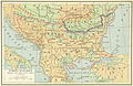 FIELD(1885) p195 TURKEY IN EUROPE, BEFORE THE WAR WITH RUSSIA.jpg 2,100 × 1,373; 1.57 MB
-
 FIELD(1885) p224 TURKEY IN EUROPE, AFTER THE WAR WITH RUSSIA.jpg 2,095 × 1,373; 1.58 MB
-
 FINSEN(1885) Map of Iceland.jpg 1,873 × 1,427; 752 KB
-
 GRIERSON(1885) p008 MAP.jpg 2,445 × 1,571; 1.41 MB
-
 (1885) Ethnographische Karte, das Gebiet der TLINKIT.jpg 3,788 × 4,886; 2.61 MB
-
 SIMON(1885) p138 Plan de l'Église de Addi-Barroa.jpg 821 × 1,235; 333 KB
-
 SIMON(1885) p403 Plate 1 - Plan général de l'église Gorghuis (Saint-Georges)..jpg 2,055 × 1,369; 1.26 MB
-
 SIMON(1885) p405 Plate 2 - Plan de l'église Médiné Allem.jpg 1,272 × 1,838; 960 KB
-
 1885 birds-eye map of Ludlow, Vermont.jpg 8,296 × 5,016; 9.57 MB
-
 1885 GT text.jpg 9,764 × 4,852; 13.75 MB
-
 1885- Claes; Ghys, Ghys, Martin, Felixarchief, 12 8841.jpg 9,652 × 7,848; 14.31 MB
-

-

-
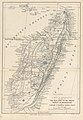 6 of 'The True Story of the French Dispute in Madagascar. With a map' (11179336154).jpg 2,416 × 3,483; 1.89 MB
-
 A Map of the Staten Island Rapid Transit Company from 1885.png 497 × 586; 642 KB
-

-
 Ayer station on 1885 aerial map.PNG 638 × 353; 651 KB
-
 Battle of Chattanooga, Nov. 23, 24, 25, 1863. LOC 99448453.jpg 1,570 × 2,303; 928 KB
-
-
 Boothbay Harbor, Lincoln County, Maine (2675887798).jpg 2,000 × 1,578; 2.49 MB
-
 Bremen Meyer 1885.png 2,050 × 1,625; 963 KB
-
 Carta geologica dell’isola d’Elba. Roma, Tip. Nazionale, 1884 - 1886.jpg 3,273 × 2,504; 1.69 MB
-
 Carte des opérations de 1885 5218.jpg 3,154 × 2,865; 1.96 MB
-
 Carte du fleuve Rouge droite 1885 05209.jpg 4,261 × 1,278; 1.07 MB
-
 Carte du fleuve Rouge gauche 1885 05210.jpg 4,446 × 1,178; 1.13 MB
-
 Carte du Tonkin dressée par le capitaine.jpg 6,492 × 7,655; 6.81 MB
-

-
 Curtice & Potts' standard map of Ramsey Co., Minnesota LOC 2012593066.jpg 16,174 × 20,046; 43.7 MB
-
 Da Qing er shi san sheng yu di quan tu; fu Chaoxian zhou dao yu di tu. LOC gm71005068.jpg 7,353 × 6,725; 9.65 MB
-
 Da Qing er shi san sheng yu di quan tu; fu Chaoxian zhou dao yu di tu. LOC gm71005068.tif 7,353 × 6,725; 141.47 MB
-
 Deutsche kolonien 1885.jpg 3,669 × 5,152; 2.71 MB
-

-
 EB9 Saint Helena.png 1,276 × 1,292; 790 KB
-

-
 Forest and stream (1885) (14594005530).jpg 3,586 × 3,620; 2.91 MB
-
 Fort Myer and vicinity LOC 89692637.jpg 13,943 × 9,670; 16.56 MB
-
 Fort Myer and vicinity LOC 89692637.tif 13,943 × 9,670; 385.75 MB
-
 Frazier Aruba Gold Mining Co circa 1885.jpg 2,294 × 1,674; 422 KB
-
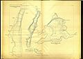
 Geistbeck 1885 - Königssee Tiefenkarten.png 1,516 × 3,988; 2.57 MB
-
 Geistbeck 1885 - Schliersee.jpg 976 × 1,361; 268 KB
-
 Geistbeck 1885-Ammer Staffel Rieg Pilsen Achen Plansee Tiefenkarten.jpg 6,748 × 4,779; 7.27 MB
-
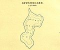 Geistbeck 1885-Spitzingsee.jpg 1,306 × 1,092; 258 KB
-
 Geistbeck 1885-Starnberger Königs Walchensee Tiefenkarten.jpg 6,748 × 4,779; 7.53 MB
-
 General map of the battle-field of Manassas. (July 16-21, 1861) LOC 99439137.jpg 1,606 × 2,086; 522 KB
-
 General map of the battle-field of Manassas. (July 16-21, 1861) LOC 99439137.tif 1,606 × 2,086; 9.59 MB
-
 Geologische Karte der Stadt Berlin, 1885.jpg 7,342 × 8,406; 28.46 MB
-
 Gerichtsbezirke von Kärnten, der Steiermark und Krain von 1885.jpg 3,390 × 2,474; 2.95 MB
-

-
-
 Group of slaves aboard ship RMG RT1381.jpg 1,280 × 960; 529 KB
-
 Group of slaves aboard ship RMG RT1382.jpg 960 × 1,280; 560 KB
-
 Heinrich Kiepert, Italia (FL159663164 2591084).jpg 8,752 × 10,985; 134.35 MB
-
 Heinrich Kiepert, Map of routes to the Levant (FL155882612 4049679).jpg 10,728 × 7,454; 86.19 MB
-
 Hiram H. Hardesty, Environs of Jerusalem (FL45582675 3925504).jpg 4,322 × 3,058; 4.9 MB
-
 Hiram H. Hardesty, Map of Jerusalem (FL45582674 3925477).jpg 3,058 × 4,355; 3.95 MB
-
 Hokusei yori Kōzan, Sansui, Kōshō, Chōshin o hete Chūreichin ni itaru LOC 2008486711.jpg 7,346 × 8,747; 6.25 MB
-
 Hokusei yori Kōzan, Sansui, Kōshō, Chōshin o hete Chūreichin ni itaru LOC 2008486711.tif 7,346 × 8,747; 183.84 MB
-
 Hopkins Co. LOC 2012592069.jpg 12,188 × 11,107; 18.26 MB
-
 Hopkins Co. LOC 2012592069.tif 12,188 × 11,107; 387.3 MB
-
 Itinéraire Victor Giraud.jpg 727 × 542; 51 KB
-
 Karte Adelaide MKL1888.png 365 × 539; 51 KB
-
 Kyoryūchi yori Teihei-fu ni itaru mitorizu LOC 2008486375.jpg 3,979 × 5,352; 2.49 MB
-
 Kyoryūchi yori Teihei-fu ni itaru mitorizu LOC 2008486375.tif 3,979 × 5,352; 60.93 MB
-
 Kärtchen zur Schlacht bei Solferino (24.06.1859).jpg 368 × 481; 88 KB
-

-

-
 Map of Abilene LOC 2013592009.jpg 8,278 × 7,313; 6.95 MB
-
 Map of Abilene LOC 2013592009.tif 8,278 × 7,313; 173.2 MB
-
 Map of Botetourt Co. - from surveys and and reconnoisance (sic) LOC 2005625175.jpg 6,660 × 12,999; 13.41 MB
-
 Map of Botetourt Co. - from surveys and and reconnoisance (sic) LOC 2005625175.tif 6,660 × 12,999; 247.69 MB
-
 Map of Charleston and its defences LOC 99448840.jpg 8,221 × 6,509; 10.21 MB
-
 Map of Fort Myer, Va. and vicinity LOC 89692636.jpg 8,769 × 6,566; 6.7 MB
-
 Map of Fort Myer, Va. and vicinity LOC 89692636.tif 8,769 × 6,566; 164.73 MB
-

-
 Map of the Baltimore Division; Adams Express Company. LOC 98688572.jpg 6,736 × 9,440; 8.87 MB
-
 Map of the Baltimore Division; Adams Express Company. LOC 98688572.tif 6,736 × 9,440; 181.93 MB
-
-

-

-

-

-
 Map of the Panama Canal, Meyers b16 s0558a (cropped).jpg 746 × 228; 80 KB
-
-
 Map of the siege of Vicksburg. (1864). LOC 99447420.jpg 1,670 × 2,807; 1.3 MB
-
-

-
-
 Map showing the missionary tours of the Apostle Paul (FL37663542 3915753).jpg 11,279 × 8,696; 141.4 MB
-
 Memoirs of the Geological Survey of India. (1885) (14779625832).jpg 2,871 × 2,172; 570 KB
-
 Meyers b1 s0115 b1.png 375 × 378; 96 KB
-
 Meyers b1 s0999a.jpg 2,048 × 1,653; 937 KB
-
 Meyers b16 s0558a.jpg 800 × 507; 122 KB
-
 Meyers b2 s0139 b1.png 770 × 496; 197 KB
-
 Meyers b2 s0141 b1.png 477 × 778; 140 KB
-
 Meyers b2 s0261 b1.png 387 × 453; 116 KB
-
 Meyers b2 s0299 b1.png 389 × 477; 125 KB
-
 Meyers b2 s0319 b1.png 388 × 647; 119 KB
-
 Meyers b2 s0642 b1.png 391 × 569; 149 KB
-
 Meyers b2 s0660 b1.png 386 × 497; 132 KB
-
 Meyers b3 s0177 b1.png 394 × 536; 119 KB
-
 Meyers b3 s0381 b1.png 366 × 364; 69 KB
-
 Meyers b3 s0795 Karte-von-Capri.png 472 × 352; 47 KB
-
 Meyers b4 s0655 b1.png 760 × 520; 150 KB
-
 Modern Egypt (FL35098764 3892750).jpg 5,313 × 7,209; 53.84 MB
-
 Nahum Sokolow, מפת ארץ הקדושה לס' ארץ חמדה (FL199420699 2369249).jpg 5,160 × 7,224; 25.41 MB
-
 Nahum Sokolow, מפת ארץ הקדושה לס' ארץ חמדה (FL42167302 3930672).jpg 7,881 × 11,183; 124.39 MB
-
 1885 NYCRR.jpg 9,684 × 4,928; 12.48 MB
-
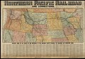 Northern Pacific Rail Road and connections (14533461260).jpg 2,000 × 1,376; 3.26 MB
-
 NSW Telegraph & Mail Routes-Oct 1885.jpg 760 × 534; 104 KB
-
 NW Australia 1885.jpg 1,263 × 1,396; 269 KB
-
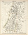 Palestine (FL37119248 3896481).jpg 2,934 × 3,671; 4.07 MB
-
 Palestine (FL37825676 3923398).jpg 6,680 × 8,484; 82.98 MB
-
 Pen Argyl (2675120408).jpg 2,000 × 1,558; 2.63 MB
-
 Plan de Rennes (1885).jpg 7,976 × 5,991; 4.62 MB
-
 Plan of Sussita by Gottlieb Schumacher 1885.jpg 1,947 × 2,037; 1.52 MB
-
 Plan of the battle of Mechanicsville, June 26 (1862). LOC 99439222.jpg 1,037 × 1,778; 349 KB
-
 Plan of the battle of Mechanicsville, June 26 (1862). LOC 99439222.tif 1,037 × 1,778; 5.28 MB
-
 Plan of the battle of Mechanicsville, June 26, 1862. LOC 2006626055.jpg 2,798 × 3,542; 871 KB
-
 Plan of the battle of Mechanicsville, June 26, 1862. LOC 2006626055.tif 2,798 × 3,542; 28.35 MB
-

-

-
 PSM V26 D162 Standard railway time vs greenwich mean time.jpg 2,586 × 1,677; 749 KB
-
 Region of queenst. cc.JPG 2,375 × 1,849; 1.99 MB
-
 Region of the Seven Days' fighting (June 25-July 1, 1862). LOC 99448343.jpg 1,634 × 2,620; 905 KB
-
 Region of the Seven Days' fighting (June 25-July 1, 1862). LOC 99448343.tif 1,634 × 2,620; 12.25 MB
-
 Saimoppo bochi kinbōzu LOC 2008486358.jpg 4,421 × 3,448; 2.01 MB
-
 Saimoppo bochi kinbōzu LOC 2008486358.tif 4,421 × 3,448; 43.61 MB
-
 Sanborn Fire Insurance Map from Bellevue, Blaine County, Idaho. LOC sanborn01565 001.jpg 6,450 × 7,650; 4.02 MB
-
 Sanborn Fire Insurance Map from Bellevue, Blaine County, Idaho. LOC sanborn01565 001.tif 6,450 × 7,650; 141.17 MB
-

-
-
 Sanborn Fire Insurance Map from Ketchum, Blaine County, Idaho. LOC sanborn01623 001.jpg 6,450 × 7,650; 3.59 MB
-
 Sanborn Fire Insurance Map from Ketchum, Blaine County, Idaho. LOC sanborn01623 001.tif 6,450 × 7,650; 141.17 MB
-
 Sanborn Fire Insurance Map from Prescott, Nevada County, Arkansas. LOC sanborn00335 001.jpg 6,450 × 7,650; 3.93 MB
-
 Sanborn Fire Insurance Map from Prescott, Nevada County, Arkansas. LOC sanborn00335 001.tif 6,450 × 7,650; 141.17 MB
-

-
 Sanborn Fire Insurance Map from Spearfish, Lawrence County, South Dakota. LOC sanborn08265 001.tif 6,510 × 7,707; 143.55 MB
-

-
 Sanborn Fire Insurance Map from Sturgis, Meade County, South Dakota. LOC sanborn08266 001.tif 6,510 × 7,707; 143.55 MB
-
 Sanborn Fire Insurance Map from Sundance, Crook County, Wyoming. LOC sanborn09782 001.jpg 6,510 × 7,707; 3.56 MB
-
 Sanborn Fire Insurance Map from Sundance, Crook County, Wyoming. LOC sanborn09782 001.tif 6,510 × 7,707; 143.55 MB
-
 Cutout from Saône Tournus à Lyon 1885.jpg 4,850 × 2,650; 2.74 MB
-
 Saône Tournus à Lyon 1885.jpg 11,158 × 8,448; 37.64 MB
-
 Senkankyō yori Kōshū ni itaru ryakuzu LOC 2008486712.jpg 8,966 × 6,182; 6.49 MB
-
 Senkankyō yori Kōshū ni itaru ryakuzu LOC 2008486712.tif 8,966 × 6,182; 158.58 MB
-
 The Gentile countries and nations of the Old Testament (FL35098794 3892755).jpg 7,357 × 5,649; 59.55 MB
-
 The Holy Land in the time of Christ (FL37663573 3915702).jpg 8,749 × 11,272; 141.65 MB
-
 The solar system. LOC 2013593146.jpg 7,177 × 5,106; 4.05 MB
-
 The solar system. LOC 2013593146.tif 7,177 × 5,106; 104.84 MB
-
 Karte Eissen.png 947 × 747; 322 KB
-
 Tranvias1885.svg 1,052 × 744; 14 KB
-
 Yellowstone National Park and north western Wyoming. LOC 97683576.jpg 8,368 × 11,376; 16.7 MB
-
 Yellowstone National Park and north western Wyoming. LOC 97683576.tif 8,368 × 11,376; 272.35 MB
-
 Übersichtskarte des Europäischen Kolonialbesitzes 01 (FL159344597 4076696).jpg 14,005 × 10,148; 189.01 MB
-
 Übersichtskarte des Europäischen Kolonialbesitzes 02 (FL159344598 4076696).jpg 14,003 × 10,188; 184.01 MB
-
 חיספין במפה של גוטליב שומאכר מ-1885.jpg 461 × 405; 70 KB
.jpg)
_p_1.068_Ireland_in_1172.jpg)
_p_1.102_Ireland_about_1300.jpg)
_p_1.159_Ireland_about_1500.jpg)
_p_1.325_Ireland_-_Ecclesiastical.jpg)
_p008_THE_HISTORICAL_LANDSCAPES_OF_THE_CENTRAL_OTTOMAN_EMPIRE.jpg)
_p195_TURKEY_IN_EUROPE,_BEFORE_THE_WAR_WITH_RUSSIA.jpg)
_p224_TURKEY_IN_EUROPE,_AFTER_THE_WAR_WITH_RUSSIA.jpg)
_Map_of_Iceland.jpg)
_p008_MAP.jpg)
_Ethnographische_Karte,_das_Gebiet_der_TLINKIT.jpg)
_p138_Plan_de_l%27%C3%89glise_de_Addi-Barroa.jpg)
_p403_Plate_1_-_Plan_g%C3%A9n%C3%A9ral_de_l%27%C3%A9glise_Gorghuis_(Saint-Georges)..jpg)
_p405_Plate_2_-_Plan_de_l%27%C3%A9glise_M%C3%A9din%C3%A9_Allem.jpg)


.jpg)
.jpg)
.jpg)
_(14782067334).jpg)


.jpg)
.jpg)


.jpg)

.jpg)
_(14594005530).jpg)


_LOC_99439137.jpg)


.jpg)
.jpg)
.jpg)
.jpg)


.jpg)


_LOC_2005625175.jpg)


_and_the_Himalayas_in_1885_from_12_of_%27The_Imperial_Gazetteer_of_India_..._Second_edition_(revised_and_enlarged)%27_(11180098823)_(cropped).jpg)


._LOC_99439181.jpg)
_line_of_the_channel_cut_by_the_Engineer_Regiment._LOC_99447230.jpg)
._LOC_99447420.jpg)

.jpg)
.jpg)
_(14779625832).jpg)


.jpg)
.jpg)
.jpg)

.jpg)


.jpg)
.jpg)
.jpg)
.jpg)

._LOC_99439222.jpg)


._LOC_99448343.jpg)


.jpg)
.jpg)


.jpg)
.jpg)

.jpg)
.jpg)