Category:1885 maps of Canada
Countries of North America: Canada · Mexico · United States of America‡
‡: partly located in North America
‡: partly located in North America
| ← 1880 1881 1882 1883 1884 1885 1886 1887 1888 1889 → |
English: Maps of Canada from 1885 or related to Canada in 1885
Français : Les cartes du Canada de 1885 ou se rapportant au Canada en 1885
Subcategories
This category has only the following subcategory.
Media in category "1885 maps of Canada"
The following 7 files are in this category, out of 7 total.
-
 1885 GT.jpg 9,752 × 4,840; 15.18 MB
-

-
 20 of 'The Old Régime in Canada (1653-1763) ... Fourteenth edition' (11181188004).jpg 2,826 × 2,197; 865 KB
-
 Count Frontenac and New France under Louis XIV BHL21318159.jpg 3,115 × 2,403; 726 KB
-
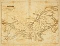
 PSM V27 D055 Map of ancient viking and portuguese colonies in canada.jpg 1,706 × 2,210; 430 KB
-
 The Settler and sportsman in Anticosti (microform) (1885) (20593462646).jpg 1,976 × 3,226; 958 KB
-
 The Settler and sportsman in Anticosti (microform) (1885) (20626341731).jpg 2,802 × 3,344; 2.52 MB

.jpg)
_..._Fourteenth_edition%27_(11181188004).jpg)


_(1885)_(20593462646).jpg)
_(1885)_(20626341731).jpg)