Category:1890 maps of Africa
Temperate regions: North America · South America · Africa · Europe · Asia · Oceania – Polar regions: – Other regions:
| ← 1890 1891 1892 1893 1894 1895 1896 1897 1898 1899 → |
Subcategories
This category has the following 10 subcategories, out of 10 total.
Media in category "1890 maps of Africa"
The following 183 files are in this category, out of 183 total.
-
-

-

-

-
-
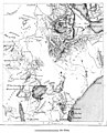
 A Map of the route of the Emin Pasha Relief Expedition Wellcome L0034226.jpg 7,770 × 4,512; 17.79 MB
-
 A Map of the routes of The Emin Pasha Relief Expedition Wellcome L0034371.jpg 7,046 × 5,282; 22.6 MB
-
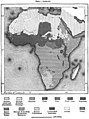
 Map of Africa from Encyclopaedia Britannica 1890.jpg 1,563 × 2,090; 2.07 MB
-
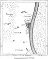
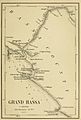 BÜTTIKOFER(1890) 1.41 Grand Bassa - Map.jpg 568 × 844; 287 KB
-
 BÜTTIKOFER(1890) 1.44 Little Culloh River - Map.jpg 719 × 563; 215 KB
-
 BÜTTIKOFER(1890) 1.47 River Cess - Map.jpg 836 × 578; 270 KB
-
 BÜTTIKOFER(1890) 1.50 Sinoe - Map.jpg 567 × 834; 284 KB
-
 BÜTTIKOFER(1890) 1.54 Cape Palmas - Map.jpg 830 × 560; 282 KB
-
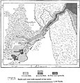
 (1890) Map of Liberia.jpg 1,393 × 956; 511 KB
-

-

-

-

-

-

-

-

-
 251 of 'Five Years with the Congo Cannibals ... Illustrated, etc' (11204962305).jpg 1,749 × 2,296; 796 KB
-

-
 A Map of Nyassaland, compiled by George Cawston... - btv1b53006743x.jpg 6,013 × 15,526; 12.13 MB
-
-
 AFR V1 D020 Highlands and plateaux of central Africa.jpg 1,785 × 2,203; 486 KB
-
 AFR V1 D021 Hydrography of Africa according to medieval geographers.jpg 1,887 × 896; 248 KB
-
 AFR V1 D025 Outflow of Lake Nyanza according to Speke.jpg 1,726 × 1,922; 266 KB
-
 AFR V1 D028 Isothermal lines of Africa.jpg 1,777 × 1,968; 697 KB
-
 AFR V1 D029 Distribution of the rainfall in Africa.jpg 1,825 × 2,236; 908 KB
-
 AFR V1 D032 Vegetable zones of Africa.jpg 1,808 × 2,416; 1.1 MB
-
 AFR V1 D036 North East Africa part 1 of 2 in colour.jpg 3,970 × 2,592; 1.07 MB
-
 AFR V1 D036 North East Africa part 1 of 2.jpg 3,607 × 2,508; 950 KB
-
 AFR V1 D036-037 Map of North East Africa combined.jpg 3,624 × 4,895; 1.97 MB
-
 AFR V1 D037 North East Africa part 2 of 2 in colour.jpg 3,970 × 2,592; 1,011 KB
-
 AFR V1 D037 North East Africa part 2 of 2.jpg 3,619 × 2,368; 861 KB
-
 AFR V1 D045 Language of Africa.jpg 1,819 × 2,442; 814 KB
-
 AFR V1 D050 Religions of Africa.jpg 1,818 × 2,276; 1.04 MB
-
 AFR V1 D054 Chief routes of explorers in the interior of Africa 1883.jpg 1,817 × 2,129; 826 KB
-
 AFR V1 D061 Sources of the Nile and Nyanza plateau.jpg 1,674 × 1,776; 363 KB
-
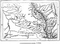
 AFR V1 D070 From Dufile to Lado.jpg 1,017 × 2,256; 285 KB
-
 AFR V1 D071 Region of the 'Sud'.jpg 1,257 × 2,598; 246 KB
-
 AFR V1 D076 Meshra-er-Rek in the Zariba region.jpg 1,718 × 1,521; 263 KB
-
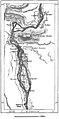
 AFR V1 D081 Basin of the Nile affluents.jpg 1,748 × 2,553; 415 KB
-
 AFR V1 D083 Cataract of Hanneck.jpg 1,831 × 2,016; 767 KB
-
 AFR V1 D084 Kaibar cataract.jpg 1,745 × 1,657; 702 KB
-
 AFR V1 D090 The Keneh valley on the route to Kosier.jpg 1,733 × 1,445; 454 KB
-
 AFR V1 D114 U-Kerewe and U-Sukuma.jpg 1,694 × 1,437; 426 KB
-
 AFR V1 D116 Karagwe.jpg 1,715 × 1,728; 408 KB
-
 AFR V1 D122 South U-Ganda.jpg 1,733 × 1,090; 453 KB
-
 AFR V1 D128 U-Nyoro.jpg 1,772 × 1,050; 306 KB
-
 AFR V1 D136 Water parting between the Nile and Congo.jpg 1,798 × 749; 140 KB
-
 AFR V1 D143 Routes of the explorers east of the Bahe-el-Jebel.jpg 1,039 × 2,411; 188 KB
-
 AFR V1 D152 Chief routes of explorers in the Zariba region.jpg 1,808 × 2,112; 439 KB
-
 AFR V1 D158 Inhabitants of the Zariba region.jpg 1,769 × 2,072; 354 KB
-
 AFR V1 D162 Confluence of the Sobat and Yal.jpg 1,805 × 1,698; 153 KB
-
 AFR V1 D173 Northern Abyssinia (Ethiopia).jpg 2,123 × 3,215; 896 KB
-
 AFR V1 D175 Profile of Abyssinia from east to west.jpg 1,966 × 812; 142 KB
-
 AFR V1 D178 Northern spurs of the Abyssinian highlands.jpg 1,699 × 1,515; 354 KB
-
 AFR V1 D179 The Simen Highlands.jpg 1,804 × 1,445; 356 KB
-
 AFR V1 D180 Lakes of East Abyssinia.jpg 928 × 2,467; 417 KB
-
 AFR V1 D186 Lake of Alalbed.jpg 1,767 × 1,278; 362 KB
-
 AFR V1 D188 Intermediate Abyssinian plateaux and valleys.jpg 1,770 × 2,641; 1.15 MB
-
 AFR V1 D201 Inhabitants of Abyssinia.jpg 1,759 × 2,520; 635 KB
-
 AFR V1 D212 Gondar.jpg 1,593 × 2,141; 579 KB
-
 AFR V1 D216 Debra-Tabor.jpg 1,754 × 992; 291 KB
-
 AFR V1 D217 Mahdera-Mariam.jpg 1,759 × 1,864; 458 KB
-
 AFR V1 D218 Koarata and southern shore of Lake Tana.jpg 1,728 × 1,620; 536 KB
-
 AFR V1 D221 Magdala.jpg 800 × 537; 106 KB
-
 AFR V1 D224 Adua and Aksum.jpg 1,728 × 1,122; 311 KB
-
 AFR V1 D227 Aksum.jpg 1,739 × 1,771; 446 KB
-
 AFR V1 D229 Kumaili Valley.jpg 1,146 × 2,282; 361 KB
-
 AFR V1 D231 Bogos Territory.jpg 1,741 × 1,134; 262 KB
-
 AFR V1 D233 Massawah.jpg 1,770 × 2,206; 494 KB
-
 AFR V1 D238 Annesley Bay.jpg 1,852 × 2,573; 832 KB
-
 AFR V1 D253 Routes of the chief explorers in South Abyssinia.jpg 1,801 × 1,541; 280 KB
-
 AFR V1 D257 Populations of South Abyssinia.jpg 1,757 × 1,421; 424 KB
-
 AFR V1 D261 Chief towns of Shoa.jpg 1,781 × 992; 224 KB
-
 AFR V1 D264 Harrar.jpg 1,737 × 1,517; 497 KB
-
 AFR V1 D265 Zeila.jpg 1,858 × 1,787; 394 KB
-
 AFR V1 D266 Course of the lower Awash.jpg 1,748 × 1,974; 544 KB
-
 AFR V1 D267 Tajurah Bay and Lake Assal.jpg 1,789 × 1,622; 394 KB
-
 AFR V1 D268 Obok.jpg 1,831 × 1,533; 476 KB
-
 AFR V1 D271 Assab.jpg 1,793 × 2,255; 544 KB
-
 AFR V1 D279 Routes of the chief explorers in Taka and neighbouring districts.jpg 1,792 × 1,164; 225 KB
-
 AFR V1 D287 The Lega country.jpg 1,771 × 1,969; 533 KB
-
 AFR V1 D290 Inhabitants of the Blue Nile.jpg 511 × 599; 84 KB
-
 AFR V1 D296 Inhabitants of Taka and neighbouring districts.jpg 1,807 × 1,574; 318 KB
-
 AFR V1 D306 Fazogl gold mines.jpg 1,724 × 1,283; 388 KB
-
 AFR V1 D308 Senar.jpg 1,744 × 2,106; 318 KB
-
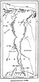
 AFR V1 D309 Confluence of the two Niles.jpg 1,810 × 2,071; 406 KB
-
 AFR V1 D311 Khartum.jpg 1,720 × 1,181; 247 KB
-
 AFR V1 D313 Pyramids of Meroe.jpg 1,719 × 1,929; 308 KB
-
 AFR V1 D319 Kassala.jpg 1,793 × 2,181; 471 KB
-
 AFR V1 D321 Berber.jpg 1,061 × 2,302; 408 KB
-
 AFR V1 D322 Suakin in 1882.jpg 1,698 × 1,779; 492 KB
-
 AFR V1 D325 Suakin uplands.jpg 1,757 × 1,540; 428 KB
-
 AFR V1 D343 Central region of Dar-For.jpg 1,748 × 1,660; 313 KB
-
 AFR V1 D357 Mineral region of the Ethai uplands.jpg 1,857 × 1,378; 287 KB
-
 AFR V1 D360 Korosko desert.jpg 1,015 × 2,505; 352 KB
-
 AFR V1 D364 Bayuda steppe.jpg 1,768 × 2,323; 344 KB
-
 AFR V1 D377 Dongola and the third cataract.jpg 1,311 × 2,639; 395 KB
-
 AFR V1 D430 Arab tribes in Egypt.jpg 1,830 × 2,487; 468 KB
-
 AFR V1 D449 Trajan's canal.jpg 1,823 × 1,235; 435 KB
-
 AFR V1 D450 Suez in the year 1800.jpg 1,769 × 2,462; 904 KB
-
 AFR V1 D463 The Egyptian Sudan.jpg 2,574 × 3,682; 1.02 MB
-
 AFR V1 D476 Kosseir.jpg 1,809 × 1,923; 565 KB
-
 AFR V1 D482 Oasis of Khargeh and Dakhel.jpg 1,839 × 1,051; 170 KB
-
 AFR V1 D484 The Siwah Oasis.jpg 1,735 × 1,315; 451 KB
-
 Africa (Volume I) pg 70.jpg 1,002 × 2,254; 299 KB
-
 Africa (Volume I) pg 71.jpg 1,247 × 2,594; 201 KB
-
 Africa - btv1b84460802.jpg 9,874 × 8,123; 10.72 MB
-
 Africa - DPLA - c7a08f5c7ee4e4eaaf042e7398c812a2.jpg 755 × 1,000; 266 KB
-
 Africa - DPLA - e435a3d5ff634b9a1fc457eb90034af5.jpg 726 × 1,000; 278 KB
-

-
 Afrika in 6 Blättern... - von R. Lüddecke - btv1b525060476.jpg 13,721 × 16,854; 38.93 MB
-
 Afrika um 1890.jpg 2,406 × 2,421; 4.07 MB
-

-
 Afrique - DPLA - 5d5dbbbbc9e79792d6dfd008a21c402e.jpg 1,000 × 651; 248 KB
-
 Afrique au 1er janvier 1890 - DPLA - 3ff254a282eb8e36a94a674458d43cd9.jpg 1,000 × 804; 280 KB
-
 Afrique au 31 décembre 1890 - DPLA - 23ae86347d14b38926c338a5031474ca.jpg 1,000 × 784; 288 KB
-

-

-

-

-

-

-

-
 Carte générale de l'Afrique... - publiée par E. Andriveau-Goujon - btv1b531210420.jpg 11,198 × 7,962; 16.25 MB
-
 Carte itinéraire de l'expédition de H. M. Stanley (1887-1889) - btv1b530619018.jpg 8,566 × 5,259; 7.32 MB
-
 Carte itinéraire de l'expédition de H. M. Stanley (1887-1889) - btv1b8440020x.jpg 12,272 × 8,154; 13.23 MB
-

-
 Die Gartenlaube (1890) b 191.jpg 1,930 × 1,406; 432 KB
-

-
 French Soudan 1889.jpg 2,738 × 1,791; 2 MB
-

-

-

-

-

-
 Kettler's Uebersichtskarte von Deutsch-Afrika - btv1b84400309.jpg 11,340 × 6,607; 8.57 MB
-
 L'Afrique française Ce qu'elle est (...)Rolland Georges btv1b84460624.jpg 1,024 × 1,114; 270 KB
-

-
 L'Esclavage en Afrique - DPLA - 3820e0bfe9f94310e39fd74107877c2a.jpg 1,000 × 837; 351 KB
-

-
 Lounda.jpg 8,073 × 13,301; 7.29 MB
-
 Madagascar - DPLA - 35c03af5853a46f00108b887aebed160.jpg 604 × 1,000; 114 KB
-

-
 Map of Emin Pasha'a Province.jpg 1,246 × 1,250; 718 KB
-
 Map of the Stevenson Road Country - DPLA - 573f6e934420b31e9f6b1c5cd434587a.jpg 1,000 × 540; 144 KB
-

-

-

-

-

-
 Meyers b14 s0300a.jpg 800 × 1,280; 376 KB
-

-

-
 Political map of Africa - DPLA - 8e5c05fd88c744e3c33338ac2aa18a5c.jpg 958 × 1,001; 221 KB
-

-
 Portulan de Nicolas de Canerio. Afrique. Dimensions de l'original - btv1b531953792.jpg 11,322 × 8,464; 7.55 MB
-
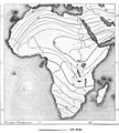
 PSM V37 D676 Map of africa circa 1890.jpg 1,781 × 1,926; 223 KB
-
 Richard Kiepert, Deutsche und Britische Schutzgebiete in Aequatorial-Ost-Afrika, 1890.jpg 3,084 × 2,509; 3.45 MB
-
 Rivières du Sud 1889.jpg 779 × 424; 66 KB
-

-

-
-

-

-

-

-

-

-
 The earth and its inhabitants (1890) (20937302410).jpg 3,278 × 2,448; 2.22 MB
-
 Trade routes of the Sahara 1890.png 1,436 × 1,024; 2.32 MB
-

-
 Un ancien diplomate.- L'esclavage en Afrique, 1890 (page 8 crop).jpg 793 × 781; 335 KB
-

-

-

-

-
 “Stevenson Road” Country... - DPLA - 00defba9993ca357cfeca3bcb43fe173.jpg 1,000 × 544; 172 KB
.jpg)
.jpg)
.jpg)
_oszt%C3%A1ly_sz%C3%A1mara_..._t%C3%A9rk%C3%A9ppel%27_(11295685694).jpg)


_1.41_Grand_Bassa_-_Map.jpg)
_1.44_Little_Culloh_River_-_Map.jpg)
_1.47_River_Cess_-_Map.jpg)
_1.50_Sinoe_-_Map.jpg)
_1.54_Cape_Palmas_-_Map.jpg)
_Map_of_Liberia.jpg)
_oszt%C3%A1ly_sz%C3%A1mara_..._t%C3%A9rk%C3%A9ppel%27_(11202900453).jpg)
_oszt%C3%A1ly_sz%C3%A1mara_..._t%C3%A9rk%C3%A9ppel%27_(11206290916).jpg)
_oszt%C3%A1ly_sz%C3%A1mara_..._t%C3%A9rk%C3%A9ppel%27_(11204852355).jpg)
_oszt%C3%A1ly_sz%C3%A1mara_..._t%C3%A9rk%C3%A9ppel%27_(11207070345).jpg)
_oszt%C3%A1ly_sz%C3%A1mara._(With_maps.)%27_(11294323464).jpg)
_oszt%C3%A1ly_sz%C3%A1mara._(With_maps.)%27_(11206059424).jpg)
_oszt%C3%A1ly_sz%C3%A1mara._(With_maps.)%27_(11296172414).jpg)
_oszt%C3%A1ly_sz%C3%A1mara._(With_maps.)%27_(11203040394).jpg)
.jpg)

_(14778821165).jpg)


.jpg)


_pg_70.jpg)
_pg_71.jpg)


.jpg)
_(18246958058).jpg)
_(18434769005).jpg)


_-_btv1b530619018.jpg)
_-_btv1b8440020x.jpg)

_b_191.jpg)


.jpg)
.jpg)
.jpg)

_-_zur_Veranschaulichung_der_Reiseroute,_Beobachtungen_und_Erkundigungen_D(okto)r._Fr._Stuhlmann_(16_August_bis_6_October_1888)_-_bearbeitet_und..._-_btv1b525062865.jpg)

Rolland_Georges_btv1b84460624.jpg)


._Itin%C3%A9raire_suivi_par_M._Bayol..._de_Kotonou_%C3%A0_Abomey_-_Croquis_%C3%A9tabli_par_M._Angot..._-_btv1b8440057z.jpg)


_(20937302410).jpg)


.jpg)


_-_DPLA_-_56e98f4b53260550197aef0fc311e63d.jpg)