Category:1890s maps of Oceania
Temperate regions: North America · South America · Africa · Europe · Asia · Oceania – Polar regions: – Other regions:
Subcategories
This category has the following 13 subcategories, out of 13 total.
- 1896 maps of Oceania (2 F)
.
A
F
- 1890s maps of French Guiana (1 F)
N
- 1890s maps of New Zealand (18 F)
S
Media in category "1890s maps of Oceania"
The following 19 files are in this category, out of 19 total.
-
 'Propeller Island' by Léon Benett 37.jpg 315 × 392; 101 KB
-
 'Propeller Island' by Léon Benett 69.jpg 892 × 684; 141 KB
-

-
 Meyers leiner Hand-atlas 1893 (73137800).jpg 9,430 × 6,604; 7.29 MB
-
 Die Deutschen Besitzungen im Stillen Ocean 11657068.jpg 13,359 × 10,744; 45.89 MB
-
 19 of 'Cavite e Santiago' (11247090055).jpg 2,448 × 1,383; 634 KB
-
 Langemak Bucht.jpg 1,196 × 876; 185 KB
-
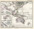
 (1899) MAP OF OCEANIA - comp. by Irvine.jpg 2,577 × 2,029; 3.13 MB
-
 44 of 'Arnold's Geographical Handbooks' (11289542445).jpg 1,202 × 1,268; 454 KB
-
 66 of 'British Possessions and Colonies. (With maps.)' (11249346983).jpg 2,704 × 2,039; 1.61 MB
-
 Advanced Geography (1899) (14595434277).jpg 3,706 × 2,960; 3.31 MB
-
 Image taken from page 28 of 'Arnold's Geographical Handbooks' (11289743874).jpg 1,078 × 1,017; 396 KB
-

-
 Meyers b12 s0083a.jpg 2,248 × 1,496; 1.06 MB
-
 Missions Catholiques De La Melanesie, Micronesie et Polynesie (Oceanie) 50 Prozent verkleinert.jpg 11,561 × 8,335; 22.38 MB
-
 Missions Catholiques De La Melanesie, Micronesie et Polynesie (Oceanie) brighter.jpg 23,122 × 16,670; 54.99 MB
-
 Missions Catholiques De La Melanesie, Micronesie et Polynesie (Oceanie).jpg 23,122 × 16,670; 74.58 MB
-
 Rotuma map in Australian Science Journal 1895.jpg 2,036 × 1,564; 1.13 MB
-
 Stielers Handatlas 1891 75.jpg 5,050 × 4,300; 5.82 MB


%27_(11220361106).jpg)
.jpg)

.jpg)

_MAP_OF_OCEANIA_-_comp._by_Irvine.jpg)
.jpg)
%27_(11249346983).jpg)
_(14595434277).jpg)
.jpg)
_50_Prozent_verkleinert_(cropped).jpg)

_50_Prozent_verkleinert.jpg)
_brighter.jpg)
.jpg)

