Category:1890s maps of Virginia
States of the United States: Alabama · Alaska · Arizona · Arkansas · California · Colorado · Connecticut · Delaware · Florida · Georgia · Hawaii · Idaho · Illinois · Indiana · Iowa · Kansas · Kentucky · Louisiana · Maine · Maryland · Massachusetts · Michigan · Minnesota · Mississippi · Missouri · Montana · Nebraska · Nevada · New Hampshire · New Jersey · New Mexico · New York · North Carolina · North Dakota · Ohio · Oklahoma · Oregon · Pennsylvania · Rhode Island · South Carolina · South Dakota · Tennessee · Texas · Utah · Vermont · Virginia · Washington · West Virginia · Wisconsin · Wyoming – Washington, D.C.
Puerto Rico
Puerto Rico
Subcategories
This category has the following 9 subcategories, out of 9 total.
- 1890 maps of Virginia (17 F)
Media in category "1890s maps of Virginia"
The following 5 files are in this category, out of 5 total.
-
 1890s Philadelphia, Wilmington and Baltimore map.jpg 1,000 × 1,393; 920 KB
-
 US-MAPS(1891) p506 - MAP OF VIRGINIA AND WEST VIRGINIA (l).jpg 1,504 × 2,160; 1.12 MB
-
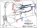 3rd Winchester 1 Infantry Beg.png 952 × 720; 281 KB
-
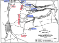 3rd Winchester 2 Crook Flank.png 982 × 713; 302 KB
-


_p506_-_MAP_OF_VIRGINIA_AND_WEST_VIRGINIA_(l).jpg)


