Category:1893 maps of Hawaii
States of the United States: California · Florida · Georgia · Hawaii · Idaho · Illinois · Indiana · Iowa · Kansas · Kentucky · Louisiana · Maine · Massachusetts · Michigan · Minnesota · Mississippi · Missouri · Montana · New Hampshire · New Mexico · New York · North Carolina · North Dakota · Ohio · Oregon · Pennsylvania · South Carolina · South Dakota · Tennessee · Texas · Utah · Virginia · Washington · West Virginia · Wisconsin · Wyoming – Washington, D.C.
| 1893 |
Media in category "1893 maps of Hawaii"
The following 5 files are in this category, out of 5 total.
-

-
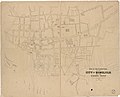 Map of the lower part of the city of Honolulu and the harbor front LOC 2012586639.jpg 12,074 × 9,738; 10.23 MB
-
 Map of the lower part of the city of Honolulu and the harbor front LOC 2012586639.tif 12,074 × 9,738; 336.39 MB
-
 Topographical map of the Hawaiian Islands LOC 2009583839.jpg 10,828 × 7,525; 11.9 MB
-
 Topographical map of the Hawaiian Islands LOC 2009583839.tif 10,828 × 7,525; 233.12 MB


