Category:1897 maps of Europe
Temperate regions: North America · South America · Africa · Europe · Asia · Oceania – Polar regions: – Other regions:
| ← 1890 1891 1892 1893 1894 1895 1896 1897 1898 1899 → |
English: 1897 maps of Europe
Español: Mapas de Europa en 1897
Suomi: Euroopan kartat vuodelta 1897
Română: Hărți ale Europei din 1897
Subcategories
This category has the following 15 subcategories, out of 15 total.
.
- 1897 maps of the Ottoman Empire (empty)
B
F
- 1897 maps of Finland (1 F)
- 1897 maps of France (27 F)
G
- 1897 maps of Georgia (1 F)
I
- 1897 maps of Italy (1 F)
N
- 1897 maps of Norway (12 F)
R
- 1897 maps of Russia (8 F)
S
- 1897 maps of Spain (3 F)
- 1897 maps of Switzerland (2 F)
U
Media in category "1897 maps of Europe"
The following 11 files are in this category, out of 11 total.
-
 Admiralty Chart No 2587 Ireland Coast Guard RMG F0181, Published 1897.tiff 5,340 × 7,695; 117.56 MB
-
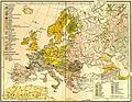 Europe ethnic map 1897 (hungarian).jpg 2,316 × 1,800; 907 KB
-
 Europe. LOC 99466750.jpg 5,114 × 3,738; 3.93 MB
-
 Europe. LOC 99466750.tif 5,114 × 3,738; 54.69 MB
-
-

-
 MapStockholm-1897-1423.jpg 5,864 × 6,880; 17.19 MB
-
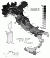
 PSM V51 D741 Physical geography of italy.png 2,286 × 2,405; 497 KB
-
 PSM V51 D742 Cephalic index of italy.png 2,227 × 2,589; 489 KB
-
 PSM V51 D745 Relative frequency of brunet traits.png 2,247 × 2,563; 465 KB
-
 PSM V51 D746 Relative frequency of tall statures.png 2,234 × 2,556; 481 KB
.jpg)

_(14758795426).jpg)


%27_(16589481992).jpg)