Category:18th-century architecture in East Sussex
Ceremonial counties of England: Bedfordshire · Berkshire · Buckinghamshire · Cambridgeshire · Cheshire · Cornwall · Cumbria · Derbyshire · Devon · Dorset · Durham · East Riding of Yorkshire · East Sussex · Essex · Gloucestershire · Greater London · Greater Manchester · Hampshire · Herefordshire · Hertfordshire · Isle of Wight · Kent · Lancashire · Leicestershire · Lincolnshire · Merseyside · Norfolk · North Yorkshire · Northamptonshire · Northumberland · Nottinghamshire · Oxfordshire · Rutland · Shropshire · Somerset · South Yorkshire · Staffordshire · Suffolk · Surrey · Tyne and Wear · Warwickshire · West Midlands · West Sussex · West Yorkshire · Wiltshire · Worcestershire
City-counties: Bristol ·
Former historic counties: Huntingdonshire · Middlesex · Sussex · Yorkshire
Other former counties:
City-counties: Bristol ·
Former historic counties: Huntingdonshire · Middlesex · Sussex · Yorkshire
Other former counties:
Subcategories
This category has the following 13 subcategories, out of 13 total.
*
A
- Abergavenny Arms, Rodmell (13 F)
C
- Cotterlings, East Sussex (4 F)
- Crown Inn, Lewes (5 F)
F
L
- Lewes Friends' Meeting House (20 F)
O
P
- Pelham Arms, Lewes (7 F)
S
- School Hill House, Lewes (2 F)
- Stanmer Park Lower Lodges (8 F)
T
- The Forge, Rodmell (10 F)
Media in category "18th-century architecture in East Sussex"
The following 26 files are in this category, out of 26 total.
-
 1 and 2 Stanmer Park, Stanmer (NHLE Code 1380964) (April 2013).JPG 2,400 × 1,800; 821 KB
-
 1 and 2 Stanmer Park, Stanmer (NHLE Code 1380964) (February 2010).jpg 2,400 × 1,900; 1.04 MB
-
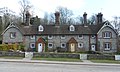
 1-3 Stanmer Village - geograph.org.uk - 596413.jpg 466 × 640; 89 KB
-
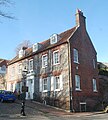
 10 Prince Albert Street, The Lanes, Brighton (NHLE Code 1380765) (July 2014).jpg 2,400 × 2,800; 2.38 MB
-
 11–13 Prince Albert Street, The Lanes, Brighton (NHLE Code 1380766) (August 2010).jpg 1,900 × 2,400; 985 KB
-
 13-16 Stanmer Village - geograph.org.uk - 596417.jpg 456 × 640; 132 KB
-
 13–16 Stanmer Park, Stanmer (NHLE Code 1380967) (April 2013).JPG 2,550 × 1,525; 1.9 MB
-
 13–16 Stanmer Park, Stanmer (NHLE Code 1380967) (February 2010).jpg 2,500 × 1,400; 954 KB
-
 15 Prince Albert Street, The Lanes, Brighton (NHLE Code 1380767) (June 2010).JPG 1,400 × 1,200; 321 KB
-
 16 Prince Albert Street, The Lanes, Brighton (NHLE Code 1380769) (August 2010).jpg 1,200 × 1,200; 249 KB
-
 3–6 Stanmer Park, Stanmer (NHLE Code 1380965) (April 2013).JPG 2,500 × 1,900; 899 KB
-
 3–6 Stanmer Park, Stanmer (NHLE Code 1380965) (February 2010).jpg 2,400 × 1,800; 1.01 MB
-
 8 Bartholomews, The Lanes, Brighton (NHLE Code 1379973) (December 2016).JPG 1,800 × 2,600; 796 KB
-

-

-
 Glynde Place stable block.jpg 640 × 480; 146 KB
-

-
 Stable Block at Patcham Place, Patcham (NHLE Code 1381687) (August 2010).JPG 2,500 × 1,600; 1 MB
-
 The Caprons, Keere Street, Lewes (NHLE Code 1286853) (April 2021).JPG 1,800 × 2,000; 1.4 MB
-
 Wall at Down House, The Green, Rottingdean (NHLE Code 1381007) (August 2010).JPG 2,400 × 1,800; 1.04 MB
-
 Wall at Hillside, The Green, Rottingdean (NHLE Code 1381010) (August 2010).JPG 2,500 × 1,200; 858 KB
-
 Wall at Southdown House, Old London Road, Patcham (NHLE Code 1380632) (August 2010).JPG 2,400 × 1,600; 898 KB
-
 Wall at Stables of Stanmer House, Stanmer (NHLE Code 1380960) (April 2013).JPG 2,400 × 1,600; 1.17 MB
-
 Walls at Home Farmhouse, Stanmer (NHLE Code 1380149) (April 2013).JPG 2,500 × 1,600; 1.12 MB
-
 Walls at Manor Lodge, Portslade (NHLE Code 1293007) (August 2010).JPG 2,400 × 1,200; 747 KB
-

_(April_2013).JPG)
_(February_2010).jpg)

_(July_2014).jpg)
_(August_2010).jpg)

_(April_2013).JPG)
_(February_2010).jpg)
_(June_2010).JPG)
_(August_2010).jpg)
_(April_2013).JPG)
_(February_2010).jpg)
_(December_2016).JPG)
_(February_2011).JPG)
_(January_2011).JPG)

_(August_2010).JPG)
_(August_2010).JPG)
_(April_2021).JPG)
_(August_2010).JPG)
_(August_2010).JPG)
_(August_2010).JPG)
_(April_2013).JPG)
_(April_2013).JPG)
_(August_2010).JPG)
_(August_2010).JPG)