Category:18th-century maps of Jamaica
Countries of North America: Antigua and Barbuda · The Bahamas · Barbados · Belize · Canada · Costa Rica · Cuba · Guatemala · Haiti · Honduras · Jamaica · Mexico · Nicaragua · Panama · Saint Kitts and Nevis · Saint Vincent and the Grenadines · Trinidad and Tobago‡ · United States of America‡
Other territories: Bermuda · Greenland · Guadeloupe · Martinique · Puerto Rico
‡: partly located in North America
Other territories: Bermuda · Greenland · Guadeloupe · Martinique · Puerto Rico
‡: partly located in North America
Subcategories
This category has only the following subcategory.
Media in category "18th-century maps of Jamaica"
The following 59 files are in this category, out of 59 total.
-

-

-
 Jamaica - btv1b59706635 (1 of 2).jpg 7,824 × 5,984; 8.12 MB
-
 Carta de la isla de la Jamayca - btv1b59706650.jpg 6,192 × 5,088; 4.1 MB
-

-
 Carta de la isla de la Jamayca; dividida en diez y nueve parroquias ó quarteles. LOC 73691844.tif 7,644 × 6,682; 146.13 MB
-
 1780 Raynal and Bonne Map of Jamaica, West Indies - Geographicus - Jamaique-bonne-1780.jpg 2,500 × 1,700; 1.05 MB
-

-
 A chart of Montego Bay on the north west shore of the Island of Jamaica (3046595634).jpg 1,500 × 2,000; 2.71 MB
-

-
 A chart of Port Royal and Kingston Harbours in the island of Jamaica LOC 81693666.jpg 16,310 × 11,751; 20.71 MB
-

-

-

-
 A draught of Blufields Bay Jamaica survey'd in March 1787 by Wm McL Rice RMG F0073.tiff 6,110 × 3,046; 53.25 MB
-
 A general plan of the harbours of Port Royal and Kingston, Jamaica - btv1b5970691g.jpg 10,480 × 7,473; 10.23 MB
-
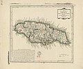
 A map of the island of Jamaica - btv1b5970655m.jpg 9,520 × 6,592; 10.74 MB
-
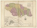
 A new map of Jamaica - btv1b5970651z.jpg 3,185 × 2,429; 1.32 MB
-
 A new map of Jamaica - btv1b5970658v.jpg 15,700 × 9,867; 22.77 MB
-
 A new Map of Jamaica... - btv1b530300434.jpg 8,494 × 6,456; 8.22 MB
-
 A new map of the island of Jamaica - by G. Foster - btv1b8596230g.jpg 9,102 × 4,548; 7.14 MB
-

-
 A New map of the island of Jamaica, from an actual survey. LOC 73691848.jpg 5,964 × 4,320; 2.95 MB
-

-
 Carta de los puertos de Kingston y Puerto Real - btv1b59706902.jpg 5,942 × 5,180; 4.54 MB
-

-
 Craskell (1763) Cornwall, Jamaica.jpg 14,786 × 11,905; 155.68 MB
-
 Craskell (1763) Middlesex Jamaica.jpg 14,491 × 11,832; 182.68 MB
-
 Craskell (1763) Surr(e)y, Jamaica.jpg 14,607 × 11,954; 175.52 MB
-

-

-

-

-

-

-
 Insula Jamaica - btv1b5970652c.jpg 3,728 × 2,152; 1.39 MB
-
 Island of Jamaica with exact plans of Port Royal and Kingston - btv1b8442526r.jpg 8,590 × 5,424; 5.46 MB
-
 Jamaica - btv1b5970664k.jpg 8,504 × 6,624; 5.48 MB
-
 Jamaica - btv1b8494267n.jpg 10,338 × 7,918; 8.18 MB
-
 Jamaica - btv1b8596233q.jpg 10,448 × 7,931; 9.13 MB
-
 Jamaica Map Sloane 1707 mobot31753000820123 0169.jpg 5,652 × 5,222; 3.93 MB
-
 Jamaique - btv1b5970666d.jpg 11,632 × 7,888; 9.58 MB
-
 Jamaïca - btv1b530299724.jpg 9,128 × 6,626; 5.5 MB
-
 Kaart van het eiland Jamaïka - btv1b8442429n.jpg 7,090 × 4,535; 4.39 MB
-
 Les principales forteresses, ports &c. de lAmérique septentrionale (4071869633).jpg 8,936 × 7,408; 10.23 MB
-
 Map of the county of Cornwall in the island of Jamaica - btv1b5970674z.jpg 15,136 × 12,192; 24.71 MB
-
 Map of the county of Middlesex in the island of Jamaica - btv1b5970661b.jpg 15,492 × 12,861; 26.93 MB
-
 Map of the county of Middlesex in the island of Jamaica - btv1b5970676s.jpg 15,319 × 12,223; 24.68 MB
-
 Map of the county of Surry in the island of Jamaica - btv1b5970673j.jpg 15,172 × 12,208; 23.91 MB
-
 Map of the island of Jamaica - btv1b59706598.jpg 17,236 × 12,844; 33.19 MB
-

-
 The island of Jamaica - btv1b5970650j.jpg 7,176 × 5,576; 6.12 MB
-

-
 This map of the county of Cornwall, in the island of Jamaica LOC 73691849.jpg 14,786 × 11,905; 21.68 MB
-
 This map of the county of Middlesex in the island of Jamaica LOC 73691872.jpg 14,491 × 11,832; 20.72 MB
-
 This map of the county of Surry (sic) in the island of Jamaica LOC 73691870.jpg 14,607 × 11,954; 23.09 MB
-
 This map of the island of Jamaica; LOC 73691873.jpg 15,041 × 11,836; 29.28 MB
-

-

.jpg)
.jpg)
.jpg)


.jpg)
.jpg)
_Port_Antonio_on_the_north_east_shore_of_the_island_of_Jamaica_RMG_K0410.jpg)


_Cornwall,_Jamaica.jpg)
_Middlesex_Jamaica.jpg)
_Surr(e)y,_Jamaica.jpg)

.jpg)


.jpg)


_-_The_fourth_book._Describing_The_West-India_navigation,_from_Hudson%27s_Bay_to_the_River_Amazones._Particularly_delineating_The_Sea_Coasts,_Capes,_Headlands,_(14593494230).jpg)

._S.I._Neele_;_sculp_-_btv1b530985604.jpg)


_in_the_island_of_Jamaica_LOC_73691870.jpg)


