Category:18th-century maps of Maine
States of the United States: Alabama · Alaska · Arizona · Arkansas · California · Colorado · Connecticut · Delaware · Florida · Georgia · Hawaii · Illinois · Indiana · Kansas · Kentucky · Louisiana · Maine · Maryland · Massachusetts · Michigan · Minnesota · Mississippi · Missouri · Montana · Nevada · New Hampshire · New Jersey · New Mexico · New York · North Carolina · North Dakota · Ohio · Oklahoma · Oregon · Pennsylvania · Rhode Island · South Carolina · Tennessee · Texas · Utah · Vermont · Virginia · Washington · Wisconsin – Washington, D.C.
Puerto Rico
Puerto Rico
Subcategories
This category has the following 4 subcategories, out of 4 total.
- 1710s maps of Maine (1 F)
- 1760s maps of Maine (5 F)
Media in category "18th-century maps of Maine"
The following 12 files are in this category, out of 12 total.
-
 Fort Casco, Brunswick, Maine by Cyprian Southack, 1720 map inset.png 666 × 424; 673 KB
-

-

-

-

-

-
-
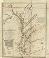
 Maine 1798.jpg 715 × 1,024; 202 KB
-
 Memoires-des-commissaires-du-roi-et-de-ceux-de-sa-majesté-brittanique MG 1220.tif 5,010 × 3,621; 51.94 MB
-
 Rigobert-Bonne-Atlas-de-toutes-les-parties-connues-du-globe-terrestre MG 0026.tif 5,251 × 3,605; 54.19 MB
-
 The coast of northern Maine and New Brunswick (3045761991).jpg 2,000 × 1,409; 2.34 MB
-


.jpg)
_from_the_Bay_of_Fundy,_up_to_St._Anns_or_Frederick%27s_Town;_being_little_known_by_white_people,_until_1783;_settled_by_the_American_LOC_73694671.jpg)

.jpg)
_-_The_fourth_book._Describing_The_West-India_navigation,_from_Hudson%27s_Bay_to_the_River_Amazones._Particularly_delineating_The_Sea_Coasts,_Capes,_Headlands,_(14780020825).jpg)