Category:1900s maps of Czechia
Countries of Europe: Albania · Armenia‡ · Azerbaijan‡ · Belarus · Belgium · Bosnia and Herzegovina · Bulgaria · Croatia · Cyprus‡ · Czech Republic · Denmark · Finland · France‡ · Georgia‡ · Germany · Greece · Hungary · Iceland · Republic of Ireland · Italy · Lithuania · Netherlands‡ · Norway · Poland · Portugal‡ · Romania · Russia‡ · Serbia · Slovakia · Spain‡ · Sweden · Switzerland · Turkey‡ · Ukraine · United Kingdom
Limited recognition: Abkhazia‡
‡: partly located in Europe
Limited recognition: Abkhazia‡
‡: partly located in Europe
Media in category "1900s maps of Czechia"
The following 7 files are in this category, out of 7 total.
-
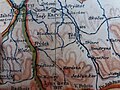
 Uherský Ostroh BV035880562.jpg 10,026 × 7,924; 12.4 MB
-
 Göding BV035880256.jpg 10,002 × 7,840; 10.78 MB
-
 Bohemia 1138–1254.jpg 2,001 × 1,561; 1.59 MB
-
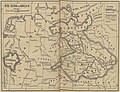
 J.Brunclíkův atlas pro školy měšťanské 1904.jpg 4,128 × 3,096; 3.51 MB
-
 Kammweg-Karte.jpg 5,240 × 2,113; 2.66 MB
-
 Rise Ceska za Karla IV.jpg 3,289 × 2,516; 1.36 MB
-
 Spezialkarte 4055 Caslau und Chrudim auf 300 dpi farbig.jpg 5,710 × 4,436; 23.49 MB


