Category:1905 maps of Canada
Countries of North America: Canada · Mexico · Nicaragua · United States of America‡
‡: partly located in North America
‡: partly located in North America
| ← 1900 1901 1902 1903 1904 1905 1906 1907 1908 1909 → |
English: Maps of Canada from 1905 or related to Canada in 1905
Français : Les cartes du Canada de 1905 ou se rapportant au Canada en 1905
Media in category "1905 maps of Canada"
The following 11 files are in this category, out of 11 total.
-
 1905 Saskatchewan general election - Results by riding (simple).svg 5,333 × 5,573; 316 KB
-
 1905albertaelectionbydistrictmap.png 343 × 603; 69 KB
-
 Canadian mining journal January-June 1905 (1905) (14781983062).jpg 2,907 × 3,206; 1.02 MB
-
 D126- N° 445. Archipel polaire américain. - Liv3-Ch17.png 1,446 × 1,768; 431 KB
-
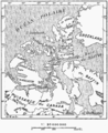
 D273- N° 364. Rivages des deux Cabot - liv3-ch10.png 1,444 × 1,944; 268 KB
-
 D475- N° 395. Embouchure du Saint-Laurent - liv3-ch13.png 1,440 × 1,771; 278 KB
-
 D589- N° 416. Embouchure du Saint-Laurent. - liv3-ch15.png 1,436 × 1,830; 284 KB
-
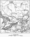
 D593- N° 418. Bostonie et Canada. - liv3-ch15.png 1,444 × 2,048; 324 KB
-
 Genom Canada 11.jpg 1,880 × 1,275; 460 KB
-
 NorthernNewfoundland.jpg 492 × 805; 265 KB
-
 P025 - N° 524. Canada Oriental. - Liv4-Ch05.png 1,442 × 1,794; 321 KB
.svg)

_(14781983062).jpg)


