Category:1908 U.S. presidential election maps, county subdivisions
Media in category "1908 U.S. presidential election maps, county subdivisions"
The following 18 files are in this category, out of 18 total.
-
 CartogramDemocraticPresidentialCounty1908.png 2,800 × 2,200; 240 KB
-
 CartogramOtherPresidentialCounty1908.png 2,800 × 2,200; 216 KB
-
 CartogramPresidentialCounty1908.gif 2,800 × 2,200; 255 KB
-
 CartogramRepublicanPresidentialCounty1908.png 2,800 × 2,200; 239 KB
-
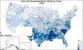
 DemocraticPresidentialCounty1908.gif 2,800 × 2,200; 248 KB
-
 OtherPresidentialCounty1908.gif 2,800 × 2,200; 217 KB
-
 PresidentialCounty1908.gif 2,800 × 2,200; 265 KB
-
 PresidentialCounty1908Colorbrewer.gif 2,800 × 1,700; 225 KB
-
 RepublicanPresidentialCounty1908.gif 2,800 × 2,200; 245 KB
-
 1908 United States presidential election results map by county.svg 555 × 352; 1.38 MB
-
 1908 US Presidential Election in Florida by county.svg 800 × 769; 2.03 MB
-
 CartogramDemocraticPresidentialCounty1908Colorbrewer.gif 2,800 × 1,700; 207 KB
-
 CartogramOtherPresidentialCounty1908Colorbrewer.gif 2,800 × 1,700; 223 KB
-
 CartogramPresidentialCounty1908Colorbrewer.gif 2,800 × 1,700; 232 KB
-
 CartogramRepublicanPresidentialCounty1908Colorbrewer.gif 2,800 × 1,700; 209 KB
-
 DemocraticPresidentialCounty1908Colorbrewer.png 2,800 × 1,700; 254 KB
-
 OtherPresidentialCounty1908Colorbrewer.gif 2,800 × 1,700; 210 KB
-
 RepublicanPresidentialCounty1908Colorbrewer.gif 2,800 × 1,700; 197 KB


