Category:1908 maps
| ← · 1900 · 1901 · 1902 · 1903 · 1904 · 1905 · 1906 · 1907 · 1908 · 1909 · → |
Deutsch: Karten mit Bezug zum Jahr 1908
English: Maps related to the year 1908
Español: Mapas relativos al año 1908
Français : Cartes concernant l’an 1908
Русский: Карты 1908 года
Subcategories
This category has the following 9 subcategories, out of 9 total.
Media in category "1908 maps"
The following 138 files are in this category, out of 138 total.
-
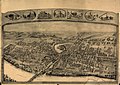 (Bird's-eye view of Thompsonville (now Enfield), Connecticut). LOC 91680391.jpg 8,384 × 5,904; 14.74 MB
-
 1908 moscow mozd.jpg 13,056 × 17,992; 20.08 MB
-
 1908 Moscow railway plans.jpg 1,220 × 1,210; 965 KB
-
 1908- Ossining, Briarcliff Manor 2.jpg 3,253 × 3,475; 1.64 MB
-
 1908- Ossining, Briarcliff Manor.jpg 11,710 × 8,080; 13.31 MB
-

-
 Balga Messtischblatt Nr 1485 1908 001.jpg 1,535 × 1,598; 1.23 MB
-
 Barcelona 1908.jpg 3,070 × 2,537; 2.97 MB
-
 Berlin Innere Stadt Meyers kleines Konversationslexikon 7. Auflage 1908.jpg 4,008 × 3,196; 9.19 MB
-
 Biała (Bielsko-Biała) mapa 1908.jpg 3,337 × 5,578; 2.28 MB
-
 Bird's eye view of Winsted, Connecticut 1908. LOC 75693170.jpg 10,912 × 9,824; 24.38 MB
-
 Birds eye view of Wilson, North Carolina 1908. LOC 75694902.jpg 10,288 × 7,152; 15.09 MB
-
 Birds-eye view from summit of Mt. Washington, White Mountains, New-Hampshire LOC 85693138.jpg 7,889 × 8,289; 10.67 MB
-
 Birds-eye view from summit of Mt. Washington, White Mountains, New-Hampshire LOC 85693138.tif 7,889 × 8,289; 187.09 MB
-
 Birds-eye view from summit of Mt. Washington, White Mountains, New-Hampshire LOC 85693139.tif 7,915 × 8,322; 188.45 MB
-
 City of Chicopee (9475311496).jpg 800 × 564; 87 KB
-
 City of Newburyport (7557363856).jpg 7,675 × 5,390; 38.72 MB
-
 Dervent und Kotorsko. NYPL1226923.tiff 4,640 × 5,475; 72.69 MB
-
 Devecser und Varoslod. NYPL1226664.tiff 4,432 × 5,315; 67.4 MB
-
 Development and electrical distribution of water power (1908) (14783464613).jpg 1,664 × 2,100; 283 KB
-

-

-
 Dobromil. NYPL1226378.tiff 4,552 × 5,291; 68.91 MB
-
 Dorna-Watra (Bukowina). NYPL1226646.tiff 4,496 × 5,419; 69.71 MB
-
 Dunaadony und Kunszentmiklos. NYPL1226667.tiff 4,432 × 5,315; 67.4 MB
-

-
 Fakovic. NYPL1226976.tiff 4,360 × 5,243; 65.41 MB
-
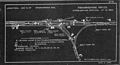 Framingham Center interlocking diagram, August 1908.jpg 3,180 × 1,710; 1.05 MB
-
 Gospel temperance railroad map. LOC 2004633094.jpg 6,197 × 5,270; 6.12 MB
-
 Gospel temperance railroad map. LOC 2004633094.tif 6,197 × 5,270; 93.44 MB
-
 Grand Canyon National Monument within Grand Canyon National Forest Arizona. LOC 98687191.jpg 4,976 × 7,535; 5.63 MB
-
 Grand Canyon National Monument within Grand Canyon National Forest Arizona. LOC 98687191.tif 4,976 × 7,535; 107.27 MB
-
 Grbavica und Glamoc. NYPL1226971.tiff 4,360 × 5,243; 65.41 MB
-
 Gubin und Vrlika. NYPL1226984.tiff 4,320 × 5,147; 63.62 MB
-

-
 Hosszumezo und Avas-Felsofalu. NYPL1226573.tiff 4,384 × 5,339; 66.97 MB
-
 I. Solta. NYPL1227009.tiff 4,376 × 5,139; 64.34 MB
-
 Ill Urspring. NYPL1226681.tiff 4,432 × 5,315; 67.4 MB
-
 Index Continued NYPL3905184.tiff 6,655 × 8,378, 2 pages; 159.79 MB
-
 Index NYPL3905183.tiff 6,732 × 8,249, 2 pages; 159.15 MB
-
 Jablanica und Podklecani. NYPL1226999.tiff 4,320 × 5,147; 63.62 MB
-
-
 Kanyahaza und Szatmar-Nemeti. NYPL1226572.tiff 4,384 × 5,339; 66.97 MB
-
 Karte des tell-el-mutsellim und von el-leddschōn.jpg 3,808 × 4,725; 1.83 MB
-
 Key NYPL3905185.tiff 8,733 × 6,172, 2 pages; 154.48 MB
-
 Key West Reservation EO 923 illustration.jpg 1,952 × 2,160; 487 KB
-
 Kezdi-Vasarhely. NYPL1226809.tiff 4,464 × 5,355; 68.4 MB
-
 Kherson 1908.jpg 6,966 × 4,966; 4.05 MB
-
 Kitzbuhel und Zell Am See. NYPL1226620.tiff 4,496 × 5,419; 69.71 MB
-
 Konjica und Bjelemic. NYPL1227000.tiff 4,320 × 5,147; 63.62 MB
-

-

-
 Las Injurias-1908-Baedeker.jpg 1,247 × 772; 356 KB
-
 Messtischblatt 4640 Leipzig von 1908 df dk 0000095.jpg 7,677 × 7,554; 13.47 MB
-
 LXXII-12 Zaslavl 1908 i 1928.jpg 4,955 × 6,303; 7.97 MB
-
 Madrid Baedeker 1908.jpg 2,165 × 2,290; 1.68 MB
-
 Map of a part of the campus of Princeton University LOC 80695243.jpg 17,286 × 8,880; 25.4 MB
-
 Map of a part of the campus of Princeton University LOC 80695243.tif 17,286 × 8,880; 439.17 MB
-
-

-
 Map of Napa & Solano Counties Cal. LOC 2005625302.jpg 9,005 × 9,487; 13.9 MB
-
 Map of Napa & Solano Counties Cal. LOC 2005625302.tif 9,005 × 9,487; 244.42 MB
-
 Map of Pond Town Plantation, Maine (10089806583).jpg 620 × 799; 95 KB
-

-

-

-

-

-
 Map of the city of Washington showing United States reservations LOC 87694475.jpg 18,846 × 16,965; 37.75 MB
-
 Map of the permanent system of highways, District of Columbia LOC 80693352.jpg 16,313 × 13,874; 35.17 MB
-
 Map of the permanent system of highways, District of Columbia LOC 80693352.tif 16,313 × 13,874; 647.53 MB
-
 Map of the permanent system of highways, District of Columbia LOC 87691452.jpg 6,802 × 5,767; 8.14 MB
-
 Map of the permanent system of highways, District of Columbia LOC 87691452.tif 6,802 × 5,767; 112.23 MB
-
 Map of the permanent system of highways, District of Columbia LOC 87695723.jpg 16,054 × 13,548; 32.95 MB
-

-
 Map showing location of public buildings, Washington, D.C. LOC 87691454.jpg 8,644 × 6,241; 1.79 MB
-
 Map showing location of public buildings, Washington, D.C. LOC 87691454.tif 8,644 × 6,241; 154.34 MB
-
 Moldova Stefan cel Mare (coloured).png 1,581 × 1,167; 2.5 MB
-
 Moldova Stefan cel Mare.png 11,817 × 8,717; 1.98 MB
-
 Mosel-Weinbau-Karte für den Regierungsbezirk Coblenz , 1897 - urn-nbn-de-0128-1-3517.jpg 7,389 × 4,748; 3.85 MB
-
 New Orleans Hammond Map 1908.jpg 2,000 × 1,998; 3.42 MB
-
 Otters and otter-hunting (1908) (14802406783).jpg 1,825 × 2,519; 502 KB
-
 Otzthal. NYPL1226651.tiff 4,496 × 5,419; 69.71 MB
-
 Paks und Kalocsa. NYPL1226733.tiff 4,352 × 5,195; 64.69 MB
-
 Part of the (Quincy) metropolitan district (3719860767).jpg 1,024 × 720; 688 KB
-

-
 Plan du parc du château du Bois-Cornillé.jpg 354 × 481; 175 KB
-
 Planlaflèche1908.jpg 8,956 × 7,296; 9.08 MB
-

-
 Portpatrick station.jpg 1,024 × 592; 354 KB
-
 Post-card map, vicinity of Washington D.C. LOC 87695774.jpg 4,492 × 5,857; 2.45 MB
-
 Post-card map, vicinity of Washington D.C. LOC 87695774.tif 4,492 × 5,857; 75.27 MB
-

-

-

-
 PSM V73 D200 Map of ceylon 1907.png 1,405 × 2,278; 237 KB
-
 PSM V73 D212 Powell map of aboriginal linguistic stocks of the us.png 1,578 × 1,847; 542 KB
-
 Radkersburg und Luttenberg. NYPL1226727.tiff 4,328 × 5,219; 64.63 MB
-
 Railroad Commissioners' map of the State of Vermont (13383964193).jpg 1,273 × 2,000; 2.68 MB
-

-

-
 Rapid transit map of Manhattan and adjacent districts of New York City. LOC 00554816.tif 2,699 × 10,253; 79.17 MB
-
 Rattenberg. NYPL1226619.tiff 5,419 × 4,496; 57 MB
-
 Ravca und Zastrazisce. NYPL1227020.tiff 5,179 × 4,376; 42.84 MB
-
 Richmond Park - (Washington D.C.). LOC 88693043.jpg 11,485 × 8,225; 10.4 MB
-
 Salomon Funk, Landkarte von Babel (FL147453434 2612072).jpg 2,964 × 2,153; 4.41 MB
-
 Santander map 1908.jpg 3,496 × 2,315; 2.9 MB
-
 Sarbogard. NYPL1226698.tiff 4,480 × 5,275; 67.62 MB
-

-

-
 Skizze der Verteilung der Schutztruppe von Deutsch-Ostafrika (1908).jpg 1,500 × 2,100; 935 KB
-
 Somogyvar. NYPL1226730.tiff 4,352 × 5,195; 64.69 MB
-
 Spezialkarte der Österreichisch-ungarischen Monarchie - Rudolfswerth 1908.jpg 14,648 × 11,398; 35.93 MB
-
 Sprachatlas Weigand 67.JPG 3,412 × 3,044; 1.99 MB
-
 Sumeg und Zala-Egerszeg. NYPL1226695.tiff 4,480 × 5,275; 67.62 MB
-
 Szalacs und Bihar-Dioszeg. NYPL1226639.tiff 4,496 × 5,419; 69.71 MB
-
 TA RIV 069 Kaart Nieuwe Waterweg 1908 (cropped, colorized).jpg 12,364 × 4,037; 20.98 MB
-
 TA RIV 069 Kaart Nieuwe Waterweg 1908 (cropped, mark Botlek).jpg 7,168 × 2,341; 13.31 MB
-
 TA RIV 069 Kaart Nieuwe Waterweg 1908.jpg 12,833 × 4,633; 12.45 MB
-
 The City of Washington and environs - 1908. LOC 87691453.jpg 2,763 × 3,770; 2 MB
-
 The City of Washington and environs - 1908. LOC 87691453.tif 2,763 × 3,770; 29.8 MB
-
 The Commercial and financial chronicle (1908) (14591210538).jpg 2,634 × 4,270; 2.99 MB
-
 The Commercial and financial chronicle (1908) (14755238806).jpg 2,614 × 4,284; 2.78 MB
-

-
 Third section, permanent system of highways, District of Columbia. LOC 87694481.jpg 8,333 × 14,089; 12.46 MB
-
 Third section, permanent system of highways, District of Columbia. LOC 87694481.tif 8,333 × 14,089; 335.89 MB
-
 Toledo 1908.jpg 2,088 × 2,550; 2.41 MB
-
 Torres Strait pearl 1908 atlas comp.jpg 4,881 × 5,686; 3.05 MB
-
 Uj-(Neu)-Verbasz. NYPL1226855.tiff 4,616 × 5,547; 73.26 MB
-
 Verteilung der Schutztruppe auf das Schutzgebiet Kamerun (1908).jpg 1,500 × 2,100; 768 KB
-
 Vrtoce DL. und Ribnikgrn. NYPL1226955.tiff 4,360 × 5,235; 65.31 MB
-
 Walpole interlocking diagram, January 1911.jpg 3,192 × 1,752; 1.36 MB
-

-
 Wildon und Leibnitz. NYPL1226692.tiff 4,480 × 5,339; 68.44 MB
-
 Zemplenoroszi und Dydiowa. NYPL1226433.tiff 4,536 × 5,347; 69.4 MB
-
 Zirovac und Vrnograc. NYPL1226900.tiff 4,640 × 5,475; 72.69 MB
-
 Zupanjac und Cista. NYPL1226998.tiff 4,320 × 5,147; 63.62 MB
-
 План Николаева 1908.JPG 2,816 × 2,112; 1.47 MB
,_Connecticut)._LOC_91680391.jpg)


_mapa_1908.jpg)


.jpg)
.jpg)
_(14783464613).jpg)

.jpg)


_(FL173354534_0991247).jpg)


.jpg)


.jpg)

.png)


_(14802406783).jpg)
_metropolitan_district_(3719860767).jpg)


_(14785047723).jpg)


.jpg)

._LOC_88693043.jpg)
.jpg)

.jpg)


_(14591210538).jpg)
_(14755238806).jpg)
_(14781741661).jpg)


.jpg)


.jpg)
.jpg)