Category:1910s maps of Belgium
Countries of Europe: Albania · Armenia‡ · Austria · Azerbaijan‡ · Belarus · Belgium · Bosnia and Herzegovina · Bulgaria · Croatia · Cyprus‡ · Czech Republic · Denmark · Finland · France‡ · Georgia‡ · Germany · Greece · Hungary · Iceland · Republic of Ireland · Italy · Lithuania · Luxembourg · Netherlands‡ · Norway · Poland · Portugal‡ · Romania · Russia‡ · Serbia · Slovakia · Slovenia · Spain‡ · Sweden · Switzerland · Turkey‡ · Ukraine · United Kingdom
Limited recognition: Abkhazia‡
‡: partly located in Europe
Limited recognition: Abkhazia‡
‡: partly located in Europe
Media in category "1910s maps of Belgium"
The following 37 files are in this category, out of 37 total.
-

-
 1911 Britannica - Map of Belgium and Luxemburg.png 920 × 682; 828 KB
-

-
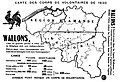 Carte des corps de volontaires de 1830.jpg 1,290 × 882; 213 KB
-

-
 (Map of World War I battle positions in the Bruges region, Belgium). LOC 80691199.jpg 14,562 × 8,026; 15.63 MB
-
 (Map of World War I battle positions in the Bruges region, Belgium). LOC 80691199.tif 14,562 × 8,026; 334.38 MB
-

-
 Unsere Front im Osten und Westen - page 1.jpg 13,997 × 10,766; 42.75 MB
-
 De LYser a LAisne, Acervo do Museu Paulista da USP.jpg 5,412 × 7,216; 35.23 MB
-

-
 Belgium 10. Arlon.png 9,230 × 7,269; 125.13 MB
-
 Belgium 11. Lens.png 9,198 × 7,295; 115.8 MB
-
 Belgium 12. Valenciennes.png 9,026 × 7,434; 117.12 MB
-
 Belgium 13. Calais.png 6,725 × 9,978; 100.85 MB
-
 Belgium 14. Abbeville.png 9,391 × 7,145; 98.24 MB
-
 Belgium 16. Dieppe.png 8,921 × 7,521; 121.32 MB
-
 Belgium 17. Amiens.png 9,053 × 7,412; 116.73 MB
-
 Belgium 18. St. Quentin.png 9,390 × 7,146; 121.42 MB
-
 Belgium 19. Mézières.png 9,375 × 7,157; 132.59 MB
-
 Belgium 1A. Dunkerque.png 10,777 × 6,226; 89.03 MB
-
 Belgium 2. Ghent.png 8,976 × 7,475; 100.46 MB
-
 Belgium 21. Beauvais.png 9,019 × 7,440; 123.62 MB
-
 Belgium 22. Soissons.png 9,023 × 7,437; 120.01 MB
-
 Belgium 23. Reims.png 9,070 × 7,398; 116.81 MB
-
 Belgium 3. Antwerp.png 9,019 × 7,440; 115.12 MB
-
 Belgium 5. Tournai.png 9,056 × 7,410; 107.62 MB
-
 Belgium 5A. Hazebrouck.png 9,078 × 7,391; 111.68 MB
-
 Belgium 6. Brussels.png 9,046 × 7,417; 115.01 MB
-
 Belgium 7. Liége.png 9,059 × 7,407; 120.48 MB
-
 Belgium 8. Namur.png 9,039 × 7,423; 121.08 MB
-
 Belgium 9. Marche.png 8,997 × 7,458; 121.06 MB
-
 Deutsche Kriegszeitung (1914) 01 02 2.png 542 × 399; 306 KB
-
 German occupation of Belgium 1914-1916.jpg 886 × 775; 212 KB
-
 Guerre de 1914-1917-les destructions d'immeubles en Belgique. LOC 2012593517.jpg 4,800 × 3,704; 2.4 MB
-
 Guerre de 1914-1917-les destructions d'immeubles en Belgique. LOC 2012593517.tif 4,800 × 3,704; 50.87 MB
-

_(18198228632).jpg)

.jpg)

.jpg)
._LOC_80691199.jpg)
.jpg)


_(14783100192).jpg)


_01_02_2.png)


