Category:1910s maps of Egypt
Subcategories
This category has the following 9 subcategories, out of 9 total.
- 1910 maps of Egypt (3 F)
- 1911 maps of Egypt (1 F)
- 1912 maps of Egypt (1 F)
- 1913 maps of Egypt (3 F)
- 1914 maps of Egypt (3 F)
- 1915 maps of Egypt (10 F)
- 1916 maps of Egypt (8 F)
- 1918 maps of Egypt (empty)
- 1919 maps of Egypt (4 F)
Media in category "1910s maps of Egypt"
The following 21 files are in this category, out of 21 total.
-
 W. & A.K. Johnston. Asia Minor. 1911 F.jpg 879 × 483; 74 KB
-
 1914 map - Flemmings Karte für das türkische Interessen-Gebiet - Arabia cropped.tif 4,824 × 3,760; 52.53 MB
-
 Egypt and the Sûdân; handbook for travellers (1914) (14597330338).jpg 2,208 × 1,480; 381 KB
-
 Egypt and the Sûdân; handbook for travellers (1914) (14597331348).jpg 2,320 × 1,497; 463 KB
-
-
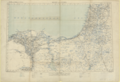
 Suez Canal (ca 1914).jpg 1,692 × 2,256; 3.38 MB
-
 1915 bird's eye view map of the Middle Eastern theatre of World War I.jpg 6,440 × 5,240; 5.28 MB
-
 1916 map of Sinai Peninsula, Egypt, the Gulf of Suez and the Gulf of Akaba by the British War Office.jpg 15,719 × 15,179; 34.02 MB
-

-
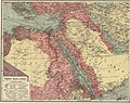
 Bacon's excelsior map of Egypt, the Nile basin and adjoining countries. LOC 2009580100.jpg 12,235 × 16,136; 19.34 MB
-
 Bacon's excelsior map of Egypt, the Nile basin and adjoining countries. LOC 2009580100.tif 12,235 × 16,136; 564.83 MB
-
 EB1911 Egypt - map.jpg 1,744 × 2,382; 1.91 MB
-
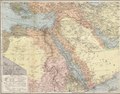
 Egypt and Syria.png 9,905 × 6,774; 85.47 MB
-
 Egypt and the Sûdân; handbook for travellers (1914) (14781602214).jpg 2,320 × 1,497; 456 KB
-
 Egyptian Empire, B.C. 1450 (2710782990).jpg 1,245 × 2,000; 2.2 MB
-
 Kings and gods of Egypt (1912) (14583125749).jpg 2,368 × 2,316; 671 KB
-
 Map of Sîwa Oasis and Mersa Matrûh (1915).png 7,239 × 9,269; 78.84 MB
-

-
 The Times history of the war (1914) (14781028584).jpg 2,992 × 1,836; 1.12 MB
-
 Карта к статье «Египет». Военная энциклопедия Сытина (Санкт-Петербург, 1911-1915).jpg 1,033 × 1,951; 292 KB
-


_(14597330338).jpg)
_(14597331348).jpg)
.jpg)
.jpg)


.jpg)


_(14781602214).jpg)
.jpg)
_(14583125749).jpg)
.png)
_(14766137562).jpg)
_(14781028584).jpg)
.jpg)
.jpg)