Category:1918 maps of Europe
Temperate regions: North America · South America · Africa · Europe · Asia · Oceania – Polar regions: – Other regions:
English: 1918 maps of Europe
Español: Mapas de Europa en 1918
Suomi: Euroopan kartat vuodelta 1918
Română: Hărți ale Europei din 1918
Subcategories
This category has the following 12 subcategories, out of 12 total.
.
A
- 1918 maps of Albania (empty)
F
- 1918 maps of France (9 F)
G
L
- 1918 maps of Lithuania (11 F)
N
- 1918 maps of Norway (39 F)
P
- 1918 maps of Poland (5 F)
R
- 1918 maps of Russia (29 F)
S
- 1918 maps of Switzerland (6 F)
T
- 1918 maps of Turkey (5 F)
U
- 1918 maps of Ukraine (22 F)
Media in category "1918 maps of Europe"
The following 19 files are in this category, out of 19 total.
-
 09-Übersichtskarte für den europäischen Kriegsschauplatz (1918).png 12,326 × 9,917; 165.38 MB
-
 1918 Japanese propaganda map of World War I and the Russo-Japanese War.jpg 4,414 × 9,000; 12.99 MB
-
 1918 map - Artaria's Eisenbahnkarte von Österreich-Ungarn und den Balkanländern.jpg 18,624 × 14,270; 159.14 MB
-
 1918 trench map Sint Juliaan area detail tanks.jpg 3,024 × 4,032; 1.9 MB
-
 Battle of Isaszeg map from 06.04.1849. The situation at 16,30 o'clock.jpg 5,545 × 7,387; 38.19 MB
-
 Battle of Isaszeg map from 06.04.1849. The situation at 17,30 o'clock.jpg 5,585 × 7,427; 38 MB
-
 Battle of Isaszeg map from 06.04.1849. The situation at 19 o'clock.jpg 5,224 × 7,378; 35.86 MB
-
 Ethnographic map of Europe - by lithuanians Sudare and J Gabrys - Lausanne - 1918 AD.jpg 12,906 × 10,596; 18.37 MB
-
 Europe 1918.jpg 1,444 × 1,200; 1.25 MB
-
 Map of Central Europe according to Austrian Slavs (black and white).jpg 1,781 × 2,298; 1.61 MB
-
 Map of Central Europe according to Austrian Slavs.jpg 1,794 × 2,330; 2.1 MB
-
 Map of central Europe in Great Britain's new allies-The Czecho-Slovaks.png 907 × 1,383; 526 KB
-
 New Map of Europe 1918.jpg 1,488 × 1,073; 134 KB
-
 PanGerman Plan.jpg 4,318 × 3,653; 3.56 MB
-
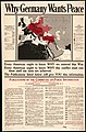 Why Germany wants peace. LOC 2017585602.jpg 5,875 × 8,897; 8.69 MB
-
 Zones of civilization of the Balkan Peninsula LOC 2007627466.jpg 6,575 × 5,423; 5.23 MB
-
 Zones of civilization of the Balkan Peninsula LOC 2007627466.tif 6,575 × 5,423; 102.01 MB
-
 Zsigmond Batky Karoly Kogutowicz The ethnographical map of Hungary (1918).jpg 5,479 × 7,522; 8.54 MB
-
 Змієвий острів.jpg 1,181 × 886; 473 KB
.png)


.jpg)


.jpg)
