Category:1920s maps of Iraq
Countries of Asia: Armenia‡ · Azerbaijan‡ · Cambodia · People's Republic of China · Egypt‡ · Georgia‡ · India · Indonesia‡ · Iran · Iraq · Israel · Japan · Jordan · Laos · Lebanon · Philippines · Russia‡ · Syria · Turkey‡ · Vietnam
Limited recognition: Taiwan · State of Palestine
‡: partly located in Asia
Limited recognition: Taiwan · State of Palestine
‡: partly located in Asia
Media in category "1920s maps of Iraq"
The following 8 files are in this category, out of 8 total.
-
 Motor and Camel Surveys in the North Arabian Desert.jpg 5,000 × 2,985; 1.64 MB
-
 Carte archéologique de l'Iraq - btv1b53212203v.jpg 7,421 × 9,127; 8.21 MB
-
 MAP THE TIGRIS FROM KUT AL AMARA TO BAGHDAD.jpg 1,490 × 979; 196 KB
-
 RIVER TIGRIS BETWEEN ALI GHARBI AND SHUMRAN.jpg 1,616 × 832; 158 KB
-
 LOWER MESOPOTAMIA.jpg 1,028 × 966; 172 KB
-
 Iraq Persia map.jpg 8,052 × 7,392; 12.29 MB
-
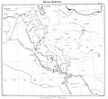
 Ethnographical Map of the contested territory (1922-1924) (Mosul vilayet).jpg 1,851 × 1,443; 323 KB
-
 خارطة المملكة العراقية.jpg 1,080 × 1,094; 362 KB


_(Mosul_vilayet).jpg)
