Category:1927 maps of the United States
Other areas: Hawaii
States of the United States: California · Delaware · Hawaii · Idaho · Illinois · Iowa · Kansas · Massachusetts · Michigan · Minnesota · New Hampshire · North Dakota · Virginia · Wisconsin · Wyoming – Washington, D.C.
Subcategories
This category has the following 17 subcategories, out of 17 total.
C
- 1927 maps of California (3 F)
D
H
I
K
M
- 1927 maps of Massachusetts (6 F)
N
V
- 1927 maps of Virginia (2 F)
W
- 1927 maps of Wisconsin (1 F)
- 1927 maps of Wyoming (2 F)
Media in category "1927 maps of the United States"
The following 6 files are in this category, out of 6 total.
-
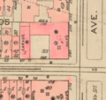 1927 BAKER HOUSES.png 474 × 447; 381 KB
-
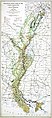 1927 LA Flood Map.jpg 2,292 × 5,214; 9.56 MB
-
 1927 New York, New Haven and Hartford Railroad promotional calendar.png 8,422 × 8,137; 127.27 MB
-

-
 Tennessee Map of Interstate Routes 1927.png 2,568 × 1,522; 2.4 MB
-
 The Mall and vicinity, Washington - 1927 LOC 88690912.tif 15,077 × 7,630; 329.13 MB


