Category:1930s maps of South America
Temperate regions: North America · South America · Africa · Europe · Asia · Oceania – Polar regions: – Other regions:
Subcategories
This category has the following 18 subcategories, out of 18 total.
A
- 1930s maps of Argentina (4 F)
B
C
- 1930s maps of Chile (3 F)
- 1930s maps of Colombia (2 F)
P
- 1930s maps of Paraguay (2 F)
- 1930s maps of Peru (1 F)
U
- 1930s maps of Uruguay (3 F)
V
Media in category "1930s maps of South America"
The following 6 files are in this category, out of 6 total.
-
-

-

-
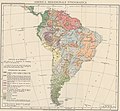 Map Ethnographic map of South America 1928-1940 - Touring Club Italiano CART-TRC-31.jpg 7,302 × 6,736; 21.52 MB
-
 Map Geological Map of South America 1928-1940 - Touring Club Italiano CART-TRC-27.jpg 8,213 × 7,176; 9.59 MB
-


.jpg)
.jpg)
.jpg)