Category:1960 maps of Massachusetts
States of the United States: California · Hawaii · Massachusetts · Michigan · New York · Pennsylvania · Virginia – Washington, D.C.
| 1960 → |
Media in category "1960 maps of Massachusetts"
The following 3 files are in this category, out of 3 total.
-
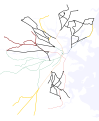 Boston-Area Trackless Trolleys 1960.svg 2,550 × 3,100; 51 KB
-
 Massachusetts 1-25,000. Camp Edwards LOC 79693093.jpg 6,486 × 10,023; 12.86 MB
-
 Massachusetts 1-25,000. Camp Edwards LOC 79693093.tif 6,486 × 10,023; 185.99 MB

