Category:1960s maps of Mexico
Countries of the Americas: Argentina · The Bahamas · Belize · Brazil · Canada · Chile · Colombia · Costa Rica · Cuba · Guatemala · Haiti · Mexico · Panama · Peru · United States of America · Venezuela
Other areas: Aruba · Greenland · Puerto Rico
Other areas: Aruba · Greenland · Puerto Rico
Media in category "1960s maps of Mexico"
The following 3 files are in this category, out of 3 total.
-
 1967 data of Mexico.jpg 2,172 × 2,880; 829 KB
-
 Cerralvo.jpg 883 × 1,567; 1.08 MB
-
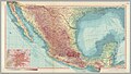 Mexico, 1967.jpg 5,118 × 2,900; 2.7 MB


