Category:1960s maps of Sudan
Countries of Africa: Algeria · Angola · Botswana · Chad · Democratic Republic of the Congo · Egypt‡ · Eritrea · Ethiopia · Ghana · Kenya · Liberia · Libya · Madagascar · Malawi · Mali · Mauritania · Morocco · Mozambique · Namibia · Niger · Nigeria · Senegal · Sierra Leone · South Africa · Sudan · Tanzania · Tunisia · Uganda · Zambia · Zimbabwe
‡: partly located in Africa
‡: partly located in Africa
Countries of the Arab world: Algeria · Chad · Egypt · Eritrea · Iraq · Libya · Mauritania · Morocco · State of Palestine · Saudi Arabia · Sudan · Syria · Tunisia
Subcategories
This category has the following 4 subcategories, out of 4 total.
- 1960 maps of Sudan (2 F)
- 1961 maps of Sudan (2 F)
- 1963 maps of Sudan (6 F)
- 1968 maps of Sudan (1 F)
Media in category "1960s maps of Sudan"
The following 2 files are in this category, out of 2 total.
-
 1967 data of Northern African countries.jpg 3,912 × 2,896; 1.49 MB
-
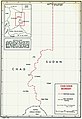 Chad-Sudan boundary map.jpg 665 × 968; 110 KB

