Category:1969 maps of Africa
Temperate regions: North America · South America · Africa · Europe · Asia · – Polar regions: – Other regions:
| ← 1960 1961 1962 1963 1964 1965 1966 1967 1968 1969 → |
Subcategories
This category has the following 5 subcategories, out of 5 total.
E
- 1969 maps of Ethiopia (8 F)
K
- 1969 maps of Kenya (5 F)
S
- 1969 maps of Sierra Leone (6 F)
U
- 1969 maps of Uganda (2 F)
Z
- 1969 maps of Zimbabwe (1 F)
Media in category "1969 maps of Africa"
The following 11 files are in this category, out of 11 total.
-
 Africa, administrative divisions. LOC 97687552.jpg 3,150 × 4,196; 1.62 MB
-
 Africa, administrative divisions. LOC 97687552.tif 3,150 × 4,196; 37.82 MB
-
 Africa- Population density. 7-69. LOC 75690460.jpg 3,138 × 4,086; 1.48 MB
-
 Africa- Population density. 7-69. LOC 75690460.tif 3,138 × 4,086; 36.68 MB
-
 Africa. 9-69. LOC gm70003354.jpg 3,167 × 4,148; 1.99 MB
-
 Africa. 9-69. LOC gm70003354.tif 3,167 × 4,148; 37.58 MB
-
 Africa. LOC 97687551.jpg 3,138 × 4,161; 1.09 MB
-
 Africa. LOC 97687551.tif 3,138 × 4,161; 37.36 MB
-
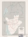
 Burundi, administrative divisions. 5-69. LOC 75695704.jpg 3,210 × 4,140; 1.63 MB
-
 Burundi, administrative divisions. 5-69. LOC 75695704.tif 3,210 × 4,140; 38.02 MB
-
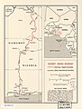 Dahomey-Nigeria boundary. LOC 76696106.jpg 3,179 × 4,196; 1.07 MB


