Category:1977 maps of Florida
States of the United States: Florida · Georgia · Maine · Massachusetts · New York · North Carolina · Pennsylvania · South Carolina · Virginia · West Virginia
| ← 1971 1972 1973 1974 1975 1976 1977 1978 1979 → |
Media in category "1977 maps of Florida"
The following 23 files are in this category, out of 23 total.
-

-

-
 Entrance to Pensacola Bay, Florida. LOC 78692125.jpg 7,471 × 6,325; 4.76 MB
-
 Entrance to Pensacola Bay, Florida. LOC 78692125.tif 7,471 × 6,325; 135.2 MB
-
 Florida Keys, Florida, satellite image map, NASA LANDSAT-1. LOC 78693105.jpg 7,478 × 6,096; 5.67 MB
-
 Florida Keys, Florida, satellite image map, NASA LANDSAT-1. LOC 78693105.tif 7,478 × 6,096; 130.42 MB
-

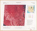
-

-
 Lake George, Florida, satellite image map - NASA LANDSAT-1, 1-500,000, N2849W08119 LOC 79694278.tif 7,428 × 6,124; 130.15 MB
-

-

-

-

-
-

-

-

-

-

-
 Southwest Florida Water Management District LOC 78693408.jpg 7,446 × 10,772; 7.93 MB
-
 Southwest Florida Water Management District LOC 78693408.tif 7,446 × 10,772; 229.48 MB
-

-


