Category:1986 in Norfolk, England
Ceremonial counties of England: Bedfordshire · Berkshire · Buckinghamshire · Cambridgeshire · Cheshire · Cornwall · Cumbria · Derbyshire · Devon · Dorset · Durham · East Riding of Yorkshire · East Sussex · Essex · Gloucestershire · Greater London · Greater Manchester · Hampshire · Herefordshire · Hertfordshire · Isle of Wight · Kent · Lancashire · Leicestershire · Lincolnshire · Merseyside · Norfolk · North Yorkshire · Northumberland · Nottinghamshire · Oxfordshire · Rutland · Shropshire · Somerset · South Yorkshire · Staffordshire · Suffolk · Surrey · Tyne and Wear · Warwickshire · West Midlands · West Sussex · West Yorkshire · Wiltshire ·
City-counties: Bristol · City of London
Former historic counties:
Other former counties:
City-counties: Bristol · City of London
Former historic counties:
Other former counties:
Subcategories
This category has the following 5 subcategories, out of 5 total.
Media in category "1986 in Norfolk, England"
The following 27 files are in this category, out of 27 total.
-
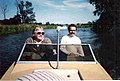 Afloat on the Broads - geograph.org.uk - 256250.jpg 640 × 434; 77 KB
-
 Blickling Hall Trees - geograph.org.uk - 1201744.jpg 640 × 427; 139 KB
-
 Broadland Conservation Centre (1986) - geograph.org.uk - 871008.jpg 640 × 415; 83 KB
-
 Broads Hotel, Wroxham - geograph.org.uk - 256236.jpg 640 × 399; 82 KB
-
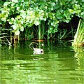
 Coot on River Bure - geograph.org.uk - 449579.jpg 547 × 547; 75 KB
-
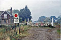 County School station, 1986 geograph-3092269-by-Ben-Brooksbank.jpg 847 × 561; 482 KB
-
 Entrance to Hoveton Little Broad - geograph.org.uk - 870918.jpg 640 × 415; 132 KB
-
 Fritton Lake Country Park - geograph.org.uk - 778909.jpg 640 × 411; 99 KB
-
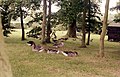
 Greylag Geese on the River Bure - geograph.org.uk - 449696.jpg 640 × 609; 93 KB
-
 Horsey Mill - geograph.org.uk - 939748.jpg 550 × 468; 52 KB
-
 Mallard on River Bure - geograph.org.uk - 449582.jpg 640 × 499; 81 KB
-
 Moorhen on River Bure - geograph.org.uk - 449586.jpg 640 × 640; 126 KB
-
 No mooring^ - geograph.org.uk - 449601.jpg 519 × 640; 113 KB
-

-
 Ol'Mississippi Steamboat (1986) - geograph.org.uk - 871043.jpg 640 × 415; 70 KB
-
 Pudding Norton Church - geograph.org.uk - 347862.jpg 640 × 482; 99 KB
-
 Refreshments at Horsey - geograph.org.uk - 1201758.jpg 640 × 545; 126 KB
-
 Sugar Silos at Cantley - geograph.org.uk - 141619.jpg 640 × 420; 63 KB
-
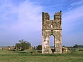 The ruins of Godwick Church - geograph.org.uk - 347859.jpg 640 × 473; 86 KB
-
 Trowse swing bridges - old and new togehter, Norwich.jpg 1,857 × 1,248; 462 KB
-
 Wroxham Broad - geograph.org.uk - 256232.jpg 640 × 425; 117 KB
-

-
 Burnham Overy Staithe pathway - geograph.org.uk - 261752.jpg 640 × 431; 82 KB
-
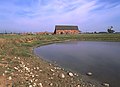 Godwick Pond - geograph.org.uk - 347861.jpg 640 × 463; 77 KB
-
 Mute Swans on River Bure - geograph.org.uk - 449553.jpg 640 × 640; 107 KB
-
 Sevenstead, Belaugh - geograph.org.uk - 261885 (cropped).jpg 539 × 329; 69 KB
-
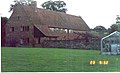 Sevenstead, Belaugh - geograph.org.uk - 261885.jpg 640 × 391; 93 KB


_-_geograph.org.uk_-_871008.jpg)


_-_geograph.org.uk_-_871043_(cropped).jpg)
_-_geograph.org.uk_-_871043.jpg)


.jpg)


.jpg)
