Category:1990s maps of Arkansas
States of the United States: Alabama · Alaska · Arizona · Arkansas · California · Colorado · Delaware · Florida · Georgia · Hawaii · Kentucky · Louisiana · Maine · Maryland · Massachusetts · Mississippi · Nebraska · New Hampshire · New Jersey · New York · North Carolina · Ohio · Pennsylvania · Rhode Island · South Carolina · South Dakota · Tennessee · Texas · Utah · Vermont · Virginia · West Virginia – Washington, D.C.
Media in category "1990s maps of Arkansas"
The following 6 files are in this category, out of 6 total.
-
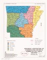
 Arkansas Association of Conservation Districts administrative areas LOC 93682956.jpg 2,533 × 3,272; 957 KB
-
 Arkansas Association of Conservation Districts administrative areas LOC 93682956.tif 2,533 × 3,272; 23.71 MB
-
 Pea Ridge National Military Park, Arkansas - official map and guide LOC 95685305.jpg 5,038 × 4,716; 4.21 MB
-
 Pea Ridge National Military Park, Arkansas - official map and guide LOC 95685305.tif 5,038 × 4,716; 67.98 MB
-
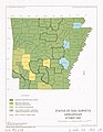 Status of soil surveys, Arkansas - October 1995 LOC 2013592238.jpg 2,540 × 3,284; 831 KB
-
 Status of soil surveys, Arkansas - October 1995 LOC 2013592238.tif 2,540 × 3,284; 23.87 MB


