Category:19th-century maps of Australia
Countries of Oceania: Australia · New Zealand · Papua New Guinea · Samoa · Solomon Islands · Vanuatu
Other areas: Hawaii – Partly: Indonesia
Other areas: Hawaii – Partly: Indonesia
Subcategories
This category has the following 18 subcategories, out of 18 total.
.
- 1800s maps of Australia (6 F)
- 1810s maps of Australia (10 F)
- 1820s maps of Australia (3 F)
- 1850s maps of Australia (13 F)
- 1860s maps of Australia (15 F)
- 1870s maps of Australia (19 F)
1
- 19th-century maps of Tasmania (35 F)
M
- Maps by John Sands (136 F)
N
Q
S
V
W
Media in category "19th-century maps of Australia"
The following 8 files are in this category, out of 8 total.
-

-
-
-

-
 Admiralty Chart No 2759b Australia Southern Portion, Published 1885, Large Corrections 1968.jpg 16,513 × 11,264; 34.37 MB
-
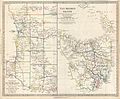
 Egerton warburton exp.png 940 × 638; 579 KB
-
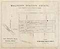 Malvern Station Estate.jpg 1,600 × 1,290; 377 KB
-
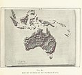
 Map of Australia, New Zealand, Cook & Friendly Islands (1900) (18288648358).jpg 5,872 × 4,336; 2.26 MB
.jpg)

.jpg)
.jpg)


_(18288648358).jpg)