Category:19th-century maps of Yucatán
Media in category "19th-century maps of Yucatán"
The following 28 files are in this category, out of 28 total.
-

-
 Heller, Leon, & Wilhelmi Karte von Yucatan 1847-1848 UTA.jpg 2,761 × 3,600; 2.61 MB
-
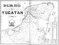 1848 map Yucatan.jpg 2,500 × 1,907; 1.27 MB
-

-

-
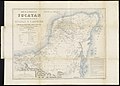
 1882 Map Yucatan Charnay.jpg 1,500 × 1,395; 2.39 MB
-
 159 of 'A Popular History of the Mexican People' (11289362475).jpg 1,384 × 972; 274 KB
-

-

-
 Admiralty Chart No 1204 Belize to Cabo Catoche, Published 1839.jpg 8,250 × 11,049; 17.79 MB
-

-
 Admiralty Chart No 2626 Bay of Campeche, Published 1858, Large Corrections 1938.jpg 16,234 × 11,124; 40.71 MB
-
 Atlas mexicano. LOC 2007627316-10.jpg 7,139 × 6,424; 6.25 MB
-
 Atlas mexicano. LOC 2007627316-10.tif 7,139 × 6,424; 131.21 MB
-
 Contribution (I)-III to the coastal and plain flora of Yucatan (1895) (20496883258).jpg 2,688 × 2,830; 943 KB
-
 Incidents of travel in Central America, Chiapas, and Yucatan (1858) (14577377197).jpg 2,344 × 2,480; 377 KB
-
 Incidents of travel in Central America, Chiapas, and Yucatan (1858) (14783739073).jpg 2,136 × 1,472; 192 KB
-
-
 Mapa Geografico De La Peninsula Y Provincia De Yucatan 1801.jpg 2,000 × 1,681; 540 KB
-
 Plan of the Ruins of Ake Yucatan by Charnay.jpg 996 × 1,032; 544 KB
-
 Plano de Kanasin 1866.jpg 481 × 736; 345 KB
-
 Plano de la Población de la villa y puerto de Sisal (1869).jpg 2,125 × 1,840; 466 KB
-
 Plano del Departmento de Yucatan 1842.jpg 9,717 × 7,908; 3.84 MB
-
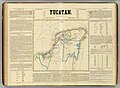 Yucatan 1858 Atlas Mexicano.jpg 1,536 × 1,123; 292 KB
-
 Yucatan 1884 Atlas Mexicano.jpg 4,753 × 5,516; 34.31 MB
-
 Yucatan-Peninsula-1822 Map.jpg 592 × 674; 71 KB
-
 Lizars Mexico & Guatimala 1836 UTA (cropped).jpg 6,247 × 5,049; 16.37 MB
-
 Lizars Mexico & Guatimala 1836 UTA.jpg 6,566 × 5,320; 14 MB
%27_(11109921423).jpg)


%27_(11111415163).jpg)

.jpg)
.jpg)
.jpg)


-III_to_the_coastal_and_plain_flora_of_Yucatan_(1895)_(20496883258).jpg)
_(14577377197).jpg)
_(14783739073).jpg)
.jpg)


.jpg)


.jpg)
