Category:19th-century maps of the Americas
Subcategories
This category has the following 13 subcategories, out of 13 total.
*
-
Media in category "19th-century maps of the Americas"
The following 49 files are in this category, out of 49 total.
-
 North america ethnic 1500.JPG 4,800 × 3,848; 3.8 MB
-

-
 173 of 'Eclectic Physical Geography' (11200707004).jpg 1,315 × 2,066; 725 KB
-

-

-

-

-

-
 Image taken from page 208 of Amerika(15967951404).jpg 1,257 × 1,692; 375 KB
-

-
-

-
 7 of 'Arnold's Geographical Handbooks' (11251265024).jpg 1,192 × 1,752; 622 KB
-

-
-

-
-
 87 of '(A class book of physical geography.)' (11148993433).jpg 1,297 × 2,031; 712 KB
-
 America (2674152579).jpg 2,000 × 1,471; 2.1 MB
-
 America (3121047384).jpg 1,710 × 2,000; 3.1 MB
-
 America (3121047664).jpg 1,678 × 2,000; 3.24 MB
-
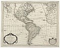
 America - politische Karte.jpg 6,447 × 7,670; 15.04 MB
-
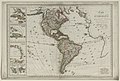
 America - Stieler's Hand-Atlas.jpg 4,619 × 5,546; 6.72 MB
-
 America from Court Game of Geography MET DP862920.jpg 808 × 1,211; 325 KB
-
 America LOC 2015588081.tif 8,082 × 6,248; 144.47 MB
-
 America relief map.JPG 1,781 × 2,301; 1,017 KB
-
 Amerika (8346517369).jpg 661 × 800; 133 KB
-
 Amérique - dressée par E. Desbuissons ; sous la Direction de E. Cortambert... - btv1b84689981.jpg 8,004 × 10,464; 12.04 MB
-

-

-
-
-
-

-
 Carte du nouveau continent (2674651935).jpg 1,268 × 2,000; 1.79 MB
-

-
 Géographie de lAmérique (4071868415).jpg 2,000 × 1,491; 3.2 MB
-

-
 Historia naturalis palmarum (Tab. geograph. I) BHL281667.jpg 600 × 815; 109 KB
-
-
 Karte von America (3121046728).jpg 1,450 × 2,000; 2.88 MB
-
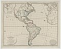
 Map of America.jpg 5,642 × 7,253; 12.06 MB
-
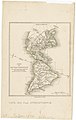
 Map of the Western Hemisphere (from Sketchbook) MET DP306660.jpg 2,686 × 3,853; 1.93 MB
-
 Map-Palm Trees of the Amazon.jpg 1,555 × 2,672; 2.08 MB
-
 Peter Parley's common school history. Illustrated by engravings (1857) (14596685267).jpg 1,634 × 2,610; 829 KB
-

-
 Roze fig.1.png 444 × 693; 218 KB
-
 The Americas in Ottoman Turkish.jpg 3,169 × 4,609; 1.45 MB
-
 The Western Hemisphere map of Haiguotuzhi.jpg 1,417 × 1,051; 980 KB

.jpg)
.jpg)
.jpg)
.jpg)
.jpg)
.jpg)
.jpg)
.jpg)
%27_(11247233413).jpg)
%27_(11246681114).jpg)
.jpg)
%27_(11205274293).jpg)
%27_(11161249875).jpg)
.jpg)
%27_(11224009644).jpg)
%27_(11148993433).jpg)
.jpg)
.jpg)
.jpg)


.jpg)


.jpg)
_(20838006655).jpg)
.jpg)
.jpg)
_BHL281667.jpg)
.jpg)
.jpg)

_MET_DP306660.jpg)

_(14596685267).jpg)


.jpg)