Category:19th-century maps of the Caribbean
Subcategories
This category has the following 23 subcategories, out of 23 total.
- 1820s maps of the Caribbean (5 F)
A
B
C
G
- 19th-century maps of Guadeloupe (23 F)
H
J
M
- 19th-century maps of Martinique (16 F)
P
S
Media in category "19th-century maps of the Caribbean"
The following 5 files are in this category, out of 5 total.
-
 Admiralty Chart No 2600 West Indies, Published 1858.jpg 16,225 × 11,082; 28.28 MB
-
-
 Brockhaus and Efron Encyclopedic Dictionary b2 844-0.jpg 3,546 × 2,552; 3.47 MB
-
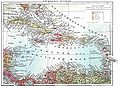 Brockhaus-Efron Antilskiye ostrova.jpg 1,773 × 1,276; 299 KB
-
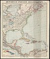
 Spanish antilles.jpg 1,991 × 657; 395 KB


