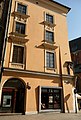
Category:1 Floriańska Street in Kraków
| Object location | | View all coordinates using: OpenStreetMap |
|---|
house in Kraków, Poland  | |||||
| Upload media | |||||
| Instance of | |||||
|---|---|---|---|---|---|
| Location | Kraków, Lesser Poland Voivodeship, Poland | ||||
| Heritage designation |
| ||||
 | |||||
| Address |
|
Media in category "1 Floriańska Street in Kraków"
The following 16 files are in this category, out of 16 total.
-
 A-185 kamienica Pod Etiopy Kraków, ul. Floriańska 1.jpg 1,944 × 2,896; 2.37 MB
-
 Kamienica Pod Matką Boską w Krakowie 01.jpg 3,000 × 3,790; 2.02 MB
-
 Kamienica Pod Murzynami w Krakowie 01.jpg 3,000 × 4,000; 2.3 MB
-
 Kamienica, Floriańska 1, Kraków 1.JPG 2,048 × 1,536; 1.36 MB
-
 Kamienica, Floriańska 1, Kraków 2.JPG 1,536 × 2,048; 1.35 MB
-
 KamienicaPodEtiopy-UlicaFloriańska1-POL, Kraków.jpg 1,024 × 768; 294 KB
-
 Krakow Pod Murzynami 2.jpg 5,184 × 3,456; 8.55 MB
-
 Krakow Pod Murzynami.jpg 2,112 × 2,816; 3.33 MB
-
 Kraków, kamienica Pod Murzynkami 01.JPG 3,456 × 2,592; 2.84 MB
-
 Kraków, kamienica Pod Murzynkami 02.JPG 3,456 × 2,592; 2.87 MB
-
 Pod Murzynami House, 1 Florianska street,Old Town,Krakow,Poland.jpg 3,714 × 2,596; 8.62 MB
-

-
 Płaskorzeźba na Kamienicy Pod Murzynami w Krakowie, 20230909 1651 0432.jpg 2,871 × 3,493; 11.21 MB
-
 Relief-Pod Murzynami house-Kraków-2.jpg 2,322 × 4,128; 1.08 MB
-
 Relief-Pod Murzynami house-Kraków.jpg 2,448 × 3,264; 1.45 MB
-
 Ul. Floriańska 1, Kraków.JPG 1,987 × 2,948; 2.52 MB


_and_Magic_Carriage_commemorative_plaque_(1998_design._by_M._Stankiewicz),_1_Floria%C5%84ska_street_(1_Mariacki_square),_Old_Town,_Krakow,_Poland.jpg)


