Category:2000 United States Senate election maps
Media in category "2000 United States Senate election maps"
The following 53 files are in this category, out of 53 total.
-
 00MontanaSenateCounties.PNG 800 × 461; 79 KB
-
 00PASenateCounties.PNG 800 × 460; 76 KB
-
 00WASenateCounties.PNG 800 × 521; 97 KB
-
 2000 Arizona.png 2,000 × 2,332; 224 KB
-

-

-

-

-

-

-
 2000 United States Senate election in Hawaii results map by county.svg 1,052 × 614; 2.12 MB
-

-

-
 2000 United States Senate election in Maine results map by municipality.svg 810 × 810; 3.03 MB
-

-
 2000 United States Senate Election in Massachusetts by Town.svg 810 × 502; 182 KB
-

-
 2000 United States Senate election in Massachusetts results map by municipality.svg 2,100 × 1,300; 1.55 MB
-

-

-

-

-

-

-

-

-

-
 2000 United States Senate election in New York results map by county.svg 744 × 577; 297 KB
-

-
 2000 United States Senate election in Ohio results map by county.svg 810 × 810; 39 KB
-

-

-

-

-

-
 2000 United States Senate election in Utah results map by county.svg 810 × 810; 29 KB
-

-

-

-

-

-

-

-
 2000 United States Senate elections results map.svg 959 × 593; 82 KB
-

-
 2000 Virginia Senate election map.png 833 × 364; 34 KB
-
 INSenCounties00.png 690 × 1,020; 38 KB
-
 Michigan US Senate Results 2000 by Municipality.svg 810 × 810; 1.45 MB
-
 MN US Senate 2000.svg 744 × 744; 4.31 MB
-
 Minnesota Senate 2000.png 550 × 626; 69 KB
-
 NJSenCounties00.png 327 × 598; 69 KB
-
 NYSen000Counties.png 657 × 500; 22 KB
-
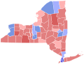
 NYSen00Counties.png 500 × 376; 13 KB


