Category:2005 in Barrow upon Humber
Media in category "2005 in Barrow upon Humber"
The following 25 files are in this category, out of 25 total.
-
 A Regatta of Swans - geograph.org.uk - 292291.jpg 640 × 480; 115 KB
-
 Railway Bridge at Barrow Haven - geograph.org.uk - 143426.jpg 640 × 473; 114 KB
-
 Barrow Haven Mill.jpg 427 × 640; 122 KB
-

-
 Cemetery Entrance - geograph.org.uk - 57497.jpg 640 × 480; 185 KB
-
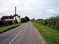
 The road to Barrow Haven - geograph.org.uk - 60049.jpg 640 × 439; 80 KB
-
 Goxhill Road - geograph.org.uk - 60307.jpg 640 × 480; 113 KB
-
 The Path to South Marsh Farm - geograph.org.uk - 60777.jpg 640 × 426; 128 KB
-
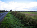
 Reedy River Bank - geograph.org.uk - 60763.jpg 640 × 414; 148 KB
-
 Providence Row 1838 - geograph.org.uk - 72690.jpg 640 × 480; 135 KB
-
 Near Barrow Vale - geograph.org.uk - 75348.jpg 640 × 426; 143 KB
-
 Calm Evening at Barrow Haven - geograph.org.uk - 1375630.jpg 640 × 452; 64 KB
-
 The Haven Inn - geograph.org.uk - 43701.jpg 640 × 426; 162 KB
-
 Marsh Lane - geograph.org.uk - 50302.jpg 640 × 479; 81 KB
-
 College Road - geograph.org.uk - 59916.jpg 640 × 480; 114 KB
-
 Looking towards Boundary Farm - geograph.org.uk - 59915.jpg 640 × 472; 105 KB
-
 B1206 Junction - geograph.org.uk - 62936.jpg 640 × 480; 122 KB
-
 Looking towards Barrow - geograph.org.uk - 62942.jpg 640 × 480; 128 KB
-
 West Hann Farm - geograph.org.uk - 71956.jpg 640 × 480; 72 KB
-
 Barrow Hann Junction - geograph.org.uk - 71948.jpg 640 × 480; 107 KB
-
 Barrow Hall - Entrance Gates - geograph.org.uk - 72702.jpg 640 × 480; 208 KB
-
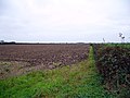 Leys Farm - Field - geograph.org.uk - 72696.jpg 640 × 480; 128 KB
-
 Westoby Lane - geograph.org.uk - 72689.jpg 640 × 480; 142 KB
-
 Westoby Lane - Looking South East - geograph.org.uk - 72706.jpg 640 × 480; 108 KB
-
 Looking towards Deepdale - geograph.org.uk - 75343.jpg 640 × 426; 88 KB


