Category:2006 in County Donegal
Counties of the Republic of Ireland: Carlow · Cavan · Clare · Cork(1) · Donegal · Fingal(2) · Galway(3) · Kerry · Kildare · Kilkenny · Laois · Leitrim · Limerick · Longford · Louth · Mayo · Meath · Monaghan · Offaly · Roscommon · Sligo · Tipperary(4) · Waterford · Westmeath · Wexford · Wicklow – Separate cities: Cork(1) · Dublin(2) · – Former counties: Dublin(2) · Former counties of Northern Ireland: Antrim · Armagh · Down · Fermanagh · Londonderry · Tyrone
Media in category "2006 in County Donegal"
The following 33 files are in this category, out of 33 total.
-
 25th commemoration of 1981 Irish hunger strike.JPG 2,048 × 1,536; 754 KB
-
 80 km-h signs at Ballyfolliard - Inisclan - geograph.org.uk - 137402.jpg 640 × 479; 104 KB
-
 Animals-Sheep-Road-Donegal-Ireland.JPG 2,304 × 1,712; 2.61 MB
-
-
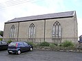
 Ballyglennon Presbyterian Church - geograph.org.uk - 213222.jpg 640 × 479; 49 KB
-
 Ballymacavany Townland - geograph.org.uk - 449757.jpg 640 × 479; 72 KB
-
 Bridge over the Gweebarra River - geograph.org.uk - 619837.jpg 640 × 475; 65 KB
-
 Carrig Inn, Carrigans, County Donegal - geograph.org.uk - 142058.jpg 640 × 510; 98 KB
-
 Carrigans Church of Ireland - geograph.org.uk - 108220.jpg 640 × 479; 118 KB
-
 Church of Ireland, Laghey Co Donegal - geograph.org.uk - 149481.jpg 640 × 548; 128 KB
-
 Costcutter's Cloghore, County Donegal - geograph.org.uk - 204200.jpg 640 × 479; 54 KB
-
 Dinghy at Inch Harbour - geograph.org.uk - 845394.jpg 640 × 480; 82 KB
-
 Downings.jpg 2,816 × 2,112; 1.73 MB
-
 Drumenny Townland - geograph.org.uk - 141988.jpg 640 × 479; 111 KB
-
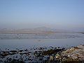
 Estuary of the Culdaff River - geograph.org.uk - 172859.jpg 640 × 480; 97 KB
-
 Gatehouse - geograph.org.uk - 108234.jpg 640 × 479; 140 KB
-
 Gleneely Bridge - geograph.org.uk - 172855.jpg 640 × 479; 97 KB
-
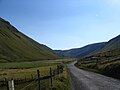 Glengesh Pass ouest.JPG 2,048 × 1,536; 695 KB
-
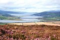
 Grianan of Aileach view.Jpg 2,304 × 1,728; 1.68 MB
-
 Inch Island Causeway, Lough Swilly - geograph.org.uk - 646166.jpg 640 × 427; 73 KB
-
 Lifford.jpg 640 × 479; 144 KB
-
 Maghera caves, Ardara - geograph.org.uk - 1073912.jpg 640 × 480; 95 KB
-
 Malin Beg Bay - geograph.org.uk - 256797.jpg 640 × 480; 44 KB
-
 Miracle Tree, Carrigans, County Donegal - geograph.org.uk - 142065.jpg 640 × 479; 109 KB
-
-
 River Crana near Buncrana.jpg 1,200 × 1,600; 624 KB
-
 Road at Ballymacavany - geograph.org.uk - 449759.jpg 640 × 479; 81 KB
-
 St Johnston Railway Station - geograph.org.uk - 142072.jpg 640 × 479; 99 KB
-
 St Patrick's Chapel, Donegal Town - geograph.org.uk - 144348.jpg 480 × 640; 82 KB
-

-
 Swilly Bridge - geograph.org.uk - 213299.jpg 640 × 479; 100 KB
-
 The Saint Patrick - geograph.org.uk - 449772.jpg 640 × 479; 68 KB
-
 White Strand - geograph.org.uk - 172959.jpg 640 × 480; 97 KB


_-_geograph.org.uk_-_204202.jpg)


