Category:2008 in County Leitrim
Media in category "2008 in County Leitrim"
The following 23 files are in this category, out of 23 total.
-
 Ballinaglera Walks - geograph.org.uk - 1112805.jpg 640 × 480; 87 KB
-
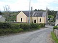 Ballinagleragh Church - geograph.org.uk - 796651.jpg 640 × 480; 59 KB
-
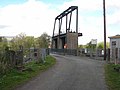 Bellantra Bridge - geograph.org.uk - 798107.jpg 640 × 480; 54 KB
-
 Bonet River - geograph.org.uk - 798508.jpg 640 × 480; 98 KB
-
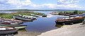 Breffni Pier, Lough Melvin (1) - geograph.org.uk - 825818.jpg 640 × 279; 37 KB
-
 Bridge over the Stony River - geograph.org.uk - 1111723.jpg 640 × 480; 126 KB
-
 Car park for the Scardan Waterfall - geograph.org.uk - 1607450.jpg 640 × 480; 113 KB
-
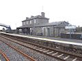 Carrick on Shannon railway station 1.jpg 640 × 480; 77 KB
-
 Countyleitrimcows.jpg 3,648 × 2,736; 3.27 MB
-
 Dromod Garda Station - geograph.org.uk - 918939.jpg 640 × 480; 66 KB
-
 Footbridge over the Stony River - geograph.org.uk - 796575.jpg 480 × 640; 91 KB
-
 John Rynn's Bar, Ballinagleragh - geograph.org.uk - 796646.jpg 640 × 480; 74 KB
-

-
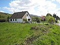 Modern house near Ballinagleragh - geograph.org.uk - 1112215.jpg 640 × 480; 94 KB
-
 Moorland near Ardlougher - geograph.org.uk - 1607443.jpg 640 × 480; 88 KB
-
 Mulvey's Bar, Ballinagleragh - geograph.org.uk - 1112803.jpg 640 × 480; 63 KB
-

-

-
 Scarden Falls - geograph.org.uk - 798051.jpg 480 × 640; 114 KB
-
 St Hugh's Well - geograph.org.uk - 796639.jpg 640 × 480; 93 KB
-
 The lane from Fahy - geograph.org.uk - 1111726.jpg 640 × 480; 91 KB
-
 The road down from Corry Mountain - geograph.org.uk - 798047.jpg 640 × 480; 72 KB
-
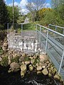
 Walkway down to the Scarden Falls - geograph.org.uk - 798050.jpg 480 × 640; 78 KB


_-_geograph.org.uk_-_825818.jpg)


