Category:2008 in the London Borough of Wandsworth
Boroughs of London: City of London · City of Westminster · Barking and Dagenham · Barnet · Bexley · Brent · Bromley · Camden · Croydon · Ealing · Enfield · Greenwich · Hackney · Hammersmith and Fulham · Haringey · Harrow · Havering · Hillingdon · Hounslow · Islington · Kensington and Chelsea · Kingston · Lambeth · Lewisham · Merton · Newham · Redbridge · Richmond · Southwark · Sutton · Tower Hamlets · Waltham Forest · Wandsworth
Subcategories
This category has only the following subcategory.
C
Media in category "2008 in the London Borough of Wandsworth"
The following 111 files are in this category, out of 111 total.
-
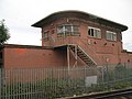 (The former) Balham signal box - geograph.org.uk - 899090.jpg 640 × 480; 61 KB
-
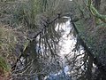
 Beverley Brook at Beverley Bridge - geograph.org.uk - 676081.jpg 640 × 480; 131 KB
-
 Beverley Brook on Wimbledon Common - geograph.org.uk - 675709.jpg 640 × 480; 123 KB
-
 Hugh llewelyn 450 016 (6340694345).jpg 2,592 × 1,944; 1.24 MB
-
 377149-WandsworthRoad-20080513.JPG 1,936 × 1,296; 421 KB
-
 456002-WandsworthRoad-20080513.JPG 1,936 × 1,296; 364 KB
-
 456006-WandworthRoad-20080513.JPG 1,936 × 1,296; 319 KB
-
 465036-WandsworthRoad-20080513.JPG 1,936 × 1,296; 357 KB
-
 Duke of Cambridge, Battersea, SW11 (4869256431).jpg 3,000 × 2,000; 2.22 MB
-
 Battersea Park stn main line fast look north.JPG 1,600 × 1,200; 492 KB
-

-
 A205, Putney - geograph.org.uk - 789618.jpg 640 × 430; 64 KB
-
 Alchemist, Clapham Junction, SW11 (2630441445).jpg 1,280 × 960; 347 KB
-
 Annual Service. - geograph.org.uk - 1122404.jpg 640 × 480; 99 KB
-
 Approaches to Wandsworth Bridge. - geograph.org.uk - 789643.jpg 640 × 430; 62 KB
-
 Avalon Comics, Lavender Hill, SW11.jpg 2,137 × 2,848; 2.36 MB
-
 Balham Mosque - geograph.org.uk - 1014169.jpg 640 × 480; 73 KB
-
 Balham Railway Bridge - geograph.org.uk - 1014029.jpg 640 × 480; 75 KB
-
 Banksy - houses cleared (3047578427).jpg 358 × 295; 69 KB
-
 Battersea Albion Riverside (1) - geograph.org.uk - 828332.jpg 640 × 480; 79 KB
-
 Battersea Park bowling Green - geograph.org.uk - 957346.jpg 640 × 480; 58 KB
-

-
 Battersea Park Station - geograph.org.uk - 890222.jpg 640 × 480; 72 KB
-
 Beatrix Potter Primary School - geograph.org.uk - 747122.jpg 640 × 480; 106 KB
-
 Bedford Hill - geograph.org.uk - 1014308.jpg 640 × 480; 97 KB
-
 Brewery Tap, Wandsworth, SW18 (2384001310).jpg 1,280 × 960; 389 KB
-
 Brown Dog location - Latchmere Park - Battersea Park - 2008-04-09.jpg 1,280 × 960; 436 KB
-
 Bus shelter on Putney Heath - geograph.org.uk - 1587919.jpg 640 × 480; 27 KB
-
 Chez Bruce, Wandsworth Common, SW17.jpg 960 × 1,280; 325 KB
-
 Chimney of the former Ram Brewery - geograph.org.uk - 785125.jpg 480 × 640; 25 KB
-
 Clapham South stn roundel.JPG 1,200 × 1,600; 598 KB
-

-
 Dalby Road, Wandsworth - geograph.org.uk - 773630.jpg 480 × 640; 83 KB
-
 Dingwall Road, SW18 - geograph.org.uk - 897705.jpg 640 × 480; 83 KB
-

-
 District line to Southfields - geograph.org.uk - 1079272.jpg 640 × 480; 158 KB
-
 Dr Johnson Avenue - geograph.org.uk - 715879.jpg 640 × 480; 100 KB
-
 Earlsfield book shop (2253454688).jpg 1,296 × 1,936; 247 KB
-
 East Hill Wandsworth - geograph.org.uk - 1744913.jpg 1,600 × 1,200; 1.32 MB
-
 East Putney stn roundel.JPG 1,200 × 1,600; 317 KB
-
 East Putney Underground station - geograph.org.uk - 823957.jpg 640 × 480; 60 KB
-

-
 Elderfield Place - geograph.org.uk - 1012860.jpg 640 × 480; 106 KB
-
 Elmbourne Road - geograph.org.uk - 1012922.jpg 640 × 480; 80 KB
-
 Fawe Park Road railway - geograph.org.uk - 1079259.jpg 640 × 480; 81 KB
-
 Fazl Mosque - panoramio.jpg 2,560 × 1,920; 1.09 MB
-
 Fazl-Moschee nachts.JPG 2,448 × 3,264; 3.84 MB
-
 Fircroft Primary School, Tooting - geograph.org.uk - 938176.jpg 640 × 480; 80 KB
-
 Flats, Nutwell St., Tooting - geograph.org.uk - 1019775.jpg 640 × 430; 83 KB
-
 Footpath on Wimbledon Common - geograph.org.uk - 879675.jpg 640 × 480; 145 KB
-

-
 Fountain, Compass House, Wandsworth - geograph.org.uk - 773934.jpg 455 × 640; 81 KB
-
-
 Gardiner & Co Cabinet Maker (3048417374).jpg 640 × 480; 89 KB
-
 Garratt Green Playground, Earlsfield, London - panoramio.jpg 3,072 × 2,304; 3.16 MB
-
 Garratt Lane Old Burial Ground - geograph.org.uk - 1030527.jpg 640 × 480; 92 KB
-
 Garratt Lane, London SW18 - geograph.org.uk - 725685.jpg 640 × 480; 77 KB
-
 Garratt Lane, London SW18 - geograph.org.uk - 725692.jpg 640 × 480; 73 KB
-
 Halo, Battersea, SW11 (2411320647).jpg 1,280 × 960; 301 KB
-
 Hillbury Road - geograph.org.uk - 1012916.jpg 640 × 480; 78 KB
-
 Hoppers at Pier Wharf - geograph.org.uk - 773862.jpg 489 × 640; 72 KB
-
 Hoppers at Pier Wharf - geograph.org.uk - 773875.jpg 640 × 480; 66 KB
-

-
 Indian Restaurants, Tooting High St. - geograph.org.uk - 1019814.jpg 640 × 430; 85 KB
-

-
 Latchmere, Battersea, SW11 (2412139340).jpg 1,280 × 960; 329 KB
-
 Lyford Road, Wandsworth - geograph.org.uk - 1030496.jpg 640 × 480; 82 KB
-
 MacDonald's sign, Wandsworth - geograph.org.uk - 773839.jpg 480 × 640; 67 KB
-
 Main line from Victoria - geograph.org.uk - 1012667.jpg 640 × 480; 110 KB
-
 Massingberd Way - geograph.org.uk - 1012873.jpg 640 × 480; 103 KB
-
 Mitcham Road, Tooting - geograph.org.uk - 674882.jpg 640 × 480; 77 KB
-
 Mr Wandles Works (3120703510).jpg 1,936 × 1,296; 334 KB
-
 Muir Drive, Wandsworth - geograph.org.uk - 1030220.jpg 640 × 480; 126 KB
-
 Out of the Blue, Clapham Junction, SW11 (2630442853).jpg 1,280 × 960; 375 KB
-
 Putney Station - geograph.org.uk - 789611.jpg 640 × 430; 65 KB
-

-
-
 S Krett and sons, bespoke tailors,soon to close. (2427791707).jpg 1,936 × 1,296; 220 KB
-

-
 Shops along Tooting High st. - geograph.org.uk - 1019809.jpg 640 × 430; 89 KB
-
 Small Overgrown Seating Area - geograph.org.uk - 793681.jpg 640 × 427; 295 KB
-
 St George's Hospital, Tooting - geograph.org.uk - 938157.jpg 636 × 428; 78 KB
-
 St John's Hill, London SW11 - geograph.org.uk - 674893.jpg 640 × 480; 89 KB
-

-
 Taybridge, Lavender Hill, SW11 (4869246959).jpg 3,696 × 2,772; 3.83 MB
-
 The Allotments - geograph.org.uk - 747129.jpg 640 × 480; 76 KB
-
 The Devas Club for Young People.JPG 2,304 × 1,510; 1.48 MB
-
 The Green Man - geograph.org.uk - 1588182.jpg 640 × 480; 94 KB
-
 The King's Arms, Wandsworth - geograph.org.uk - 785120.jpg 640 × 496; 69 KB
-
 The old Tooting Library on Mitcham Road - geograph.org.uk - 1580365.jpg 640 × 480; 191 KB
-
 The Pond - geograph.org.uk - 747138.jpg 640 × 480; 94 KB
-
 Tooting Bec station east entrance - geograph.org.uk - 2248046.jpg 1,600 × 1,200; 515 KB
-
 Tooting Bec stn east entrance.JPG 1,600 × 1,200; 461 KB
-
 Tooting Bec stn roundel.JPG 1,200 × 1,600; 591 KB
-
 Tooting Bec stn west entrance.JPG 1,600 × 1,200; 619 KB
-
 Tooting Broadway station - geograph.org.uk - 2248059.jpg 1,600 × 1,200; 555 KB
-
 Tooting Broadway stn building.JPG 1,552 × 1,130; 314 KB
-
 Tooting Broadway stn roundel.JPG 1,200 × 1,600; 596 KB
-
 Tooting Broadway Underground Station - geograph.org.uk - 674884.jpg 640 × 480; 99 KB
-

-
 Tower above the Southside Centre - geograph.org.uk - 785112.jpg 480 × 640; 67 KB
-
 Trainspotters!.jpg 1,024 × 768; 133 KB
-

-
 Upper Tooting Kingdom Hall - geograph.org.uk - 938183.jpg 640 × 480; 79 KB
-
 Wandsworth Bus Garage, SW18 - geograph.org.uk - 899290.jpg 640 × 480; 53 KB
-
 Wandsworth Common stn east entrance and old building.JPG 1,600 × 1,200; 484 KB
-
 Wandsworth High Street - geograph.org.uk - 785119.jpg 640 × 484; 61 KB
-
 Wandsworth Road railway station in 2008.jpg 427 × 640; 209 KB
-
 Woolworths, Tooting Broadway, November 2008 - panoramio.jpg 1,152 × 864; 156 KB
-
 York Road Wandsworth - geograph.org.uk - 1060877.jpg 640 × 478; 103 KB
-
 Zodiac Records - geograph.org.uk - 785123.jpg 640 × 482; 57 KB
_Balham_signal_box_-_geograph.org.uk_-_899090.jpg)


.jpg)


.jpg)


.jpg)


_-_geograph.org.uk_-_828332.jpg)


.jpg)


.jpg)


.jpg)


.jpg)


.jpg)


.jpg)

.jpg)


.jpg)
_-_geograph.org.uk_-_785127.jpg)


.jpg)


.jpg)