Category:2009 in Bridlington
Media in category "2009 in Bridlington"
The following 200 files are in this category, out of 222 total.
(previous page) (next page)-
 A Bridlington Avian Resident - geograph.org.uk - 1348688.jpg 618 × 640; 36 KB
-
 A Bridlington Avian Resident - geograph.org.uk - 1348694.jpg 640 × 534; 40 KB
-
 A popular site for nesting birds^ - geograph.org.uk - 1358723.jpg 480 × 640; 118 KB
-

-
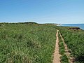
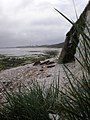
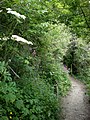 A secluded path, leading to .......^ - geograph.org.uk - 1358837.jpg 480 × 640; 130 KB
-
 A View Up Bempton Lane - geograph.org.uk - 1207447.jpg 640 × 480; 94 KB
-
 A window back to the past^ - geograph.org.uk - 1358764.jpg 480 × 640; 64 KB
-

-
 A165 Direction Bridlington - geograph.org.uk - 1218328.jpg 640 × 480; 76 KB
-
 A165 Roundabout - geograph.org.uk - 1211997.jpg 640 × 480; 73 KB
-
 A614 Near Bessingby - geograph.org.uk - 1223468.jpg 640 × 481; 131 KB
-
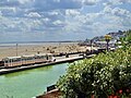
 Access to South Sands, Bridlington - geograph.org.uk - 1556793.jpg 640 × 427; 286 KB
-
 Alexandra Place, Bridlington - geograph.org.uk - 1567002.jpg 640 × 480; 52 KB
-
 An expanse of limestone pavement^ - geograph.org.uk - 1358683.jpg 640 × 480; 92 KB
-
 Are you sitting comfortably^ - geograph.org.uk - 1358739.jpg 640 × 480; 79 KB
-

-
 Bayle Gate - geograph.org.uk - 1212038.jpg 640 × 480; 99 KB
-
 Beach - panoramio - Immanuel Giel.jpg 1,685 × 1,715; 324 KB
-
 Beach Huts, South Sands - geograph.org.uk - 1244039.jpg 640 × 480; 60 KB
-
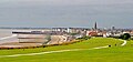 Beach of Bridlington 01.jpg 1,679 × 785; 404 KB
-
 Belvedere Cafe, South Sands - geograph.org.uk - 1270325.jpg 640 × 480; 46 KB
-
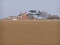
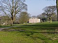
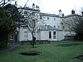
 Bessingby Hall - geograph.org.uk - 1223465.jpg 640 × 506; 126 KB
-
 Boats in Bridlington Harbour - geograph.org.uk - 1348670.jpg 640 × 470; 118 KB
-
 Boats in the Harbour - geograph.org.uk - 1270335.jpg 640 × 480; 103 KB
-
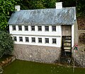
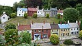
 Bondville Model Village 01.jpg 1,282 × 1,306; 268 KB
-
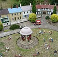
 Bondville Model Village 02.jpg 1,633 × 1,435; 503 KB
-
 Bondville Model Village 03.jpg 1,883 × 1,856; 935 KB
-
 Bondville Model Village 04.jpg 2,560 × 1,920; 2.41 MB
-
 Bondville Model Village 05.jpg 2,560 × 1,920; 2.54 MB
-
 Bondville Model Village 06.jpg 2,560 × 1,920; 2.32 MB
-
 Bondville Model Village 07.jpg 2,560 × 1,920; 2.44 MB
-
 Breakwater North beach - geograph.org.uk - 1208036.jpg 640 × 427; 99 KB
-
 Brid Bay Cafe, North Marine Drive - geograph.org.uk - 1566988.jpg 640 × 408; 48 KB
-
 Bridleway towards East Huntow - geograph.org.uk - 1284898.jpg 640 × 480; 125 KB
-
 Bridlington Ambulance Station - geograph.org.uk - 1212018.jpg 640 × 480; 80 KB
-

-
 Bridlington Belverdere Golf Club - geograph.org.uk - 1218352.jpg 640 × 424; 55 KB
-
 Bridlington Boating Lake - geograph.org.uk - 1244036.jpg 640 × 480; 74 KB
-
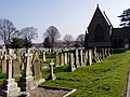
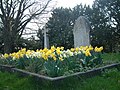
 Bridlington Cemetery - geograph.org.uk - 1209021.jpg 640 × 480; 42 KB
-
 Bridlington Fire Station - geograph.org.uk - 1212024.jpg 640 × 411; 57 KB
-
 Bridlington Funfair - geograph.org.uk - 1208075.jpg 640 × 427; 85 KB
-
 Bridlington Harbour - geograph.org.uk - 1202654.jpg 640 × 480; 69 KB
-
 Bridlington Harbour - geograph.org.uk - 1270326.jpg 640 × 480; 91 KB
-
 Bridlington harbour - geograph.org.uk - 1361023.jpg 640 × 417; 61 KB
-
 Bridlington Harbour fish dock - geograph.org.uk - 1202657.jpg 640 × 480; 71 KB
-
 Bridlington Hospital - geograph.org.uk - 1212015.jpg 640 × 480; 56 KB
-
 Bridlington Market - geograph.org.uk - 1348980.jpg 455 × 640; 99 KB
-
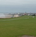
 Bridlington North Bay - geograph.org.uk - 1330313.jpg 640 × 473; 102 KB
-
 Bridlington North Beach - geograph.org.uk - 1348651.jpg 640 × 391; 65 KB
-
 Bridlington North Beach - geograph.org.uk - 1566937.jpg 640 × 480; 73 KB
-
 Bridlington Old Town - geograph.org.uk - 1427253.jpg 640 × 487; 142 KB
-
 Bridlington Priory Church 2009 03 20.jpg 640 × 480; 138 KB
-
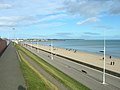
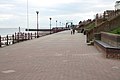 Bridlington Promenade - geograph.org.uk - 1227688.jpg 640 × 427; 55 KB
-
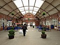
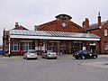 Bridlington Railway Station Exterior - geograph.org.uk - 1212027.jpg 640 × 480; 62 KB
-
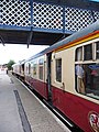
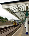
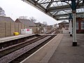 Bridlington Railway Station Platform - geograph.org.uk - 1212035.jpg 640 × 480; 83 KB
-
 Bridlington Railway Station Platforms - geograph.org.uk - 1212031.jpg 462 × 640; 113 KB
-
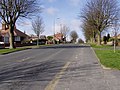
 Bridlington Residential - geograph.org.uk - 1207449.jpg 640 × 480; 62 KB
-
 Bridlington School.jpg 640 × 480; 73 KB
-
 Bridlington Station - geograph.org.uk - 1423895.jpg 640 × 480; 124 KB
-
 Bridlington Station - geograph.org.uk - 1423905.jpg 480 × 640; 145 KB
-
 Bridlington Station - geograph.org.uk - 1424369.jpg 640 × 479; 135 KB
-
 Bridlington Station - geograph.org.uk - 1428533.jpg 640 × 465; 143 KB
-
 Bridlington Station Foyer - geograph.org.uk - 1348966.jpg 640 × 480; 106 KB
-
 Bridlington Station from walkway - geograph.org.uk - 1423910.jpg 640 × 480; 157 KB
-
 Bridlington Station from walkway - geograph.org.uk - 1423915.jpg 480 × 640; 133 KB
-
 Bridlington Town Centre - geograph.org.uk - 2252067.jpg 1,024 × 768; 265 KB
-
 Bridlington Town Hall - geograph.org.uk - 1427256.jpg 640 × 470; 154 KB
-

-
 Bridlington01.jpg 2,560 × 1,920; 2.45 MB
-
 Bridlington02.jpg 1,627 × 1,767; 626 KB
-
 Bridlington03.jpg 2,482 × 1,395; 798 KB
-
 Bright Crescent - geograph.org.uk - 1227677.jpg 640 × 427; 57 KB
-

-
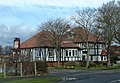 Broadacres Pub - geograph.org.uk - 1218344.jpg 640 × 442; 103 KB
-
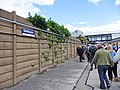
 Carrying the Scarborough Fares - geograph.org.uk - 1348961.jpg 510 × 640; 119 KB
-
 Cemetery Gravestones - geograph.org.uk - 1209042.jpg 640 × 480; 92 KB
-
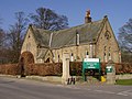
 Cemetery Lodge House - geograph.org.uk - 1209030.jpg 640 × 480; 56 KB
-
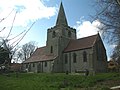 Church of St Magnus, Bessingby - geograph.org.uk - 1223494.jpg 640 × 481; 89 KB
-
 Cliff top walk Sewerby - geograph.org.uk - 1330356.jpg 640 × 480; 90 KB
-
 Clifftop Walk - geograph.org.uk - 1209140.jpg 640 × 480; 88 KB
-
 Clock Tower Tearoom - geograph.org.uk - 1204680.jpg 640 × 481; 89 KB
-
 Coastal Erosion - geograph.org.uk - 1209177.jpg 640 × 480; 113 KB
-
 Coastal panorama - geograph.org.uk - 1358871.jpg 640 × 480; 82 KB
-
 Coastal scenery near Beacon Hill - geograph.org.uk - 1387752.jpg 640 × 480; 75 KB
-
 Coastguard Headquarters - geograph.org.uk - 1126903.jpg 640 × 480; 53 KB
-
 Coastguard Station, Bridlington - geograph.org.uk - 1566929.jpg 640 × 455; 36 KB
-
 County Farm - geograph.org.uk - 1213381.jpg 640 × 480; 55 KB
-
 Danes Dyke Farm - geograph.org.uk - 1126803.jpg 640 × 480; 69 KB
-
 Danes Dyke From the Flamborough Road - geograph.org.uk - 1212540.jpg 640 × 427; 63 KB
-
 Descent through the Chalk^ - geograph.org.uk - 1358622.jpg 480 × 640; 73 KB
-
 East Huntow Farm - geograph.org.uk - 1213408.jpg 640 × 414; 76 KB
-

-
 Entering Bridlington - geograph.org.uk - 1213384.jpg 640 × 480; 62 KB
-
 Entrance to Bessingby Hall - geograph.org.uk - 1223456.jpg 640 × 481; 116 KB
-
 Entrance to Danes Dyke - geograph.org.uk - 1212562.jpg 640 × 427; 109 KB
-
 Entrance to Walled Garden - geograph.org.uk - 1509488.jpg 480 × 640; 71 KB
-
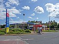
 Esso Service Station - geograph.org.uk - 1211993.jpg 640 × 480; 53 KB
-
 Evidence of landslip and erosion - geograph.org.uk - 1358694.jpg 640 × 480; 102 KB
-
 Farm Buildings - geograph.org.uk - 1213398.jpg 640 × 480; 74 KB
-
 Farm buildings, East Huntow - geograph.org.uk - 1213412.jpg 640 × 480; 82 KB
-
 Farm Track and Farmland - geograph.org.uk - 1209260.jpg 640 × 480; 91 KB
-
 Farm Track towards The Grange - geograph.org.uk - 1284901.jpg 640 × 458; 94 KB
-
 Farm Track, East Huntow - geograph.org.uk - 1213414.jpg 640 × 480; 94 KB
-
 Farmland Near The Grange - geograph.org.uk - 1207455.jpg 640 × 480; 91 KB
-
 Farmshop and Holiday Cottages - geograph.org.uk - 1209274.jpg 640 × 480; 106 KB
-
 Fishing Coble in Bridlington Harbour - geograph.org.uk - 1126906.jpg 640 × 480; 69 KB
-
 Floral display, Bridlington Station - geograph.org.uk - 1424371.jpg 640 × 480; 207 KB
-
 Floral display, Bridlington Station - geograph.org.uk - 1428527.jpg 640 × 480; 219 KB
-
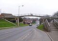
 Footbridge over the busy A165 - geograph.org.uk - 1212002.jpg 640 × 480; 77 KB
-
-
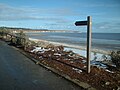 Footpath Waymarker North beach - geograph.org.uk - 1208055.jpg 640 × 480; 85 KB
-
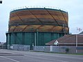 Full of gas needs a paint job - geograph.org.uk - 1115274.jpg 640 × 480; 61 KB
-
 Gatehouse to Sewerby Hall and Estate - geograph.org.uk - 1358590.jpg 640 × 471; 81 KB
-
 Gateway into Sewerby Park - geograph.org.uk - 1126889.jpg 640 × 480; 75 KB
-
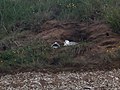
 Get off my perch - geograph.org.uk - 1427248.jpg 640 × 480; 73 KB
-

-
 Graffiti on Building - geograph.org.uk - 1212009.jpg 640 × 463; 88 KB
-
 Graveyard, St Magnus Church - geograph.org.uk - 1223499.jpg 640 × 481; 126 KB
-
 Greenhouse, Sewerby Hall Walled Garden - geograph.org.uk - 1509498.jpg 640 × 480; 137 KB
-
 Grindale Lane Junction With A165 - geograph.org.uk - 1213391.jpg 640 × 480; 58 KB
-
 Groyne into the sea - geograph.org.uk - 1202635.jpg 640 × 480; 68 KB
-
 Gull in the harbour - geograph.org.uk - 1270333.jpg 640 × 480; 88 KB
-
-
 Headlands School and Science College.jpg 640 × 480; 81 KB
-
 Hedgerow and Woodland - geograph.org.uk - 1223469.jpg 640 × 481; 98 KB
-
 Hedgerow off Short Lane - geograph.org.uk - 1207482.jpg 640 × 480; 82 KB
-
 High Street, Bridlington Old Town - geograph.org.uk - 1561133.jpg 640 × 480; 81 KB
-
 Hilderthorpe Beach and South sands - geograph.org.uk - 1202664.jpg 640 × 480; 48 KB
-
 Hillfield near Bridlington - geograph.org.uk - 1213393.jpg 640 × 480; 75 KB
-
 Holiday Caravan Park - geograph.org.uk - 1115277.jpg 640 × 480; 44 KB
-
 Holy Trinity Church - geograph.org.uk - 1566997.jpg 470 × 640; 45 KB
-
 Houses in Bridlington - geograph.org.uk - 1428548.jpg 640 × 481; 113 KB
-
 Houses on Short Lane - geograph.org.uk - 1207475.jpg 640 × 480; 70 KB
-
 Houses with a view of the sea - geograph.org.uk - 1556802.jpg 640 × 427; 268 KB
-
 Housing on Bessingby Gate - geograph.org.uk - 1223448.jpg 640 × 481; 113 KB
-
 I see no ships^ - geograph.org.uk - 1358639.jpg 640 × 480; 59 KB
-

-

-
 Looking Down St Chad Road - geograph.org.uk - 1226619.jpg 640 × 481; 112 KB
-
 Looking North Up Bempton Lane - geograph.org.uk - 1207460.jpg 640 × 480; 48 KB
-
 Looking south from Dane's Dyke - geograph.org.uk - 1358809.jpg 640 × 480; 46 KB
-
-
 Marton Gate - Direction Flamborough - geograph.org.uk - 1212506.jpg 640 × 427; 66 KB
-

-
 Marton Hall - geograph.org.uk - 1209203.jpg 640 × 480; 107 KB
-
 Marton Hall - geograph.org.uk - 1209209.jpg 640 × 480; 95 KB
-
 Modern Housing - geograph.org.uk - 1218432.jpg 640 × 439; 70 KB
-
 New Caravan Park - geograph.org.uk - 1284896.jpg 640 × 480; 68 KB
-
 North Sands toward Flamborough - geograph.org.uk - 1126905.jpg 640 × 480; 67 KB
-
 North Sands towards Sewerby cliffs - geograph.org.uk - 1202475.jpg 640 × 480; 58 KB
-
 North Sands towards the harbour - geograph.org.uk - 1202483.jpg 640 × 480; 52 KB
-
 Old Milestone Cardigan Road - geograph.org.uk - 1126913.jpg 640 × 480; 41 KB
-
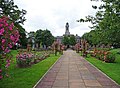
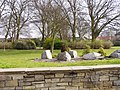 Ornamental Park - geograph.org.uk - 1211999.jpg 640 × 480; 137 KB
-
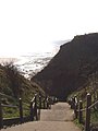 Path Down The Cliff - geograph.org.uk - 1209161.jpg 480 × 640; 46 KB
-
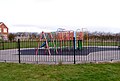 Play Area - geograph.org.uk - 1218445.jpg 640 × 433; 85 KB
-
 Polytelis swainsonii -Sewerby Zoo -Yorkshire-6a.jpg 3,888 × 2,592; 7.43 MB
-
 Priory Church - geograph.org.uk - 1115275.jpg 640 × 480; 66 KB
-
 Promenade, North Beach - geograph.org.uk - 1566982.jpg 640 × 462; 55 KB
-
 Public Toilets, North Beach - geograph.org.uk - 1566931.jpg 640 × 453; 43 KB
-
 Queensgate, Bridlington - geograph.org.uk - 1226607.jpg 640 × 481; 116 KB
-

-
 Radio Mast - geograph.org.uk - 1213419.jpg 480 × 640; 72 KB
-
 Railway Bridge over Flamborough Road - geograph.org.uk - 1567010.jpg 640 × 434; 58 KB
-
 Railway Bridge, Bridlington - geograph.org.uk - 1209081.jpg 640 × 480; 88 KB
-
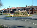 Roundabout on Queensgate - geograph.org.uk - 1226628.jpg 640 × 481; 79 KB
-
 Sewerby Bridlington England East Yorkshire.jpg 1,995 × 3,000; 5.98 MB
-
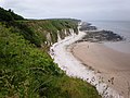
 Sewerby Cliffs - geograph.org.uk - 1209168.jpg 640 × 480; 88 KB
-
 Sewerby Cottages - geograph.org.uk - 1209109.jpg 640 × 480; 83 KB
-
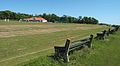
 Sewerby Cricket Club - geograph.org.uk - 1126812.jpg 640 × 480; 88 KB
-
 Sewerby Cricket Club Pavilion - geograph.org.uk - 1209135.jpg 640 × 480; 59 KB
-
 Sewerby cricket club.jpg 640 × 354; 63 KB
-

-
 Sewerby Grange - geograph.org.uk - 1209097.jpg 640 × 448; 110 KB
-
 Sewerby Hall Bandstand.jpg 640 × 480; 123 KB
-
 Sewerby Hall pitch and Putt - geograph.org.uk - 1509480.jpg 640 × 480; 120 KB
-
 Sewerby Hall. - geograph.org.uk - 1555698.jpg 640 × 426; 82 KB
-
 Sewerby Lodge House - geograph.org.uk - 1209200.jpg 640 × 480; 87 KB
-
 Sewerby Park Gates - geograph.org.uk - 1209128.jpg 640 × 480; 103 KB
-
 Sewerby Road Roundabout - geograph.org.uk - 1209065.jpg 640 × 480; 97 KB
-
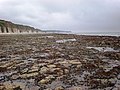
 Sewerby Rocks - geograph.org.uk - 1227616.jpg 640 × 480; 75 KB
-
 Sewerby Rocks Foreshore - geograph.org.uk - 1227632.jpg 640 × 493; 111 KB
-
 Signpost, Bridlington - geograph.org.uk - 1428539.jpg 468 × 640; 184 KB
-
 Slipway to North Beach - geograph.org.uk - 1566935.jpg 640 × 480; 51 KB
-
 Slipway to the Beach - geograph.org.uk - 1227663.jpg 640 × 427; 84 KB
-
 Small Woodland Beside B1255 - geograph.org.uk - 1212401.jpg 640 × 427; 124 KB
-
 Social Housing - geograph.org.uk - 1212013.jpg 640 × 480; 98 KB
-
 South Sands - geograph.org.uk - 1244071.jpg 640 × 480; 43 KB
-
 South Sands Beach - geograph.org.uk - 1208109.jpg 640 × 480; 44 KB
-
 South Sands Bridlington - geograph.org.uk - 1208090.jpg 640 × 480; 40 KB
-
 South Tower, Bridlington Priory - geograph.org.uk - 1630122.jpg 480 × 640; 81 KB
-
 Southern Promenade - geograph.org.uk - 1208098.jpg 640 × 480; 54 KB
-
 Springfield Avenue, Bridlington - geograph.org.uk - 1428558.jpg 640 × 481; 137 KB
-
 St John the Evangelist Parish Church Sewerby.jpg 640 × 480; 127 KB
-

-
 Summer fun at Bridlington, East Riding - geograph.org.uk - 1412953.jpg 640 × 480; 134 KB
-
 Tesco, Bridlington - geograph.org.uk - 1428538.jpg 640 × 481; 113 KB
-

-
 The back of Sewerby Hall - geograph.org.uk - 1126823.jpg 640 × 480; 91 KB
-

-
 The Black Lion - geograph.org.uk - 1561130.jpg 640 × 480; 66 KB


