Category:2009 in Cherry Burton
Media in category "2009 in Cherry Burton"
The following 42 files are in this category, out of 42 total.
-
 'Snicket' in the Snow - geograph.org.uk - 1402611.jpg 640 × 482; 69 KB
-

-
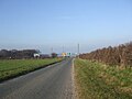
 B1248 towards Beverley - geograph.org.uk - 1519270.jpg 640 × 480; 102 KB
-
 Bishop Burton Road, Cherry Burton - geograph.org.uk - 1422041.jpg 640 × 480; 91 KB
-

-
 Cherry Burton Pond - geograph.org.uk - 1422066.jpg 640 × 480; 116 KB
-
 Cycle Path beside the B1248 - geograph.org.uk - 1543251.jpg 640 × 480; 98 KB
-
 Cycle Path towards Beverley - geograph.org.uk - 1543260.jpg 640 × 480; 95 KB
-
 Deepdale Plantation, Bishop Burton - geograph.org.uk - 1197417.jpg 473 × 640; 167 KB
-
 Elm Drive in the Snow - geograph.org.uk - 1402606.jpg 640 × 482; 51 KB
-
 Entrance to Bygot House Farm - geograph.org.uk - 1422165.jpg 640 × 480; 112 KB
-
 Entrance to Cherry Burton Golf Club - geograph.org.uk - 1422088.jpg 640 × 480; 86 KB
-
 Entrance to Dunkenhill Farm - geograph.org.uk - 1422457.jpg 640 × 480; 82 KB
-
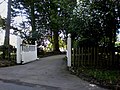 Entrance to Leicester Lodge - geograph.org.uk - 1422082.jpg 640 × 480; 100 KB
-

-

-

-
 Footpath near Cherry Burton - geograph.org.uk - 1422510.jpg 640 × 480; 130 KB
-
 Footpath to Leconfield - geograph.org.uk - 1519285.jpg 640 × 480; 58 KB
-
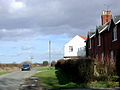
 Former Station House - geograph.org.uk - 1519275.jpg 640 × 480; 48 KB
-
 Former York to Beverley Railway - geograph.org.uk - 1519278.jpg 640 × 480; 114 KB
-
 Gardham Road.jpg 640 × 482; 65 KB
-
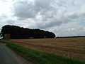
 Gardham Warren - geograph.org.uk - 1422417.jpg 640 × 480; 93 KB
-
 Go West^ - geograph.org.uk - 1422445.jpg 480 × 640; 121 KB
-
 High Gardham Farm - geograph.org.uk - 1227251.jpg 640 × 480; 57 KB
-
 High Gardham Woods.jpg 640 × 480; 53 KB
-
 Highgate, Cherry Burton - geograph.org.uk - 1422475.jpg 640 × 480; 67 KB
-
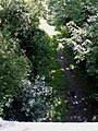
 Hudson Way (Disused Railway) - geograph.org.uk - 1543235.jpg 640 × 480; 108 KB
-
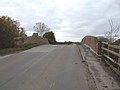 Humpback Bridge over Disused Railway - geograph.org.uk - 1543240.jpg 640 × 480; 50 KB
-
 Junction with the A1079 - geograph.org.uk - 1227257.jpg 640 × 480; 56 KB
-
 Looking Back^ - geograph.org.uk - 1422427.jpg 640 × 480; 72 KB
-
 Minor road junction - geograph.org.uk - 1422137.jpg 640 × 454; 55 KB
-
 Minor Road Towards Leconfield - geograph.org.uk - 1519271.jpg 640 × 480; 63 KB
-
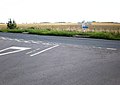
 Road Junction - geograph.org.uk - 1422436.jpg 640 × 480; 70 KB
-
 Safely gathered in^ - geograph.org.uk - 1422120.jpg 640 × 480; 69 KB
-
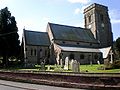 St Michael and All Angels Church Cherry Burton.jpg 640 × 480; 71 KB
-
 Step this way^ - geograph.org.uk - 1422108.jpg 480 × 640; 135 KB
-
 The Bay Horse, Cherry Burton - geograph.org.uk - 1422055.jpg 640 × 480; 75 KB
-
 The Hudson Way near Cherry Burton - geograph.org.uk - 1422099.jpg 480 × 640; 126 KB
-
 Track to Grange Farm - geograph.org.uk - 1422453.jpg 640 × 480; 74 KB
-
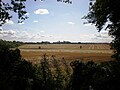
 View across Cherry Burton Wold - geograph.org.uk - 1422434.jpg 640 × 480; 124 KB
-
 View towards Dunken Hill - geograph.org.uk - 1422460.jpg 640 × 480; 77 KB


_-_geograph.org.uk_-_1543235.jpg)


