Category:2009 in the London Borough of Lewisham
Boroughs of London: City of London · City of Westminster · Barking and Dagenham · Barnet · Bexley · Brent · Bromley · Camden · Croydon · Ealing · Enfield · Greenwich · Hackney · Hammersmith and Fulham · Haringey · Harrow · Havering · Hillingdon · Hounslow · Islington · Kensington and Chelsea · Kingston · Lambeth · Lewisham · Merton · Newham · Redbridge · Richmond · Southwark · Sutton · Tower Hamlets · Waltham Forest · Wandsworth
Media in category "2009 in the London Borough of Lewisham"
The following 165 files are in this category, out of 165 total.
-

-
 Unit 466041 at Grove Park.JPG 1,600 × 1,200; 437 KB
-
 Hugh llewelyn 319 444 (6454451875).jpg 524 × 351; 84 KB
-
 Hugh llewelyn 377 407 (6454451525).jpg 597 × 400; 128 KB
-
 Hugh llewelyn 377 157 (6454452901).jpg 597 × 400; 139 KB
-
 Hugh llewelyn 455 816 (6454452189).jpg 597 × 400; 117 KB
-
 Hugh llewelyn 319 454 (6453639913).jpg 533 × 400; 111 KB
-
 Hugh llewelyn 319 375 (6454453687).jpg 597 × 400; 132 KB
-
 Meeting close to the Meridian - geograph.org.uk - 1253654.jpg 640 × 480; 166 KB
-
 22 Darmouth Hill - geograph.org.uk - 1597528.jpg 640 × 427; 75 KB
-
 364 Lee High Road, Lewisham - geograph.org.uk - 1209879.jpg 640 × 480; 78 KB
-
-

-
 Albertine's Public House, St John's - geograph.org.uk - 1597456.jpg 640 × 427; 60 KB
-
 Allied Carpets, Thurston Road - geograph.org.uk - 1496430.jpg 640 × 480; 175 KB
-
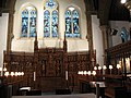
 Altar of St George's church - geograph.org.uk - 1203750.jpg 640 × 480; 156 KB
-
 Amersham Arms, New Cross, SE14 (3634179694).jpg 3,968 × 2,232; 3.11 MB
-

-

-
 Aragon Tower, London SE8 - geograph.org.uk - 1406995.jpg 640 × 480; 50 KB
-
 Baptistery area of St George's - geograph.org.uk - 1203759.jpg 640 × 480; 86 KB
-

-
 Blackheath Village, London SE3 - geograph.org.uk - 1573819.jpg 640 × 480; 64 KB
-
 Blackheath Village, London SE3 - geograph.org.uk - 1573821.jpg 640 × 480; 78 KB
-
 BP filling station on Lee High Road - geograph.org.uk - 1496758.jpg 640 × 480; 144 KB
-

-
 Bridge on Evelyn Street, SE8 - geograph.org.uk - 1491140.jpg 640 × 480; 79 KB
-
 Bromley Hill, Bromley - geograph.org.uk - 1234718.jpg 640 × 480; 92 KB
-
 Brookmill Park, rose garden - geograph.org.uk - 1496134.jpg 640 × 480; 304 KB
-
 Building behind the facade - geograph.org.uk - 1496056.jpg 640 × 480; 303 KB
-
 Building on Lee High Road - geograph.org.uk - 1210771.jpg 640 × 480; 98 KB
-

-

-
 Capitol, Forest Hill, SE23 (3386917751).jpg 2,848 × 2,136; 2.4 MB
-

-
 Car dealer, Lee - geograph.org.uk - 1572643.jpg 640 × 480; 61 KB
-
 Car Rental site, Lewisham - geograph.org.uk - 1573185.jpg 640 × 480; 58 KB
-
 Catford Centre - geograph.org.uk - 1723212.jpg 640 × 480; 84 KB
-
 Church on Blackheath - geograph.org.uk - 1564931.jpg 640 × 480; 49 KB
-
 Citibank training centre - geograph.org.uk - 1496523.jpg 640 × 480; 318 KB
-

-

-
 Cycle path under the DLR viaduct - geograph.org.uk - 1496078.jpg 640 × 480; 298 KB
-

-

-
 Deptford High Street, SE8 (2) - geograph.org.uk - 1498383.jpg 640 × 480; 86 KB
-
 Deptford High Street, SE8 - geograph.org.uk - 1490848.jpg 640 × 480; 83 KB
-
 Deptford Park - geograph.org.uk - 1449602.jpg 640 × 480; 58 KB
-
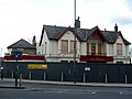
 Deptford Park School - geograph.org.uk - 1449626.jpg 640 × 480; 92 KB
-
 Dockers Shelter - Redriff Road, SE16 - geograph.org.uk - 1483035.jpg 640 × 422; 104 KB
-

-
 Dunkery Road, Mottingham, London SE9 - geograph.org.uk - 1219778.jpg 640 × 480; 60 KB
-

-

-
 Entrance to Manor House Park - geograph.org.uk - 1496846.jpg 640 × 480; 404 KB
-
 Escape of the Catford Cat^ - geograph.org.uk - 1353065.jpg 640 × 480; 78 KB
-
 Evelyn Street, SE8 - geograph.org.uk - 1498688.jpg 640 × 480; 109 KB
-

-
 Factories on Childers Street, Deptford - geograph.org.uk - 1405358.jpg 640 × 480; 120 KB
-
 Ffinch Street, SE8 - geograph.org.uk - 1490869.jpg 640 × 480; 93 KB
-

-
 Footbridge to nowhere - geograph.org.uk - 1496489.jpg 640 × 480; 354 KB
-
 Gas pipe at Lower Sydenham - geograph.org.uk - 1633820.jpg 640 × 480; 100 KB
-
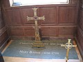 Grave of Christopher and Mary Boone - geograph.org.uk - 1496720.jpg 640 × 480; 261 KB
-
 Grey Day - geograph.org.uk - 1166392.jpg 640 × 480; 50 KB
-
 Greyhound, Sydenham, SE26 (3300842307).jpg 2,848 × 2,136; 2.32 MB
-

-
 Grove Park Road, Mottingham - geograph.org.uk - 1219784.jpg 640 × 480; 70 KB
-
 Chancel of St Augustine's church - geograph.org.uk - 1155316.jpg 640 × 480; 213 KB
-

-
 Hamburger and chips - Royal Albert, New Cross, London.jpg 3,776 × 2,520; 3.69 MB
-

-
 Hill Rise, grounds of Horniman Museum - geograph.org.uk - 1253485.jpg 640 × 480; 166 KB
-
 Hither Green Cemetery, White Sky.jpg 3,264 × 2,448; 1.97 MB
-
 Hob, Forest Hill, SE23 (3431110521).jpg 2,848 × 2,136; 2.43 MB
-
 Holbeach Primary School - geograph.org.uk - 1633717.jpg 640 × 480; 47 KB
-
 Horniman Museum - geograph.org.uk - 1253435.jpg 640 × 480; 144 KB
-
 Housing estate, Lee, London SE12 - geograph.org.uk - 1572664.jpg 640 × 480; 101 KB
-
 Housing estate, Lee, London SE12 - geograph.org.uk - 1572672.jpg 640 × 480; 122 KB
-
 Inside the ice-house - geograph.org.uk - 1496874.jpg 480 × 640; 288 KB
-
 InSpace development under construction - geograph.org.uk - 1405350.jpg 640 × 480; 167 KB
-
 Island Buka, Deptford High Street - geograph.org.uk - 1490889.jpg 640 × 480; 60 KB
-
 James Claisher Blue Plaque - geograph.org.uk - 1597530.jpg 640 × 427; 81 KB
-
 La Maison de Jeu, Deptford, SE8 (3811905120).jpg 3,025 × 2,269; 3.03 MB
-
 Ladywell Bowling Club - geograph.org.uk - 1633747.jpg 640 × 480; 74 KB
-

-
 Lee Green Telephone Exchange - geograph.org.uk - 1573181.jpg 640 × 480; 105 KB
-

-
 Lee High Road, Lewisham - geograph.org.uk - 1573161.jpg 640 × 480; 81 KB
-
 Lee High Road, Lewisham - geograph.org.uk - 1573178.jpg 640 × 480; 73 KB
-
 Lee Railway Station - geograph.org.uk - 1572633.jpg 640 × 480; 67 KB
-
 Tower of the old St Margaret's (2) - geograph.org.uk - 1450535.jpg 640 × 480; 267 KB
-
 Lewisham Fire Station - geograph.org.uk - 1633637.jpg 640 × 480; 66 KB
-
 Lewisham Hill - geograph.org.uk - 1600271.jpg 640 × 427; 48 KB
-
 Lewisham, across Ladywell Fields - geograph.org.uk - 1331461.jpg 640 × 480; 85 KB
-

-
 Lewisham, Ladywell Fields - geograph.org.uk - 1331455.jpg 640 × 480; 85 KB
-

-

-
 Lewisham, tennis courts and hospital - geograph.org.uk - 1331481.jpg 640 × 480; 81 KB
-
 London Overground depot - complete - geograph.org.uk - 1262871.jpg 640 × 480; 114 KB
-
 London Road ,Forest Hill - geograph.org.uk - 1253414.jpg 640 × 480; 105 KB
-
 Lunch - geograph.org.uk - 1490877.jpg 640 × 480; 65 KB
-
 Manor House, Steps to the ice-house - geograph.org.uk - 1496861.jpg 480 × 640; 195 KB
-
 Manze's, Deptford High Street, SE8 - geograph.org.uk - 1490995.jpg 480 × 640; 63 KB
-
 Montague Arms, Peckham, SE15 (2388671208).jpg 3,001 × 2,000; 2.44 MB
-
 New housing on Eugenia Road - geograph.org.uk - 1450558.jpg 640 × 480; 104 KB
-
 New housing on Trundleys Road - geograph.org.uk - 1332351.jpg 640 × 480; 129 KB
-

-
 Oak sapling in Sayes Court Park.jpg 1,200 × 1,600; 1.64 MB
-

-
 Open space with shelter, Ladywell Fields - geograph.org.uk - 1633754.jpg 640 × 480; 127 KB
-
 Ornamental gates to Sayes Court - geograph.org.uk - 1496621.jpg 640 × 480; 126 KB
-
 Oscillating fountain in Manor House Park - geograph.org.uk - 1496885.jpg 640 × 480; 406 KB
-
 Our Lady of Lourdes Catholic Church - geograph.org.uk - 1600416.jpg 640 × 427; 56 KB
-
 Pair of cannon at Manor House - geograph.org.uk - 1496824.jpg 640 × 480; 344 KB
-

-
 Pitchers Diner (closed) - geograph.org.uk - 1528677.jpg 640 × 480; 104 KB
-
 Place House Tavern, Catford, SE6 (3769072094).jpg 2,960 × 2,220; 2.46 MB
-
 Pond in Blackheath Common - geograph.org.uk - 1600348.jpg 640 × 427; 79 KB
-

-
 Postmen's Office, Creek Road, SE8 - geograph.org.uk - 1498738.jpg 640 × 480; 116 KB
-
 Rear of the Lewisham Centre - geograph.org.uk - 1496463.jpg 640 × 480; 169 KB
-

-
 Royal Albert, New Cross, London (3550219216).jpg 3,776 × 2,520; 3.76 MB
-
 Royal Albert, New Cross, London (3550223070).jpg 3,776 × 2,520; 4 MB
-
 Royal Albert, New Cross, London (3785931592).jpg 3,776 × 2,520; 3.85 MB
-
 Sainsburys New Cross Gate - geograph.org.uk - 1597442.jpg 640 × 427; 65 KB
-
 Sapporo Ichiban, Catford, London (4073168754).jpg 3,776 × 2,520; 3.63 MB
-
 Sapporo Ichiban, Catford, London (4073176136).jpg 3,776 × 2,520; 3.61 MB
-
 Sayes Court Park May 2009.jpg 1,600 × 1,200; 1.35 MB
-
-

-

-
 Stanley Street, New Cross - geograph.org.uk - 1332488.jpg 640 × 479; 156 KB
-
 Staring down the barrel of a cannon - geograph.org.uk - 1492533.jpg 480 × 640; 94 KB
-
 Sustrans milepost at Lower Sydenham - geograph.org.uk - 1633834.jpg 480 × 640; 91 KB
-
 Sydenham railway station signage.jpeg 1,600 × 1,200; 281 KB
-
 Telegraph at the Earl of Derby, Telegraph Hill, London (3421943238).jpg 3,776 × 2,520; 3.32 MB
-
 Tesco Express St. John's - geograph.org.uk - 1597468.jpg 640 × 427; 62 KB
-
 The Bandstand, Horniman Museum Gardens. - geograph.org.uk - 1741818.jpg 3,504 × 2,336; 4.16 MB
-

-

-
 The Deptford Project - 3806796297.jpg 2,592 × 1,944; 736 KB
-
 The Deptford Project cafe (1).jpg 3,264 × 2,448; 857 KB
-
 The Deptford Project cafe.jpg 3,264 × 2,448; 694 KB
-
 The Deptford Project.jpg 2,592 × 1,944; 847 KB
-
 The Drake Apartments - geograph.org.uk - 1405381.jpg 640 × 480; 140 KB
-

-

-

-
 The John Evelyn, Evelyn Street, SE8 - geograph.org.uk - 1498704.jpg 640 × 480; 64 KB
-
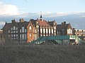
 The Manor House, Lee - geograph.org.uk - 1496786.jpg 640 × 480; 305 KB
-
 The Manor House, Lee - interior - geograph.org.uk - 1496802.jpg 640 × 480; 233 KB
-
 The Manor House, Lee - rear - geograph.org.uk - 1496791.jpg 640 × 480; 276 KB
-

-
 The Old Post Office - geograph.org.uk - 1597541.jpg 640 × 427; 52 KB
-

-
 The site of Sayes Court manor house in 2009.jpg 3,648 × 2,736; 4.9 MB
-
 The Swan on Lee High Road - geograph.org.uk - 1496761.jpg 640 × 480; 230 KB
-

-
 Venue, New Cross, SE14 (3342633030).jpg 2,848 × 2,136; 2.5 MB
-
 Waldron Health Centre, Amersham Vale - geograph.org.uk - 1332460.jpg 640 × 480; 97 KB
-
 Wickes DIY store, Catford - geograph.org.uk - 1633781.jpg 640 × 480; 48 KB
-
 Zero Degrees, Blackheath, SE3 (3316895658).jpg 2,136 × 2,848; 2.68 MB


.jpg)
.jpg)
.jpg)
.jpg)
.jpg)
.jpg)


.jpg)


_-_geograph.org.uk_-_1353043.jpg)


.jpg)


_-_geograph.org.uk_-_1597521.jpg)


_-_geograph.org.uk_-_1498383.jpg)


.jpg)


.jpg)


.jpg)


_-_geograph.org.uk_-_1450535.jpg)


.jpg)


_-_geograph.org.uk_-_1528677.jpg)
.jpg)


.jpg)
.jpg)
.jpg)

.jpg)
.jpg)


.jpg)


.jpg)


_-_geograph.org.uk_-_1498712.jpg)


.jpg)


.jpg)