Category:2010s maps of Colorado
States of the United States: Alabama · Alaska · Arizona · Arkansas · California · Colorado · Delaware · Florida · Georgia · Hawaii · Idaho · Indiana · Iowa · Kentucky · Louisiana · Maryland · Massachusetts · Michigan · Missouri · Nebraska · Nevada · New Jersey · New Mexico · New York · North Carolina · Ohio · Oklahoma · Pennsylvania · Tennessee · Utah · Virginia · West Virginia · Wisconsin – Washington, D.C.
Subcategories
This category has the following 2 subcategories, out of 2 total.
- 2010 maps of Colorado (23 F)
Media in category "2010s maps of Colorado"
This category contains only the following file.
-
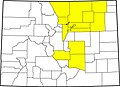 Colorado county map highlighting 14 counties affected by 2013 flooding.jpg 2,000 × 1,447; 536 KB
