Category:2010s maps of Egypt
Countries of Asia: Afghanistan · Armenia‡ · Bangladesh · Cambodia · People's Republic of China · Cyprus‡ · East Timor · Egypt‡ · Georgia‡ · India · Indonesia‡ · Iran · Iraq · Japan · Jordan · Kazakhstan‡ · Kyrgyzstan · Laos · Lebanon · Malaysia · Mongolia · Myanmar · Nepal · Pakistan · Philippines · Russia‡ · Saudi Arabia · South Korea · Syria · Tajikistan · Thailand · Turkey‡ · Turkmenistan · United Arab Emirates · Uzbekistan · Vietnam · Yemen
Limited recognition: Taiwan
‡: partly located in Asia
Limited recognition: Taiwan
‡: partly located in Asia
Countries of Africa: Algeria · Angola · Botswana · Chad · Democratic Republic of the Congo · Djibouti · Egypt‡ · Eritrea · Ethiopia · Malawi · Mauritania · Morocco · Mozambique · Namibia · Nigeria · Senegal · South Africa · Tunisia · Zambia · Zimbabwe
‡: partly located in Africa
‡: partly located in Africa
Countries of the Arab world: Algeria · Chad · Djibouti · Egypt · Eritrea · Iraq · Jordan · Lebanon · Mauritania · Morocco · Saudi Arabia · Syria · Tunisia · United Arab Emirates · Yemen
Subcategories
This category has the following 3 subcategories, out of 3 total.
- 2013 maps of Egypt (1 F)
- 2014 maps of Egypt (10 F)
- 2016 maps of Egypt (8 F)
Media in category "2010s maps of Egypt"
The following 7 files are in this category, out of 7 total.
-
 2011-2012 Egyptian election phases.svg 1,055 × 956; 461 KB
-
 2011-2012 Elections Governorates Distribution.svg 791 × 717; 856 KB
-
 Egyptian constitutional referendum 2011.svg 1,055 × 956; 667 KB
-
 Egypt-presidential-elections-2012-map.png 909 × 799; 133 KB
-
 Egyptian constitutional referendum 2012.svg 1,055 × 956; 572 KB
-
 Egyptian presidential election 2012.svg 1,055 × 956; 683 KB
-
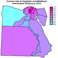 Egypt 2014 constitutional referendum - Turnout by governorate.png 825 × 825; 104 KB


