Category:2013 maps of Africa
Temperate regions: North America · South America · Africa · Europe · Asia · Oceania – Polar regions: – Other regions:
| ← 2010 2011 2012 2013 2014 2015 2016 2017 2018 2019 → |
Subcategories
This category has the following 11 subcategories, out of 11 total.
A
- 2013 maps of Algeria (2 F)
C
- 2013 maps of Chad (1 F)
D
- 2013 maps of Djibouti (1 F)
E
- 2013 maps of Egypt (1 F)
- 2013 maps of Ethiopia (2 F)
M
- 2013 maps of Mauritania (2 F)
- 2013 maps of Mozambique (1 F)
N
- 2013 maps of Nigeria (3 F)
S
- 2013 maps of Senegal (2 F)
Z
- 2013 maps of Zimbabwe (2 F)
Media in category "2013 maps of Africa"
The following 20 files are in this category, out of 20 total.
-
 15 poorest countries in 2013.svg 1,369 × 1,320; 210 KB
-
 Carta politica d'Africa 2013.png 989 × 1,009; 256 KB
-
 2013 ACN Qualification.png 360 × 360; 14 KB
-
 2013 Africa Education (30249979673).jpg 2,132 × 2,236; 1.48 MB
-
 2013 Elephant population (30249979363).jpg 2,068 × 2,551; 757 KB
-
 2013 Ivory Transportation (30885483595).jpg 4,258 × 2,940; 2.75 MB
-
 AFISMA map-en.svg 1,200 × 1,230; 79 KB
-
 AFISMA map-fr.svg 1,200 × 1,230; 80 KB
-
 Africa GFTA.png 502 × 563; 38 KB
-
 African Cup of Nations 2013 SudAfrican.png 677 × 681; 13 KB
-
 African Union member states by corruption index.svg 1,200 × 1,230; 60 KB
-
 Algeria CIA map-prise-otages-17012013.png 330 × 355; 14 KB
-
 Carte AEF.jpg 10,083 × 15,000; 22.37 MB
-
 Carte du Hassanya.svg 285 × 227; 59 KB
-
 Central African Republic map (Seleka rebellion March 2013).png 618 × 426; 635 KB
-
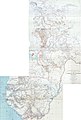
 ECHO CentralAfrica BaseMap A0 Landscape.png 4,680 × 3,311; 1.18 MB
-
 In Amenas hostage crisis map.svg 512 × 193; 809 KB
-
 Map of South Atlantic Cable System route.svg 1,321 × 977; 1.67 MB
-
 Nations 2013 of African Cup.png 677 × 681; 13 KB
-
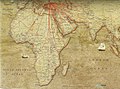 TK turkish airlines 2013 routes africa.jpg 1,600 × 1,181; 628 KB


.jpg)
.jpg)


.png)


.jpg)