Category:2014 Atlantic hurricane season track maps
Media in category "2014 Atlantic hurricane season track maps"
The following 21 files are in this category, out of 21 total.
-
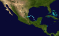
 2014 Atlantic hurricane season summary map.png 4,000 × 2,476; 6.1 MB
-
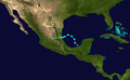
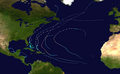 2014 Atlantic hurricane season summary.png 4,000 × 2,476; 4.87 MB
-
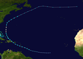
 Arthur 2014 path.png 2,700 × 2,567; 5.74 MB
-
 Arthur 2014 track.png 2,700 × 2,568; 4.69 MB
-
 Bertha 2014 path.png 2,700 × 1,904; 1.96 MB
-
 Bertha 2014 track.png 2,700 × 1,905; 1.54 MB
-
 Cristobal 2014 path.png 2,700 × 2,283; 2.9 MB
-
 Cristobal 2014 track.png 2,700 × 2,283; 2.19 MB
-
 Edouard 2014 path.png 2,700 × 2,172; 382 KB
-
 Edouard 2014 track.png 2,700 × 2,172; 252 KB
-
 Fay 2014 path.png 2,700 × 1,668; 1.44 MB
-
 Fay 2014 track.png 2,700 × 1,669; 1.02 MB
-
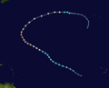
 Gonzalo 2014 track.png 2,700 × 2,683; 1.39 MB
-
 Gonzalo 2014 path.png 2,700 × 2,683; 1.91 MB
-
 02-L 2014 path.png 2,700 × 1,668; 1.36 MB
-
 02-L 2014 track.png 2,700 × 1,669; 983 KB
-
 Dolly 2014 path.png 2,700 × 1,668; 4.16 MB
-
 Dolly 2014 track.png 2,700 × 1,669; 3.1 MB
-
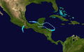
 Hanna 2014 path.png 2,700 × 1,668; 3.62 MB
-
 Hanna 2014 track.png 2,700 × 1,669; 2.67 MB
-
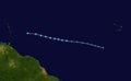
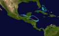
 Trudy and Hanna 2014 track.png 2,700 × 1,669; 3.08 MB


