Category:2020 Washington (state) election maps
States of the United States: Arizona · California · Colorado · Delaware · Florida · Idaho · Indiana · Iowa · Kentucky · Michigan · Missouri · Montana · New Hampshire · New Mexico · New York · North Carolina · Ohio · Oklahoma · Pennsylvania · Utah · Virginia · Washington · West Virginia
Media in category "2020 Washington (state) election maps"
The following 4 files are in this category, out of 4 total.
-
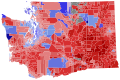 WA Governor 2020.svg 810 × 535; 27.02 MB
-
 WA Lieutenant Governor 2020.svg 955 × 638; 44.59 MB
-
 WA President 2020.svg 810 × 535; 27.03 MB
-
 WA SOS 2020.svg 810 × 535; 27.03 MB


