Category:2020 maps of California
States of the United States: Alabama · Arizona · California · Iowa · Louisiana · Massachusetts · New York · Utah · Wyoming
| ← 2020 2021 2022 2023 |
Media in category "2020 maps of California"
The following 8 files are in this category, out of 8 total.
-
 BART Sunday web map effective February 2020.png 1,000 × 803; 92 KB
-
 BART system map effective June 2020.png 8,200 × 6,800; 758 KB
-
 BART web map effective February 2020.png 1,000 × 803; 100 KB
-
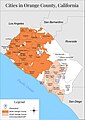 Map-of-orange-county-california.jpg 2,500 × 3,540; 779 KB
-
 Paso Robles shootings 06-10-2020.png 639 × 368; 518 KB
-
 San Francisco Chinatown + North Beach.png 750 × 766; 589 KB
-
 San Francisco Civic Center + Tenderloin.png 771 × 564; 560 KB
-
 San Francisco Union Square + Financial District.png 705 × 530; 448 KB


