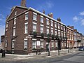
Category:86 & 88 Rodney Street, Liverpool
| Object location | | View all coordinates using: OpenStreetMap |
|---|
Grade II listed houses in Liverpool, Merseyside, UK  | |||||
| Upload media | |||||
| Instance of | |||||
|---|---|---|---|---|---|
| Location | Liverpool, Merseyside, North West England, England | ||||
| Street address |
| ||||
| Heritage designation |
| ||||
 | |||||
Media in category "86 & 88 Rodney Street, Liverpool"
The following 4 files are in this category, out of 4 total.
-
 86 & 88 Rodney Street front.jpg 4,302 × 2,982; 13.31 MB
-
 86 & 88 Rodney Street, Liverpool.jpg 4,320 × 3,240; 4.12 MB
-
 86 & 88 Rodney Street.jpg 5,128 × 3,409; 18.22 MB
-
 RodneyStreetOM.jpg 4,658 × 2,901; 5.49 MB


