Category:A140 road (England)
road _-_geograph.org.uk_-_1672184.jpg)   | |||||
| Upload media | |||||
| Instance of | |||||
|---|---|---|---|---|---|
| Location |
| ||||
| Transport network |
| ||||
| Length |
| ||||
 | |||||

Subcategories
This category has the following 8 subcategories, out of 8 total.
I
L
- The Street, Long Stratton (8 F)
- Long Stratton War Memorial (1 F)
M
- The Marsh Harrier, Norwich (11 F)
R
- Norwich Road, Roughton (17 F)
S
Media in category "A140 road (England)"
The following 196 files are in this category, out of 196 total.
-
 'Magpie Inn' at Little Stonham - geograph.org.uk - 320159.jpg 640 × 480; 62 KB
-
 'The Crossways Inn' at Scole - geograph.org.uk - 351007.jpg 640 × 480; 75 KB
-
 -2019-12-09 Marks & Spencer & BP service station, Burgh Road, Aylsham, Norfolk (1).JPG 5,152 × 3,864; 3.99 MB
-
 -2019-12-09 Marks & Spencer & BP service station, Burgh Road, Aylsham, Norfolk (2).JPG 5,152 × 3,864; 3.91 MB
-
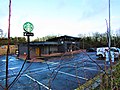 -2019-12-09 Starbucks Drive-thru, Burgh Road, Aylsham, Norfolk.JPG 5,152 × 3,864; 4.03 MB
-
 -2021-08-04 Stone wayside cross, Handworth, Norfolk.JPG 3,864 × 5,152; 8.44 MB
-
 -2021-08-16 A140 to Cromer, Hanworth, North Norfolk.jpg 1,024 × 768; 234 KB
-
 -2021-08-16 A140 to Norwich, Hanworth, North Norfolk.jpg 1,024 × 768; 154 KB
-
 -2021-08-16 Looking south along the A140, Hanworth, North Norfolk.jpg 1,024 × 768; 186 KB
-
 -2021-08-16 North to Cromer on the A140, Hanworth, North Norfolk.jpg 1,024 × 768; 197 KB
-
 -2021-08-16 Wayside stone cross, A140, Hanworth, North Norfolk (1).jpg 1,024 × 768; 198 KB
-
 -2021-08-16 Wayside stone cross, A140, Hanworth, North Norfolk.jpg 768 × 1,024; 230 KB
-
 -2022-01-14 A140 Norwich Road, Roughton, Norfolk, England.jpg 1,024 × 768; 277 KB
-
 -2022-01-14 Mini roundabout, A140 Norwich Road, Roughton, Norfolk, England.jpg 1,024 × 768; 191 KB
-
 A house on the A140 - geograph.org.uk - 379656.jpg 640 × 480; 58 KB
-
 A14 - geograph.org.uk - 4965851.jpg 640 × 426; 60 KB
-
 A14 - geograph.org.uk - 4965854.jpg 640 × 426; 43 KB
-

-
 A140 at the Magpie Public House - geograph.org.uk - 1118766.jpg 3,072 × 2,304; 1.32 MB
-
-
 A140 Boundary Road - geograph.org.uk - 4732224.jpg 640 × 480; 453 KB
-
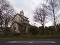 A140 crossing keepers house - geograph.org.uk - 1597214.jpg 640 × 480; 109 KB
-
 A140 From Lay-By - geograph.org.uk - 975401.jpg 640 × 480; 56 KB
-
 A140 meets A149 - geograph.org.uk - 512157.jpg 640 × 480; 80 KB
-
 A140 Norwich Road - geograph.org.uk - 2365300.jpg 3,072 × 2,304; 1.25 MB
-
 A140 Norwich Road, Brome - geograph.org.uk - 2672317.jpg 3,072 × 2,304; 1.31 MB
-

-

-

-
 A140 road map.jpg 1,952 × 873; 140 KB
-
 A140 switchback viewed from cyclepath - geograph.org.uk - 1209479.jpg 480 × 640; 148 KB
-
 A140 UK Road.png 1,316 × 749; 12 KB
-
 A140, Swainsthorpe - geograph.org.uk - 114155.jpg 640 × 480; 230 KB
-
 Allotments beside the A140 - geograph.org.uk - 1196058.jpg 640 × 435; 96 KB
-
 Allotments, Ipswich Road, Norwich - geograph.org.uk - 84357.jpg 503 × 640; 77 KB
-
 Approach lights to Norwich Airport - geograph.org.uk - 1196046.jpg 513 × 640; 79 KB
-
 Approach to Roughton on A140 - geograph.org.uk - 510149.jpg 640 × 480; 73 KB
-

-
 Approaching the A140 on Hickling Lane - geograph.org.uk - 1586476.jpg 640 × 480; 207 KB
-

-
 Bridge over the River Wensum - geograph.org.uk - 1970916.jpg 640 × 430; 174 KB
-
 Bucks Head Public House - geograph.org.uk - 319107.jpg 640 × 480; 82 KB
-
 Bus shelter at Crossdale Street - geograph.org.uk - 512121.jpg 640 × 480; 149 KB
-
 Busy Crossroads - geograph.org.uk - 362727.jpg 640 × 480; 74 KB
-
 Cromer Railway Tunnel, 27 November 2015 (7).JPG 5,152 × 3,864; 8.24 MB
-
 Cycle crossing on the A140 - geograph.org.uk - 1277917.jpg 640 × 467; 51 KB
-

-
 Cycleway to Ipswich by the A140 - geograph.org.uk - 790040.jpg 640 × 402; 68 KB
-

-

-
 St Anne's, Earlham - geograph.org.uk - 182278.jpg 640 × 477; 98 KB
-
 Emergency entrance to Norwich Airfield - geograph.org.uk - 1196054.jpg 600 × 605; 114 KB
-

-

-
 Farm Cottage Terrace, Harford Bridge - geograph.org.uk - 709760.jpg 640 × 480; 91 KB
-
 Farm Cottages, Harford Bridge - geograph.org.uk - 709774.jpg 640 × 492; 75 KB
-
 Farrow Rd (A140) - geograph.org.uk - 1388411.jpg 640 × 430; 134 KB
-
 Fengate Road, junction with A140 - geograph.org.uk - 456408.jpg 640 × 480; 70 KB
-

-
 Flooded Footpath (Boudica's Way) - geograph.org.uk - 355443.jpg 640 × 480; 119 KB
-

-
 Footpath leaving the A140 - geograph.org.uk - 1082816.jpg 640 × 470; 108 KB
-
 Footpath to Tivetshall St Margaret - geograph.org.uk - 1595953.jpg 480 × 640; 183 KB
-
 Hanworth Cross - geograph.org.uk - 1639433.jpg 640 × 480; 69 KB
-
 Hanworth Cross - geograph.org.uk - 2092788.jpg 800 × 531; 104 KB
-
 Hanworth Cross - geograph.org.uk - 2092820.jpg 800 × 531; 93 KB
-

-
 Hickling Lane meets the A140 road - geograph.org.uk - 1586481.jpg 640 × 480; 143 KB
-
 Hickling Lane west of the A140 - geograph.org.uk - 1586478.jpg 640 × 480; 173 KB
-
 House adjoining churchyard - geograph.org.uk - 1356393.jpg 640 × 493; 135 KB
-
 House by Ipswich Road, Yaxley - geograph.org.uk - 1083231.jpg 640 × 422; 71 KB
-

-

-
 Houses by the A140 (Cromer Road) - geograph.org.uk - 1196251.jpg 640 × 450; 133 KB
-

-
 Housing in Daniels Road - geograph.org.uk - 975407.jpg 640 × 480; 53 KB
-
 Ice House Shops, Long Stratton - geograph.org.uk - 907238.jpg 640 × 480; 57 KB
-

-
 Junction of Parker's Lane and A140 - geograph.org.uk - 356994.jpg 640 × 480; 70 KB
-
 Junction with A140 - geograph.org.uk - 527235.jpg 640 × 480; 68 KB
-
 Kissing Gate to Boudica's Way - geograph.org.uk - 355437.jpg 640 × 480; 96 KB
-

-
 Lay-by on A140, Tasburgh - geograph.org.uk - 355434.jpg 640 × 480; 65 KB
-
 Lay-by on the A14 - geograph.org.uk - 1286449.jpg 640 × 428; 81 KB
-
 Like a layer cake on its side - geograph.org.uk - 555397.jpg 640 × 480; 122 KB
-
 Long Stratton Village Hall - geograph.org.uk - 1356327.jpg 640 × 480; 100 KB
-
 Looking across the A140 - geograph.org.uk - 728124.jpg 640 × 463; 124 KB
-

-

-

-

-
 New Roundabout - geograph.org.uk - 510147.jpg 640 × 480; 70 KB
-
 Norwich Airport - geograph.org.uk - 1196050.jpg 640 × 480; 86 KB
-
 Norwich Road (A140) - geograph.org.uk - 4711017.jpg 640 × 480; 58 KB
-
 Old lane to Eye from Yaxley - geograph.org.uk - 1082846.jpg 640 × 422; 96 KB
-
 One Of Two Water Towers - geograph.org.uk - 320530.jpg 640 × 480; 62 KB
-
 One Of Two Water Towers - geograph.org.uk - 320533.jpg 640 × 480; 68 KB
-
 Ornate tiles surrounding roof window - geograph.org.uk - 1596618.jpg 493 × 640; 105 KB
-
 Old church A140 - geograph.org.uk - 134834.jpg 640 × 485; 76 KB
-
 Roadside Nature Reserve, A140 - geograph.org.uk - 114161.jpg 480 × 640; 301 KB
-
 Roundabout on Holt Road - geograph.org.uk - 389176.jpg 640 × 480; 61 KB
-
 Roundabout on the A140, Norwich - geograph.org.uk - 3348044.jpg 4,000 × 2,357; 6.54 MB
-

-

-
-
 St Mary's church - churchyard - geograph.org.uk - 1356390.jpg 640 × 480; 136 KB
-
 Sweet Briar Road Bridge.JPG 2,304 × 1,728; 1.76 MB
-

-
 The A140 - geograph.org.uk - 1119328.jpg 3,072 × 2,304; 1.31 MB
-
 The A140 - geograph.org.uk - 1119331.jpg 3,072 × 2,304; 1.52 MB
-
 The A140 near to the Memorial - geograph.org.uk - 1119360.jpg 3,072 × 2,304; 1.33 MB
-
 The A140 near to the Memorial - geograph.org.uk - 1119365.jpg 3,072 × 2,304; 1.36 MB
-
 The Auberge Bull on the A140 - geograph.org.uk - 2042975.jpg 640 × 480; 65 KB
-
 The Auberge Bull on the A140 - geograph.org.uk - 4256358.jpg 640 × 430; 56 KB
-
 The Auberge Hotel And Restaurant - geograph.org.uk - 319897.jpg 640 × 480; 70 KB
-
 The Auberge seen from Yaxley Road - geograph.org.uk - 1082986.jpg 640 × 363; 63 KB
-
 The end of All Saints Road - geograph.org.uk - 1413613.jpg 640 × 501; 108 KB
-
 The Hanworth Cross - geograph.org.uk - 2092804.jpg 531 × 800; 123 KB
-
 The Highwayman - geograph.org.uk - 409641.jpg 640 × 480; 95 KB
-
 The Ice House Shopping Precinct - geograph.org.uk - 1374183.jpg 640 × 480; 80 KB
-
 The Mill Inn, Saxlingham Thorpe - geograph.org.uk - 276022.jpg 640 × 480; 96 KB
-
 The Old Norwich Road - geograph.org.uk - 791328.jpg 480 × 640; 81 KB
-
 The Swan Free House, Brome, Suffolk - geograph.org.uk - 2934075.jpg 1,600 × 941; 369 KB
-
 The Swan Public House - geograph.org.uk - 319876.jpg 640 × 480; 83 KB
-
 The Swan Public House and the A140 - geograph.org.uk - 2672329.jpg 3,072 × 2,304; 1.36 MB
-

-

-

-
 Thrandeston church between the trees - geograph.org.uk - 1297516.jpg 430 × 640; 148 KB
-
 TNT Network Logistics centre - geograph.org.uk - 388388.jpg 640 × 427; 59 KB
-
 To Norwich 2 - geograph.org.uk - 1588110.jpg 640 × 480; 161 KB
-
 UK road A140.PNG 568 × 184; 6 KB
-

-
-
 View across Norwich Road (A140) - geograph.org.uk - 714915.jpg 640 × 458; 136 KB
-
 View along the A140 - geograph.org.uk - 1356346.jpg 553 × 640; 125 KB
-
 View along the A140 from Hickling Lane - geograph.org.uk - 1586485.jpg 640 × 449; 128 KB
-
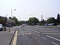
 View north along Ipswich Road (A140) - geograph.org.uk - 1672174.jpg 640 × 480; 88 KB
-
 View north along the A140 - geograph.org.uk - 1196059.jpg 640 × 480; 105 KB
-

-
 View south along the A140 - geograph.org.uk - 1196042.jpg 640 × 480; 95 KB
-
 View southwest along the A140 - geograph.org.uk - 714917.jpg 640 × 480; 173 KB
-
 View towards Park Farm - geograph.org.uk - 1196263.jpg 551 × 600; 168 KB
-
 View west across the A140 (Cromer Road) - geograph.org.uk - 728120.jpg 480 × 640; 124 KB
-
-
 Water tower A140 - geograph.org.uk - 134831.jpg 640 × 364; 61 KB
-
 Water tower beside the A140 - geograph.org.uk - 1572648.jpg 525 × 640; 85 KB
-
 Welcome to Norwich (sign) - geograph.org.uk - 1672184.jpg 640 × 480; 118 KB
-
 A section of the Old Norwich Road - geograph.org.uk - 620829.jpg 640 × 480; 70 KB
-
 A1120 Stowmarket Road at Stonham - geograph.org.uk - 1119551.jpg 3,072 × 2,304; 1.39 MB
-

-

-
 A140 east of Yaxley - geograph.org.uk - 1082831.jpg 640 × 386; 68 KB
-
-
 A140 over farmland - geograph.org.uk - 383890.jpg 640 × 480; 107 KB
-
 A140 passing Yaxley - geograph.org.uk - 1082827.jpg 640 × 446; 101 KB
-
 AA Rescue Telephone on A140 - geograph.org.uk - 363656.jpg 640 × 480; 110 KB
-
 Across The A140 - geograph.org.uk - 379049.jpg 640 × 480; 101 KB
-

-
 Approaching junction with the A140 - geograph.org.uk - 714921.jpg 640 × 464; 100 KB
-
 Approaching junction with the A140 - geograph.org.uk - 728130.jpg 480 × 640; 139 KB
-
 Approaching Norwich from the north - geograph.org.uk - 1196055.jpg 640 × 480; 99 KB
-
 Avian Influenza ( Bird Flu ) Sign - geograph.org.uk - 338388.jpg 640 × 480; 143 KB
-
 Avian Influenza ( Bird Flu ) Sign - geograph.org.uk - 338394.jpg 640 × 480; 129 KB
-
 Avian Influenza ( Bird Flu ) Sign - geograph.org.uk - 339917.jpg 640 × 480; 78 KB
-

-

-
 Congregational Church, Long Stratton - geograph.org.uk - 356595.jpg 640 × 480; 94 KB
-
 Cottages near A140 - A149 junction - geograph.org.uk - 512271.jpg 640 × 480; 137 KB
-
 Country Road - geograph.org.uk - 369868.jpg 640 × 480; 143 KB
-
 Driver's View - geograph.org.uk - 1435566.jpg 640 × 480; 89 KB
-
 Eye's right - geograph.org.uk - 555389.jpg 640 × 480; 117 KB
-
 Farmhouse on the A140 (Norwich Road) - geograph.org.uk - 620830.jpg 640 × 480; 69 KB
-
 Field next Tuttington Road - geograph.org.uk - 455368.jpg 640 × 480; 57 KB
-
 Footpath to Waltham Hall - geograph.org.uk - 388365.jpg 640 × 427; 75 KB
-
 Green Lane Farm - geograph.org.uk - 421291.jpg 640 × 480; 92 KB
-

-
 Harford Railway Bridge, Ipswich Road - geograph.org.uk - 709711.jpg 640 × 480; 86 KB
-

-
 House on the A140 (Cromer Road) - geograph.org.uk - 556341.jpg 640 × 480; 66 KB
-

-
 Junction On The A140 - geograph.org.uk - 309942.jpg 640 × 480; 60 KB
-
 Junction Onto The A140 - geograph.org.uk - 309931.jpg 480 × 640; 62 KB
-
 Long Stratton - geograph.org.uk - 222158.jpg 640 × 480; 123 KB
-
 Looking North - geograph.org.uk - 344123.jpg 640 × 480; 95 KB
-
 Looking North - geograph.org.uk - 409659.jpg 640 × 480; 77 KB
-

-

-
 Roundabout Ahead - geograph.org.uk - 344216.jpg 640 × 480; 87 KB
-
 Short Thorn Road meets the A140 - geograph.org.uk - 389024.jpg 640 × 480; 96 KB
-
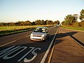
 Southbound A140 - geograph.org.uk - 310307.jpg 640 × 480; 68 KB
-
 Stoke Ash Primary School - geograph.org.uk - 353777.jpg 640 × 442; 78 KB
-

-
 The A140 through New Hainford - geograph.org.uk - 557279.jpg 640 × 480; 85 KB
-
 The Old Ram - geograph.org.uk - 320573.jpg 640 × 480; 89 KB
-
 Transmitter Mast - geograph.org.uk - 319111.jpg 640 × 480; 63 KB


.JPG)
.JPG)


.jpg)


_-_geograph.org.uk_-_620805.jpg)


.JPG)


_-_geograph.org.uk_-_1388411.jpg)


_-_geograph.org.uk_-_355443.jpg)
_-_geograph.org.uk_-_1596432.jpg)


_in_Long_Stratton_-_geograph.org.uk_-_1596535.jpg)
_in_Long_Stratton_-_geograph.org.uk_-_1596541.jpg)
_-_geograph.org.uk_-_1196251.jpg)
_in_Long_Stratton_-_geograph.org.uk_-_1596531.jpg)


_-_geograph.org.uk_-_620827.jpg)


_-_geograph.org.uk_-_4711017.jpg)


_in_Long_Stratton_-_geograph.org.uk_-_1596611.jpg)
_in_Long_Stratton_-_geograph.org.uk_-_1596613.jpg)


_-_geograph.org.uk_-_496245.jpg)


_-_geograph.org.uk_-_1596425.jpg)
_-_geograph.org.uk_-_714915.jpg)


_-_geograph.org.uk_-_1672174.jpg)

_-_geograph.org.uk_-_1596428.jpg)


_-_geograph.org.uk_-_728120.jpg)


_Sign_-_geograph.org.uk_-_338388.jpg)
_Sign_-_geograph.org.uk_-_338394.jpg)
_Sign_-_geograph.org.uk_-_339917.jpg)

_-_geograph.org.uk_-_556338.jpg)


_-_geograph.org.uk_-_620830.jpg)


_-_geograph.org.uk_-_767705.jpg)
_-_geograph.org.uk_-_556341.jpg)
_with_The_Street_-_geograph.org.uk_-_556345.jpg)


_-_geograph.org.uk_-_556329.jpg)


_through_Hevingham_-_geograph.org.uk_-_556342.jpg)

