Category:A167 road (England)
road in England  | |||||
| Upload media | |||||
| Instance of | |||||
|---|---|---|---|---|---|
| Location |
| ||||
| Transport network |
| ||||
| Connects with | |||||
| Has part(s) |
| ||||
| Terminus | |||||
 | |||||
Subcategories
This category has the following 6 subcategories, out of 6 total.
Media in category "A167 road (England)"
The following 31 files are in this category, out of 31 total.
-
 A 167 South to Chilton - geograph.org.uk - 248262.jpg 640 × 480; 87 KB
-
 A167 at Pity Me - geograph.org.uk - 294003.jpg 640 × 480; 51 KB
-
 A167 North West Radial - geograph.org.uk - 764708.jpg 640 × 427; 64 KB
-

-
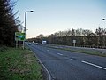
 A167 towards Chester Le Street - geograph.org.uk - 1019010.jpg 640 × 480; 73 KB
-
 A167, Newcastle upon Tyne, 1 May 2011.jpg 3,817 × 1,955; 1.44 MB
-
 Allerton Court Hotel - geograph.org.uk - 1590666.jpg 640 × 327; 32 KB
-
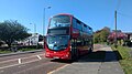 Bus on the A167 at Framwellgate Moor.jpg 4,608 × 2,592; 4.87 MB
-
 Central Avenue Newton Aycliffe - geograph.org.uk - 1493190.jpg 640 × 480; 109 KB
-

-
 Cowgate Roundabout - geograph.org.uk - 71884.jpg 640 × 480; 47 KB
-
 Duke of Wellington - geograph.org.uk - 787829.jpg 640 × 480; 55 KB
-
 Blocks of Flats - geograph.org.uk - 759625.jpg 640 × 480; 69 KB
-
 Junction of the A690 and A167 - geograph.org.uk - 2499117.jpg 640 × 481; 123 KB
-
 Wesley Memorial Church, Low Fell.JPG 3,264 × 2,448; 1.68 MB
-
 MilePost On A167 - geograph.org.uk - 637629.jpg 375 × 640; 76 KB
-
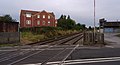
 Neville's Cross Junction - geograph.org.uk - 883838.jpg 640 × 480; 76 KB
-
 Newcastle Road Footbridge - geograph.org.uk - 883831.jpg 640 × 480; 76 KB
-
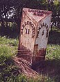
 Northallerton Milepost - geograph.org.uk - 1176569.jpg 427 × 640; 99 KB
-
 Northallerton MMB 01 Northallerton to Eaglescliffe Line (A167 Boroughbridge Road).jpg 3,609 × 2,409; 3.24 MB
-
 Northallerton MMB 02 Northallerton to Eaglescliffe Line (A167 Boroughbridge Road).jpg 3,927 × 2,553; 2.9 MB
-
 Northallerton MMB 03 Northallerton to Eaglescliffe Line (A167 Boroughbridge Road) 60040.jpg 4,176 × 2,652; 4.26 MB
-
 Northallerton MMB 04 Northallerton to Eaglescliffe Line (A167 Boroughbridge Road).jpg 4,174 × 2,247; 3.83 MB
-
-
 Railway bridge over the A167 - geograph.org.uk - 351781.jpg 640 × 480; 57 KB
-
 Road Junction at Topcliffe Station - geograph.org.uk - 356909.jpg 640 × 480; 76 KB
-
 The Kings Arms, Sandhutton - geograph.org.uk - 419998.jpg 640 × 480; 59 KB
-
 The Masons Arms - geograph.org.uk - 1265425.jpg 640 × 479; 70 KB
-
 Train passing over the A167 - geograph.org.uk - 351783.jpg 640 × 480; 63 KB
-
 UK road A167.PNG 568 × 184; 7 KB
-
 Former Black Bull Inn, Topcliffe - geograph.org.uk - 643776.jpg 640 × 438; 66 KB


.jpg)
.jpg)
_60040.jpg)
.jpg)
.jpg)


