Category:Abbey St. Bathans
village in Scottish Borders, Scotland, UK  | |||||
| Upload media | |||||
| Instance of | |||||
|---|---|---|---|---|---|
| Location |
| ||||
 | |||||
English: Abbey St. Bathans is a community in Berwickshire in the eastern part of the Scottish Borders.
Gàidhlig: 'S e baile ann an Alba a Deas a tha ann Abaid Bhaoithin (Beurla: Abbey St. Bathans), a bha ann an Siorrachd Bhearaig.
Subcategories
This category has the following 2 subcategories, out of 2 total.
A
- Abbey St Bathans Church (2 F)
W
- Whare Burn (6 F)
Media in category "Abbey St. Bathans"
The following 32 files are in this category, out of 32 total.
-
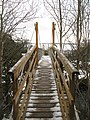
 Abbey St. Bathans footbridge - geograph.org.uk - 1032017.jpg 640 × 360; 89 KB
-
 AbbeyStBathans.jpg 768 × 1,024; 337 KB
-
 Elba Bridge - geograph.org.uk - 1726042.jpg 480 × 640; 136 KB
-
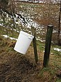 Pheasant feeder - geograph.org.uk - 336963.jpg 480 × 640; 139 KB
-
 Southern Upland Way, Abbey St. Bathans - geograph.org.uk - 153135.jpg 640 × 480; 128 KB
-
 Well trod path^ - geograph.org.uk - 138425.jpg 545 × 640; 152 KB
-
 Whiteadder Water, Abbey St Bathans - geograph.org.uk - 597405.jpg 640 × 480; 102 KB
-
 Abbey Hill (Inner) - geograph.org.uk - 336985.jpg 640 × 480; 78 KB
-
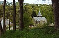 Abbey St. Bathan's church - geograph.org.uk - 636219.jpg 640 × 420; 72 KB
-
 Bell's Bank Wood, Abbey St Bathans - geograph.org.uk - 220949.jpg 480 × 640; 136 KB
-
 Cockburn Law - geograph.org.uk - 684591.jpg 640 × 416; 40 KB
-

-
 Corrugated iron roofed shed - geograph.org.uk - 568047.jpg 640 × 480; 101 KB
-
 Eller Burn and Cockburn law - geograph.org.uk - 221121.jpg 640 × 480; 93 KB
-
 Eye Water from Blackburn Mill Bridge - geograph.org.uk - 446477.jpg 640 × 480; 103 KB
-
 Field boundary - geograph.org.uk - 450193.jpg 640 × 480; 104 KB
-
 Ford, Abbey St Bathans - geograph.org.uk - 597402.jpg 640 × 480; 112 KB
-
 Forest road, Hen Toe Bog - geograph.org.uk - 336991.jpg 640 × 480; 90 KB
-
 Forest, Abbey Hill - geograph.org.uk - 336994.jpg 480 × 640; 104 KB
-
 Grassy field - geograph.org.uk - 450186.jpg 640 × 480; 106 KB
-
 Gravestones - geograph.org.uk - 568075.jpg 480 × 640; 124 KB
-
 Lammermuirs, Abbey St Bathans - geograph.org.uk - 221120.jpg 640 × 480; 94 KB
-
 Monynut Water - geograph.org.uk - 336976.jpg 640 × 561; 195 KB
-
 Pool near Edin's Hall Broch - geograph.org.uk - 153635.jpg 640 × 423; 89 KB
-
 Road to Abbey St Bathans - geograph.org.uk - 75285.jpg 480 × 640; 91 KB
-
 Road to Knock farm - geograph.org.uk - 329103.jpg 640 × 480; 96 KB
-
 Small pool - geograph.org.uk - 450177.jpg 640 × 480; 65 KB
-
 The Rest House, Abbey St Bathans - geograph.org.uk - 397535.jpg 640 × 480; 112 KB
-
 The Riverside restaurant - geograph.org.uk - 568077.jpg 480 × 640; 102 KB
-
 This way - geograph.org.uk - 142530.jpg 640 × 480; 78 KB
-
 Tyre - geograph.org.uk - 336756.jpg 640 × 550; 38 KB
-


_-_geograph.org.uk_-_336985.jpg)


